Old Maps of Provo, Utah for Metal Detecting
Plan your next treasure hunt with 43 historic maps of Provo. Find old homesites, ghost towns, trails, and gathering spots that may be lost to time — perfect for identifying promising metal detecting locations.
- Locate forgotten sites: Uncover places like long-lost settlements, abandoned rail lines, or gathering spots.
- Plan better hunts: Use map overlays combined with LiDAR or satellite views to narrow in on historically rich areas.
- Made for detectorists: Thousands of hobbyists use these maps to discover relics, coins, and hidden history.
Use these historic maps to boost your research and find new opportunities beneath the surface of Provo.
Provo, UT maps
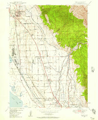
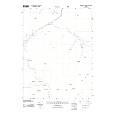
(43)- 1885 Map of Salt Lake
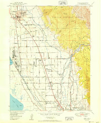
 1885 Salt Lake1885 Print · USGSThe Wasatch Front and surrounding high valleys appear here in the mid-1880s during a period of rapid mining and rail expansion. Genealogists and historians can trace early town sites and mining camps including Alta, Silver City, and the military grounds of Fort Douglass.7 unique versions available
 - 1948 Map of Orem, 1957 Print
 1948 Orem1957 Print · USGSPostwar industrialization and agricultural roots converge in this mid-century survey of the Utah Valley shoreline. Genealogists and local historians can trace the footprint of the Geneva Steel Plant, local schools like Vineyard School, and old settlements such as Christmas City.4 unique versions available
 - 1948 Map of Orem, 1959 Print
 1948 Orem1959 Print · USGSThe Utah Valley at the end of the 1940s showcases a unique blend of heavy industry and high-mountain wilderness. Local historians can trace the development of Orem and Pleasant Grove or locate the Steel Plant and Lincoln Jr HS near Utah Lake.2 unique versions available
 - 1948 Map of Springville, 1959 Print
 1948 Springville1959 Print · USGSSpringville and the southern Wasatch Front are shown here just after the war as industrial and agricultural centers. Genealogists can locate family sites near City Cem or trace school locations like Jefferson Sch and Lincoln Sch.4 unique versions available
 - 1948 Map of Provo, 1960 Print
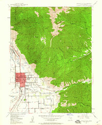
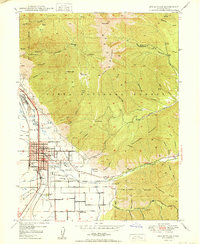
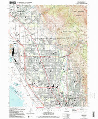
 1948 Provo1960 Print · USGSMid-century Provo is shown here as a thriving center for education and industry along the eastern shores of Utah Lake. Genealogists and historians can trace the footprint of Brigham Young University, the State Mental Hospital, and neighborhood schools like Maeser School.3 unique versions available
 - 1948 Map of Bridal Veil Falls, 1960 Print
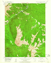 1948 Bridal Veil Falls1960 Print · USGSThe Provo River canyon was a vital transportation corridor just after the war, where the Denver & Rio Grande Western RR wound past steep peaks. Trace early settlement sites and mountain landmarks like Bridal Veil Falls, Vivian Park, and Y Mountain.4 unique versions available
 - 1949 Map of Provo, 1959 Print
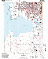
 1949 Provo1959 Print · USGSThe Utah Valley thrived in the late post-war years as industrial growth and educational institutions expanded along the eastern shore of Utah Lake. Researchers can locate family roots in settlements like Palmyra and Leland or trace the industrial sites at Ironton and the Sugar Refinery.
 - 1950 Map of Orem
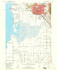
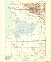
 1950 Orem1950 Print · USGSIn the shadow of the Wasatch Range after the war, this area shows the heavy industrialization of the lakeshore and the complex irrigation of the benchlands. Trace the footprint of the Geneva Steel Plant, the rail lines at Orem Sta, and local landmarks like Lincoln High Sch.
 - 1950 Map of Provo
 1950 Provo1950 Print · USGSProvo and the surrounding valley are captured here at a moment of significant mid-century expansion between the lake and the forest. Researchers can trace the layout of the B. Y. U. (Upper Campus), locate the City Cemetery, and find smaller settlements like Palmyra.
 - 1950 Map of Bridal Veil Falls
 1950 Bridal Veil Falls1950 Print · USGSThe Provo River canyon was a bustling corridor for the Denver & Rio Grande Western and mountain travelers in the 1950s. Trace old settlements like Vivian Park, Springdell, and the landmark Bridal Veil Falls.
 - 1950 Map of Springville
 1950 Springville1950 Print · USGSSpringville and Mapleton sit at the foot of the Wasatch Range in the 1950s, showing a transition from town life to mountain wilderness. Genealogists can locate family sites near Evergreen Cem or trace industry along the Utah Railway and Ironton.
 - 1954 Map of Salt Lake City, 1964 Print
 1954 Salt Lake City1964 Print · USGSThe Wasatch Front and Uinta Mountains are captured here in the mid-fifties, showing the industrial heart of Utah and its high mountain wilderness. Researchers can locate vanished infrastructure and landmarks like the Geneva Steel Plant, Bingham Canyon Mine, and the Utah State Prison.4 unique versions available
 - 1958 Map of Salt Lake City
 1958 Salt Lake City1958 Print · USGSThe Wasatch Front and Uinta Basin are captured during a period of significant post-war growth and industrial development. Researchers can trace the mid-century rail lines of the Bamberger RR and locate sites like the Kiegley Limestone Quarry and Camp Williams Military Reservation.
 - 1960 Map of Salt Lake City
 1960 Salt Lake City1960 Print · USGSThe Wasatch Front and High Uintas are captured mid-century as the Salt Lake Valley underwent significant postwar expansion. Genealogists and historians can trace rail lines like the Union Pacific and locate established landmarks such as Fort Douglas, Camp Williams, and the Bingham Canyon Mine.
 - 1986 Map of Provo
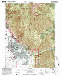
 1986 Provo1986 Print · USGSThe Utah Valley during the mid-eighties shows a bustling corridor of growth between the mountains and Utah Lake. Genealogists and historians can trace the rail lines of the Union Pacific RR through settlements like Springville, Spanish Fork, and Payson.
 - 1993 Map of Springville, 1994 Print
 1993 Springville1994 Print · USGSSpringville and Mapleton are captured in the early nineties, showing a landscape where residential growth meets the canyons of the Wasatch Range. You can trace local landmarks like City Cem, the Drive-in Theater, and the Denver and Rio Grande Western railroad.
 - 1993 Map of Bridal Veil Falls, 1994 Print
 1993 Bridal Veil Falls1994 Print · USGSCanyon life in the Wasatch Range was defined by the river and the road during the early 1990s. Trace the development of mountain communities like Vivian Park and Upper Falls alongside recreational landmarks like Bridal Veil Falls and the Sundance Ski Area.
 - 1993 Map of Provo, 1994 Print
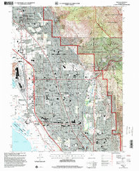
 1993 Provo1994 Print · USGSProvo and its neighboring shoreline along Utah Lake are captured here during a period of significant late-century growth. Genealogists and local historians can trace the foundations of the community through institutions like Brigham Young University, the Provo City Cem, and the rural settlement of Palmyra.2 unique versions available
 - 1994 Map of Orem
 1994 Orem1994 Print · USGSThe Utah Valley landscape is shown here in the mid-1990s as suburban growth reaches the base of Mount Timpanogos. Trace the rail corridors of the Union Pacific, the vast Brigham Young University campus, and the Bunker Grain Elevators.2 unique versions available
 - 1998 Map of Springville, 2000 Print
 1998 Springville2000 Print · USGSThe transition from the Utah Valley floor to the high peaks of the Wasatch Range is captured here during the late nineties. Genealogists and researchers can trace local landmarks like Evergreen Cem, the Drive-in Theater, and the Union Pacific line.
 - 1998 Map of Provo, 2000 Print
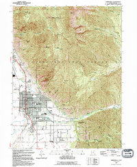
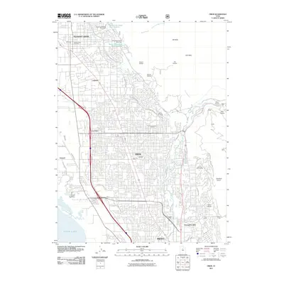
 1998 Provo2000 Print · USGSProvo and its shoreline neighbors are captured here in the late nineties, just as the region prepared for the Winter Olympics. Researchers can trace the layout of the Provo City Cemetery, identify historic local schools like Amelia Earhart Sch, and locate the Utah State Hospital.
 - 1998 Map of Orem, 2000 Print
 1998 Orem2000 Print · USGSOrem and the surrounding Utah Valley suburbs are shown during a period of rapid growth in the late nineties. Researchers can trace the expansion of Brigham Young University and find landmarks like the Bunker Grain Elevators and Orem Cem.
 - 1998 Map of Bridal Veil Falls, 2000 Print
 1998 Bridal Veil Falls2000 Print · USGSThe Provo River canyon south of Mount Timpanogos appears in the late 1990s as a mix of scenic recreation and essential infrastructure. Explore the canyon's historic character at Vivian Park, the Sundance Ski Area, and the iconic Bridal Veil Falls.
 - 2011 Map of Bridal Veil Falls, 2011 Print
 2011 Bridal Veil Falls2011 Print · USGSCovers Provo, including Canyon Glen, Wildwood, and other nearby areas
 - 2011 Map of Orem, 2011 Print
 2011 Orem2011 Print · USGSCovers Provo, including Orem, Pleasant Grove, and other nearby areas
Showing maps 1-25 of 43
Top cities near Provo
- Orem historical maps
- Lehi historical maps
- Saratoga Springs historical maps
- Draper historical maps
- Spanish Fork historical maps
- Pleasant Grove historical maps
See more
Top neighborhoods of Provo
- Edgemont historical maps
- Pleasant View historical maps
- Caryhurst historical maps
- Lakeview historical maps
- North Timpview historical maps
- Provost historical maps
See more
Frequently asked questions
- What are the different types of historical maps available for Provo?
- What is the oldest map of Provo?
- Where can I purchase historical maps of Provo for my home or office?
- Where can I download high-res historical maps of Provo?
- Are there historical topographic maps available for Provo?
- Is there historical aerial imagery available for Provo?
- Where are historical maps of Provo sourced from?