1900s (20th Century) Maps of Sleeping Rainbow, Torrey
Explore 7 historic maps of Sleeping Rainbow from the 1900s (20th Century). These maps offer a rare glimpse into what life looked like during the 1900s — showing old roads, neighborhoods, homes, and landmarks that have changed or disappeared over time.
Whether you're researching your family's past, planning a metal detecting trip, or studying how Sleeping Rainbow's landscape evolved across the 1900s, these high-resolution maps are a powerful tool for exploring the history of this region.
- Focus on a specific era: All maps on this page are from the 1900s, giving you a focused view of this time period.
- See what’s changed: Compare century-old streets, trails, and buildings to today's modern landscape using overlays and satellite layers.
- Research with precision: Use these maps for genealogy, historical research, land use analysis, or educational projects.
- View, download, or print: Maps are fully viewable online in high resolution, and can be downloaded or printed for your own records.
Start exploring Sleeping Rainbow's history through authentic maps from the 1900s. This is your window into the past.
Sleeping Rainbow, Torrey maps
(7)- 1952 Map of Notom 2 SW, 1954 Print
 1952 Notom 2 SW1954 Print · USGSSettlements in Wayne County appear during the early fifties as the region balanced cattle ranching with new infrastructure. Genealogists and historians can locate the Teasdale Cem, the Municipal Airport, and the irrigation network of the Fremont River.
 - 1952 Map of Torrey, 1958 Print
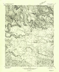
 1952 Torrey1958 Print · USGSTorrey and Teasdale sit at the edge of the desert during the early 1950s, a time when the high plateaus and sandstone reefs were still navigated by jeep trails. Researchers can locate the local Cem, the Elkhorn Ranger Sta, and early infrastructure like the Power Plant along the Fremont River.3 unique versions available
 - 1956 Map of Salina
 1956 Salina1956 Print · USGSCentral Utah in the mid-fifties reveals a landscape of high plateaus and desert basins before the modern highway era. Researchers can trace the ranching and mining roots of Hanksville and Loa or locate the Lucky Strike Mine near the San Rafael Swell.5 unique versions available
 - 1960 Map of Salina
 1960 Salina1960 Print · USGSThe high plateaus and canyonlands of south-central Utah appear in the early sixties as a region of remote ranching towns and developing parklands. Researchers can trace historic settlements like Fruita and Loa or locate the uranium mines and the tracks of the Denver and Rio Grande Western RR.2 unique versions available
 - 1962 Map of Salina
 1962 Salina1962 Print · USGSSevier County and the surrounding desert wilderness appear here in the early sixties as a network of isolated river valley towns and high-altitude forests. Researchers can locate remote landmarks like Fruita, trace the Denver & Rio Grande Western RR, and find backcountry sites like the Aquarius Ranger Station.
 - 1980 Map of Loa
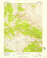
 1980 Loa1980 Print · USGSCentral Utah's high plateaus and the Fremont River corridor are captured here during the 1980s, showcasing a landscape of high-elevation reservoirs and remote ranching outposts. Genealogists can trace family names and early settlements from Loa and Teasdale to the orchards of Fruita.2 unique versions available
 - 1985 Map of Torrey
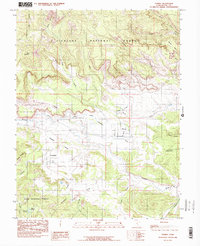 1985 Torrey1985 Print · USGSTorrey and Teasdale sit at the center of this 1980s survey of the high plateau country in Wayne County. Researchers can trace the path of the Torrey Canal across Poverty Flat and explore landmarks like Chimney Rock Can and the Teasdale Bench.2 unique versions available
End of results
Showing maps 1-7 of 7
Frequently asked questions
- What are the different types of historical maps available for Sleeping Rainbow?
- What is the oldest map of Sleeping Rainbow?
- Where can I purchase historical maps of Sleeping Rainbow for my home or office?
- Where can I download high-res historical maps of Sleeping Rainbow?
- Are there historical topographic maps available for Sleeping Rainbow?
- Is there historical aerial imagery available for Sleeping Rainbow?
- Where are historical maps of Sleeping Rainbow sourced from?