Old Maps of Powder Mountain, Utah for Academic Research
Study the evolution of Powder Mountain with 8 high-resolution historic maps. Whether you're teaching, researching, or modeling changes in land use, these maps provide essential visual documentation of urban, environmental, and geographic change.
- Analyze long-term change: Track patterns in development, transportation, and natural features.
- Ideal for environmental or urban studies: Support academic projects with primary historical map data.
- Use in the classroom or lab: Educators and researchers rely on these maps to bring historical context to life.
These maps are a powerful tool for teaching, research, and visualizing how Powder Mountain has changed over the decades.
Powder Mountain, UT maps
(8)- 1954 Map of Ogden, 1967 Print
 1954 Ogden1967 Print · USGSThe northern Utah corridor and Wyoming borderlands are captured here in the mid-1950s, showing the region's transition from mountain wilderness to settled valleys. Researchers can trace historic institutions like Utah State University or locate vanished points like Church Butte Station and the Trappist Monastery.3 unique versions available
 - 1955 Map of James Peak, 1956 Print
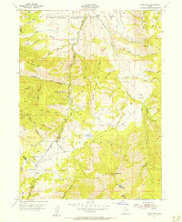 1955 James Peak1956 Print · USGSThe high wilderness of the Cache National Forest is documented here in the mid-fifties, showing a landscape defined by canyons and peaks. Researchers can locate remote sites like the Honey Bee Mine, Fourmile Ranch, and the Davenport Jeep Trail.4 unique versions available
 - 1958 Map of Ogden
 1958 Ogden1958 Print · USGSNorthern Utah and southwestern Wyoming are captured here during a period of steady growth and military expansion. You can trace the Union Pacific rail lines and early road networks connecting Ogden and Logan to Bear Lake and Evanston.
 - 1960 Map of Ogden
 1960 Ogden1960 Print · USGSIn the mid-1950s, this region of the American West balanced military expansion with frontier history along the Union Pacific RR. Genealogists and historians can trace old settlements like Fort Bridger, the residential growth of Washington Terrace, and industrial sites from the Hill AFB complex to the coal mines of Kemmerer.
 - 1986 Map of Ogden, 1987 Print
 1986 Ogden1987 Print · USGSThe Wasatch Front was undergoing significant development in the mid-eighties as the urban corridor stretched from Ogden toward the Great Salt Lake. Researchers can trace the legacy of regional transport and defense via Hill Air Force Base, the Union Pacific line, and mountain passes near Snow Basin.
 - 1991 Map of James Peak, 1992 Print
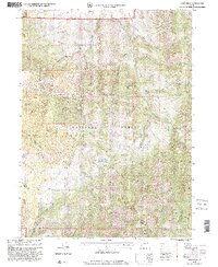
 1991 James Peak1992 Print · USGSThe high Wasatch ridgelines of the Cache and Weber county line are captured here in the early nineties. Researchers can trace historic land use through the Honey Bee Mine, Fourmile Ranch, and family landmarks like Alex Beard Hill and Jenson Hollow.
 - 1998 Map of James Peak, 2001 Print
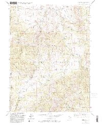
 1998 James Peak2001 Print · USGSThe high peaks of the Cache National Forest come into sharp focus in the late 1990s as the wilderness between Weber and Cache counties is mapped in detail. Researchers can trace historic water sources and ranching landmarks like Fourmile Ranch, Pats Spring, and Wolf Creek Peak.
 - 2023 Map of James Peak, 2023 Print
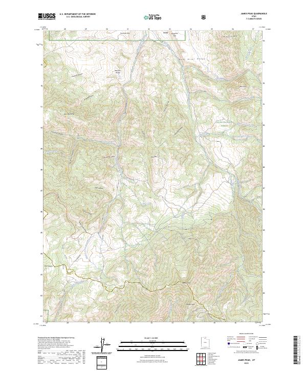 2023 James Peak2023 Print · USGSThe high mountain corridors of the Bear River Range are mapped here in the early 2020s, showcasing the rugged drainage patterns south of Avon. Researchers can trace old family landmarks like Alex Beard Hill or follow high-altitude routes along Flint Grove Rd and S Canyon Rd.
End of results
Showing maps 1-8 of 8
Top cities near Powder Mountain
- Ogden historical maps
- North Ogden historical maps
- Brigham City historical maps
- South Ogden historical maps
- Pleasant View historical maps
- Riverdale historical maps
See more
Frequently asked questions
- What are the different types of historical maps available for Powder Mountain?
- What is the oldest map of Powder Mountain?
- Where can I purchase historical maps of Powder Mountain for my home or office?
- Where can I download high-res historical maps of Powder Mountain?
- Are there historical topographic maps available for Powder Mountain?
- Is there historical aerial imagery available for Powder Mountain?
- Where are historical maps of Powder Mountain sourced from?