1990s Maps of Powder Mountain, Utah
Explore 2 historic maps of Powder Mountain from the 1990s. These maps offer a rare glimpse into what life looked like during the 1990s — showing old roads, neighborhoods, homes, and landmarks that have changed or disappeared over time.
Whether you're researching your family's past, planning a metal detecting trip, or studying how Powder Mountain's landscape evolved across the 1990s, these high-resolution maps are a powerful tool for exploring the history of this region.
- Focus on a specific era: All maps on this page are from the 1990s, giving you a focused view of this time period.
- See what’s changed: Compare century-old streets, trails, and buildings to today's modern landscape using overlays and satellite layers.
- Research with precision: Use these maps for genealogy, historical research, land use analysis, or educational projects.
- View, download, or print: Maps are fully viewable online in high resolution, and can be downloaded or printed for your own records.
Start exploring Powder Mountain's history through authentic maps from the 1990s. This is your window into the past.
Powder Mountain, UT maps
(2)- 1991 Map of James Peak, 1992 Print
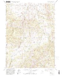 1991 James Peak1992 Print · USGSThe high Wasatch ridgelines of the Cache and Weber county line are captured here in the early nineties. Researchers can trace historic land use through the Honey Bee Mine, Fourmile Ranch, and family landmarks like Alex Beard Hill and Jenson Hollow.
 - 1998 Map of James Peak, 2001 Print
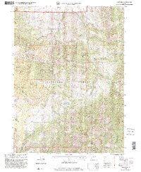 1998 James Peak2001 Print · USGSThe high peaks of the Cache National Forest come into sharp focus in the late 1990s as the wilderness between Weber and Cache counties is mapped in detail. Researchers can trace historic water sources and ranching landmarks like Fourmile Ranch, Pats Spring, and Wolf Creek Peak.
End of results
Showing maps 1-2 of 2
Top cities near Powder Mountain
- Ogden historical maps
- North Ogden historical maps
- Brigham City historical maps
- South Ogden historical maps
- Pleasant View historical maps
- Riverdale historical maps
See more
Frequently asked questions
- What are the different types of historical maps available for Powder Mountain?
- What is the oldest map of Powder Mountain?
- Where can I purchase historical maps of Powder Mountain for my home or office?
- Where can I download high-res historical maps of Powder Mountain?
- Are there historical topographic maps available for Powder Mountain?
- Is there historical aerial imagery available for Powder Mountain?
- Where are historical maps of Powder Mountain sourced from?