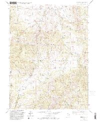
1991 Map of James Peak
USGS Topo · Published 1992About this map
Cache National Forest encompasses the high country of the Wasatch Range in this early 1990s study of the Cache and Weber County border. The landscape is defined by the sharp transition from high peaks like James Peak and Middle Mountain down into deeply cut drainages such as Broadmouth Canyon and Threemile Canyon. This area serves as a critical watershed, where the South Fork Little Bear River and Little South Fork Bear River are fed by numerous high-altitude springs, including Pets Spring. Local history is embedded in the terrain through family-named landmarks like Alex Beard Hill, Beard Hollow, and Starks Hollow. While much of the land remains wild, human activity is visible in the presence of the Honey Bee Mine, Fourmile Ranch, and the southern reaching slopes of the Powder Mountain Ski Area. The network of unimproved routes, such as Davenport Road and Grove Road, traces the ancient patterns of mountain transit through McKenzie Flat.
Find a feature on this map
41 named features on this map. Tap any name to fly to it.
Don’t see what you’re looking for? This feature index may not catch every label — zoom into the map to look around manually.
Map Details
Editions of this 1991 James Peak Map
This is the sole edition of this map. No revisions or reprints were ever made.
Other maps of this area

1914 · Logan
USGS Topo · 1:125,000

1916 · Logan
USGS Topo · 1:125,000

1954 · Ogden
USGS Topo · 1:250,000

1955 · Paradise
USGS Topo · 1:24,000

1955 · Mantua
USGS Topo · 1:24,000

1955 · Huntsville
USGS Topo · 1:24,000

1955 · James Peak
USGS Topo · 1:24,000

1955 · North Ogden
USGS Topo · 1:24,000

1955 · Mount Pisgah
USGS Topo · 1:24,000

1958 · Ogden
USGS Topo · 1:250,000
Featured Places
- Sundown Condominiums at Powder Mountain, UT
- Powder Mountain, UT
- Weber County, UT
- Cache County, UT
- Box Elder County, UT