
1958 Map of Ogden
USGS Topo · Published 1958About this map
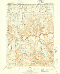
The Wasatch Range forms a dramatic spine through this mid-century survey, separating the burgeoning urban corridor of Ogden and the Cache Valley from the high-altitude expanses of Bear Lake. This map documents a post-war landscape where historical agricultural centers like Logan, Richmond, and Hyrum share the terrain with expanding military and industrial hubs. Significant infrastructure includes Hill AFB and the Utah General Depot, reflecting the regional growth during the Cold War. Along the Bear River and the eastern shores of Bear Lake, settlements such as Garden City, Pickelville, and Laketown remain distinct before the era of intensive resort development. The Union Pacific railroad lines and early highway routes like U S 30s and U S 89 connect these valley towns to the high plateaus leading toward Evanston and the Wyoming Range.
Find a feature on this map
62 named features on this map. Tap any name to fly to it.
Don’t see what you’re looking for? This feature index may not catch every label — zoom into the map to look around manually.
Map Details
Editions of this 1958 Ogden Map
This is the sole edition of this map. No revisions or reprints were ever made.
Other maps of this area

1885 · Salt Lake
USGS Topo · 1:250,000

1885 · Ashley
USGS Topo · 1:250,000

1885 · Uinta
USGS Topo · 1:250,000

1885 · Tooele Valley
USGS Topo · 1:250,000

1900 · Coalville
USGS Topo · 1:125,000
1901 · Hayden Peak
USGS Topo · 1:125,000
1903 · Hayden Peak
USGS Topo · 1:125,000

1903 · Coalville
USGS Topo · 1:125,000

1905 · Gilbert Peak
USGS Topo · 1:125,000

1906 · Gilbert Peak
USGS Topo · 1:125,000