
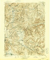
1903 Map of Coalville
USGS Topo · Published 1921About this map
Coalville and the Weber River valley serve as the primary corridor for settlement and transit in this high-altitude landscape of early twentieth-century Utah. The Union Pacific R. R. and its Park City Branch navigate the winding canyons, linking mining hubs like Park City to the broader regional economy. The presence of the Ontario Drain Tunnel near the southwestern corner highlights the significance of industrial mining engineering in draining the silver-rich depths of the district. Agricultural life is concentrated in the well-watered flats of Rhodes Valley and The Meadows, where communities like Kamas, Marion, and Oakley are established. To the east, the vast expanse of the Wasatch National Forest dominates the terrain, with high peaks and deep drainages like Chalk Creek and the South Fork leading toward the Uinta National Forest boundary.
Find a feature on this map
108 named features on this map. Tap any name to fly to it.
Don’t see what you’re looking for? This feature index may not catch every label — zoom into the map to look around manually.
Map Details
Editions of this 1903 Coalville Map
2 editions found
Other maps of this area

1885 · Salt Lake
USGS Topo · 1:250,000

1885 · Uinta
USGS Topo · 1:250,000

1900 · Coalville
USGS Topo · 1:125,000

1901 · Hayden Peak
USGS Topo · 1:125,000

1903 · Hayden Peak
USGS Topo · 1:125,000

1907 · Strawberry Valley
USGS Topo · 1:125,000

1909 · Strawberry Valley
USGS Topo · 1:125,000

1925 · Ft. Douglas
USGS Topo · 1:125,000

1928 · Ft. Douglas
USGS Topo · 1:125,000

1948 · Orem
USGS Topo · 1:62,500