
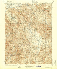
1909 Map of Strawberry Valley
USGS Topo · Published 1909About this map
Uinta Forest Reserve and the expansive drainage of the Strawberry River dominate this early 20th-century survey of the high mountain valleys. Small agricultural communities such as Charleston, Buysville, and Wallsburg are clustered in the western depressions near the Provo River, while the rugged interior is defined by remote outposts like Averetts Ranch and Becksteads Ranch. The presence of the Diamond Battle Monument near Diamond Creek speaks to the region's complex cultural history and frontier conflicts.
Find a feature on this map
60 named features on this map. Tap any name to fly to it.
Don’t see what you’re looking for? This feature index may not catch every label — zoom into the map to look around manually.
Map Details
Editions of this 1909 Strawberry Valley Map
2 editions found
Other maps of this area

1885 · Salt Lake
USGS Topo · 1:250,000

1885 · Manti
USGS Topo · 1:250,000

1885 · Uinta
USGS Topo · 1:250,000

1886 · Price River
USGS Topo · 1:250,000

1895 · Manti
USGS Topo · 1:250,000

1896 · Price River
USGS Topo · 1:250,000

1900 · Coalville
USGS Topo · 1:125,000

1901 · Hayden Peak
USGS Topo · 1:125,000

1903 · Hayden Peak
USGS Topo · 1:125,000

1903 · Coalville
USGS Topo · 1:125,000