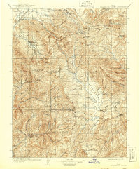
1909 Map of Strawberry Valley
USGS Topo · Published 1941About this map
The high-altitude drainage of the Strawberry River and its tributaries define this 1909 survey, illustrating the complex hydrology of the Wasatch and Utah county borderlands before the era of modern reservoirs. The settlement of Charleston and the nearby D. and R. G. R. R. rail line mark the low-lying Round Valley in the northwest, while the remainder of the territory is characterized by seasonal livestock operations and surveying landmarks. Notable family names appear at Averetts Ranch and Becksteads Ranch, providing essential data points for local genealogists. The geography is punctuated by distinctive peaks such as Mollies Nipple and Teat Mtn, and the presence of the Diamond Battle Monument near the head of Diamond Fork indicates a site of historical conflict. Infrastructure including the West Portal and a Pumphouse Hill reflect early 20th-century water management efforts in the region.
Find a feature on this map
71 named features on this map. Tap any name to fly to it.
Don’t see what you’re looking for? This feature index may not catch every label — zoom into the map to look around manually.
Map Details
Editions of this 1909 Strawberry Valley Map
2 editions found

Other maps of this area

1885 · Salt Lake
USGS Topo · 1:250,000

1885 · Manti
USGS Topo · 1:250,000

1885 · Uinta
USGS Topo · 1:250,000

1886 · Price River
USGS Topo · 1:250,000

1895 · Manti
USGS Topo · 1:250,000

1896 · Price River
USGS Topo · 1:250,000

1900 · Coalville
USGS Topo · 1:125,000

1901 · Hayden Peak
USGS Topo · 1:125,000

1903 · Hayden Peak
USGS Topo · 1:125,000

1903 · Coalville
USGS Topo · 1:125,000