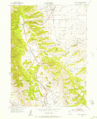
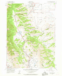
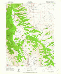
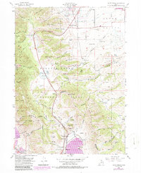
1955 Map of Mount Pisgah
USGS Topo · Published 1956About this map
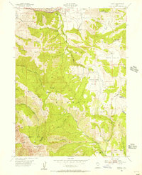
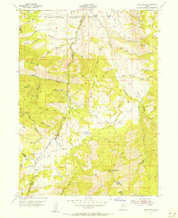
Wellsville and Mount Sterling anchor the northern reaches of this mid-century survey, where the valley floor meets the steep ascent of the Wellsville Mountains. The landscape is defined by the high-elevation passage of Highway 89/91, which winds through Sardine Canyon toward Sardine Summit, passing Dry Lake along the way. This corridor served as a vital connection between the valley and the southern settlement of Mantua, tracing a route through the heart of the Cache National Forest.
Find a feature on this map
84 named features on this map. Tap any name to fly to it.
Don’t see what you’re looking for? This feature index may not catch every label — zoom into the map to look around manually.
Map Details
Editions of this 1955 Mount Pisgah Map
4 editions found
Other maps of this area

1914 · Logan
USGS Topo · 1:125,000

1916 · Logan
USGS Topo · 1:125,000

1954 · Ogden
USGS Topo · 1:250,000

1954 · Brigham City
USGS Topo · 1:250,000

1955 · Paradise
USGS Topo · 1:24,000
1955 · Mantua
USGS Topo · 1:24,000
1955 · James Peak
USGS Topo · 1:24,000
1955 · Willard
USGS Topo · 1:24,000
1955 · Brigham City
USGS Topo · 1:24,000

1958 · Ogden
USGS Topo · 1:250,000