Old Maps of Lowell, Vermont for Hiking & Exploration
Hike through history with 41 historic maps of Lowell. Explore old trails, ghost towns, and forgotten backroads — perfect for outdoor adventurers and local explorers.
- Rediscover forgotten places: Map out old mining camps, roads, and footpaths that no longer exist on modern maps.
- Layer with modern tools: Combine with LiDAR or satellite views to plan hikes through historical terrain.
- Made for exploration: Popular among hikers, overlanders, and local history lovers.
Use these maps to find adventure and explore the hidden past of Lowell.
Lowell, VT maps
(41)- 1919 Map of Montgomery, 1920 Print
 1919 Montgomery1920 Print · USGSFranklin County at the close of the Great War was a landscape of mountain passes and railroad junctions. Genealogists and historians can trace the early layout of Montgomery and Richford, locating family-named landmarks like Nutting Corner and Farrar Corner.
 - 1920 Map of Montgomery
 1920 Montgomery1920 Print · USGSNorthern Vermont's rugged borderlands come alive in this post-World War I survey of the Missisquoi River valley. Genealogists can trace family homesteads near Grocers Corner, Hectorville, and old schoolhouses like the Notch School.
 - 1920 Map of Irasburg
 1920 Irasburg1920 Print · USGSNorthern Vermont near the Canadian border is shown here after the Great War, featuring a landscape of crossroads settlements and river valleys. Researchers can trace historic family-named junctions like McAllisters Corner, the path of the Canadian Pacific R.R., and the rural Grant School.
 - 1923 Map of Irasburg
 1923 Irasburg1923 Print · USGSOrleans County is captured in the early 1920s, showing a landscape defined by dairy farming, rail transport, and a dense network of one-room schoolhouses. Genealogists can trace family lands near North Troy or locate ancestral sites like the Center Cemetery and West Hill School.
 - 1925 Map of Irasburg
 1925 Irasburg1925 Print · USGSOrleans County, Vermont, sits at the Canadian border in the mid-1920s, showing a landscape of small hill farms and rural school districts. Researchers can trace the CANADIAN PACIFIC rail line through North Troy or locate family roots near the Farrar School and Center Cemetery.4 unique versions available
 - 1925 Map of Jay Peak
 1925 Jay Peak1925 Print · USGSThe Green Mountains of northern Vermont meet the Canadian border in the mid-1920s, showing a rugged landscape of rail junctions and mountain passes. Genealogists and historians can trace defunct district schoolhouses like Corey School, the operations of the Asbestos Mine, and timber-era landmarks like Stevens Mill.4 unique versions available
 - 1928 Map of Hardwick, 1938 Print
 1928 Hardwick1938 Print · USGSUpper Vermont at the end of the 1920s is seen here through its network of district schools and valley rail lines. Genealogists can trace family landmarks like Jackson Bridge or locate vanished schoolhouses such as Beeler Sch and Speir Sch.
 - 1934 Map of Hardwick
 1934 Hardwick1934 Print · USGSUpper Vermont's hill towns and river valleys are captured here in the mid-1930s, showing a landscape tied to the Lamoille River and small-town industry. Researchers can trace dozens of rural schoolhouses like Collinsville Sch and landmarks such as Jackson Bridge.
 - 1938 Map of Hardwick
 1938 Hardwick1938 Print · USGSVermont’s northern hills and the Lamoille River valley are shown in the late 1930s, documenting a time when rural schools and the railroad connected the highlands. Trace family roots through sites like Hazen Road Sch, Greensboro Bend, and the ST JOHNSBURY AND LAKE CHAMPLAIN RR.2 unique versions available
 - 1943 Map of Jay Peak, 1946 Print
 1943 Jay Peak1946 Print · USGSThe Vermont high country comes into focus in the mid-1940s, showing a rugged landscape of rail junctions and mountain industries. Genealogists and historians can locate remote mountain schools like Woodward Sch, the industrial Asbestos Mine, and the mill sites of Hectorville.
 - 1950 Map of Lake Champlain
 1950 Lake Champlain1950 Print · USGSThe Lake Champlain valley and its surrounding peaks are captured in detail during the late 1940s, showing the vital rail and road connections between New York and Vermont. Researchers can trace the routes of the Central Vermont Railway or locate old industrial centers like Mineville and Witherbee.2 unique versions available
 - 1951 Map of Hardwick, 1952 Print
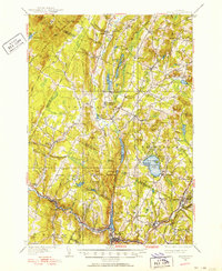 1951 Hardwick1952 Print · USGSThe Northeast Kingdom's rugged highlands and river valleys are captured here in the early fifties, centering on the granite and rail hub of Hardwick. Researchers can trace old family schoolhouses like Wright Sch and Stan Sch or follow the route of the St Johnsbury and Lake Champlain Railroad.4 unique versions available
 - 1953 Map of Jay Peak, 1954 Print
 1953 Jay Peak1954 Print · USGSNorthern Vermont's Green Mountains meet the Canadian border in this mid-century survey of the high peaks and river valleys. Researchers can trace the legacy of timber and mining at Tillotson Mill and the ASBESTOS MINE, or locate rural schools like Woodward School.4 unique versions available
 - 1953 Map of Irasburg, 1954 Print
 1953 Irasburg1954 Print · USGSOrleans County, Vermont, sits at the international border in the early fifties, where the Canadian Pacific rail line meets the frontier at North Troy. Researchers can trace old family lands near Summit Siding or locate local landmarks like Brighton School and Center Cemetery.4 unique versions available
 - 1958 Map of Lake Champlain
 1958 Lake Champlain1958 Print · USGSThe Champlain Valley and surrounding high peaks are captured here in the late fifties, showcasing the cross-border region from the Adirondacks to the Green Mountains. Researchers can trace historic rail routes like the Rutland Railway or locate old valley settlements such as Keeseville and Vergennes.2 unique versions available
 - 1962 Map of Lake Champlain, 1975 Print
 1962 Lake Champlain1975 Print · USGSLake Champlain and the high peaks of the Adirondacks and Green Mountains are captured here during the mid-twentieth century. Researchers can trace the industrial legacy of the Lyon Mountain Mine and the rail corridors of the Central Vermont RR and Delaware & Hudson RR.3 unique versions available
 - 1986 Map of Irasburg
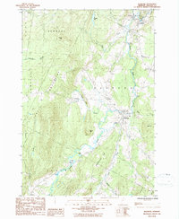 1986 Irasburg1986 Print · USGSOrleans County, Vermont, is captured here in the mid-1980s, showing a landscape defined by the winding Black River valley. Researchers can trace historic property lines and local landmarks from the village of Irasburg to remote points like Kidder Pd and Chamberlain Hill.
 - 1986 Map of Albany, 1987 Print
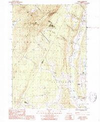 1986 Albany1987 Print · USGSOrleans County in the mid-1980s reveals a classic Vermont mix of highland wilderness and river-valley villages. Researchers can trace the layout of Craftsbury Common, locate the old Mill Village, and follow the winding course of the Black River.2 unique versions available
 - 1986 Map of Lowell, 1987 Print
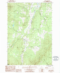 1986 Lowell1987 Print · USGSOrleans County, Vermont, is captured here in the mid-eighties as a landscape of river valleys and mountain ridges. Genealogists and local historians can trace family-named sites like Farman Hill and Leland Hill or locate the village Cem near Lowell.
 - 1986 Map of Hazens Notch, 1987 Print
 1986 Hazens Notch1987 Print · USGSThe Green Mountains of northern Vermont are captured here in the mid-1980s, centered on the high pass of Hazens Notch. Trace local industrial history at the Strip Mine or locate historic landmarks like the Covered Bridge in Hectorville and the Tillotson Mill.
 - 1989 Map of Mount Mansfield
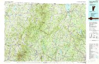 1989 Mount Mansfield1989 Print · USGSNorthern Vermont in the late eighties remains a landscape of deep forests and isolated mountain villages. Genealogists and hikers can trace the old rail lines of the Canadian Pacific RR or locate family sites near Lake Willoughby and Brownington Village.
 - 2012 Map of Hazens Notch, 2012 Print
 2012 Hazens Notch2012 Print · USGSNorthern Vermont's Green Mountains are captured here in the early twenty-first century, showing a landscape defined by steep peaks and deep notches. Researchers can locate the Hectorville Covered Bridge, trace routes to Tillotson Mill, and find family sites like Roegan Road Cem.
 - 2012 Map of Albany, 2012 Print
 2012 Albany2012 Print · USGSThe northern Vermont hills and river valleys are captured here in the early twenty-first century, showing the enduring structure of village life. Researchers can locate Sterling College in Craftsbury Common or trace the historic Bailey Hazen Rd past Mill Village.
 - 2012 Map of Lowell, 2012 Print
 2012 Lowell2012 Print · USGSThe upper Missisquoi River valley comes into focus in this 2012 survey of the Lowell area. Genealogists and local historians can trace family-named roads and landmarks like Old Catholic Cem, Browns Ledges, and the E Br Missisquoi River.
 - 2012 Map of Irasburg, 2012 Print
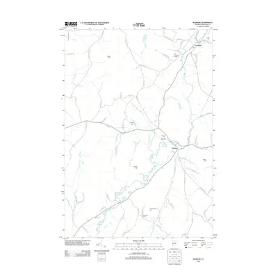 2012 Irasburg2012 Print · USGSIrasburg and Coventry are captured in this Orleans County landscape during the early 2010s. Local researchers can trace the course of the Black River past the Orne Covered Bridge and locate several burial sites like Hovey Cem and Village Cem.
Showing maps 1-25 of 41
Top cities near Lowell
- Stowe historical maps
- Newport City historical maps
- Johnson historical maps
- Hyde Park historical maps
- Hardwick historical maps
- Barton historical maps
See more
Top neighborhoods of Lowell
Frequently asked questions
- What are the different types of historical maps available for Lowell?
- What is the oldest map of Lowell?
- Where can I purchase historical maps of Lowell for my home or office?
- Where can I download high-res historical maps of Lowell?
- Are there historical topographic maps available for Lowell?
- Is there historical aerial imagery available for Lowell?
- Where are historical maps of Lowell sourced from?