Old Maps of Clarendon, Vermont for Academic Research
Study the evolution of Clarendon with 45 high-resolution historic maps. Whether you're teaching, researching, or modeling changes in land use, these maps provide essential visual documentation of urban, environmental, and geographic change.
- Analyze long-term change: Track patterns in development, transportation, and natural features.
- Ideal for environmental or urban studies: Support academic projects with primary historical map data.
- Use in the classroom or lab: Educators and researchers rely on these maps to bring historical context to life.
These maps are a powerful tool for teaching, research, and visualizing how Clarendon has changed over the decades.
Clarendon, VT maps
(45)- 1891 Map of Rutland, 1956 Print
 1891 Rutland1956 Print · USGSRutland and its surrounding mountain townships appear here during the expansion of the rail era in the late nineteenth century. Genealogists and historians can trace the early rail networks of the Central Vermont Railroad or locate family roots in communities like North Chittenden, East Pittsford, and Mendon.
 - 1893 Map of Wallingford
 1893 Wallingford1893 Print · USGSThe Green Mountains of Rutland County appear in the 1890s as a landscape of busy rail corridors and upland villages. Genealogists can trace family names and small industrial hubs like Mechanicsville, Cuttingsville, and the remote mountain settlement of Griffith.8 unique versions available
 - 1893 Map of Rutland
 1893 Rutland1893 Print · USGSThe rail hub of the Green Mountains thrives in the 1890s as several lines converge in the valley below the great peaks. Researchers can trace the early rail stops at Cold River Sta. or locate high-altitude settlements like North Chittenden and North Sherburne.8 unique versions available
 - 1894 Map of Pawlet, 1964 Print
 1894 Pawlet1964 Print · USGSRutland and Bennington Counties at the close of the nineteenth century reveal a rugged landscape of rail-linked valley towns and high mountain hollows. Genealogists can locate family lands near Middletown Springs, Danby Four Corners, or the remote Burnham Hollow.
 - 1895 Map of Castleton, 1960 Print
 1895 Castleton1960 Print · USGSRutland County's rugged terrain and valley settlements are captured here in the late nineteenth century, showing a landscape defined by mountain peaks and rail lines. You can trace the path of the Delaware and Hudson RR and locate vanished hamlets like Gothantown and Blissville.
 - 1897 Map of Pawlet
 1897 Pawlet1897 Print · USGSVermont's Taconic borderlands are captured here in the late nineteenth century, showing a landscape of high peaks and tightly clustered valley settlements. Researchers can trace the routes of the DELAWARE AND HUDSON RR or locate vanished hamlets like Spanktown and Brimstone Corners.8 unique versions available
 - 1897 Map of Castleton
 1897 Castleton1897 Print · USGSRutland County's industrial and agricultural heartland is captured here at the close of the nineteenth century. Researchers can trace historic rail routes like the Clarendon and Pittsford R. R. or locate family homesteads near Lake Bomoseen and Clarendon Springs.9 unique versions available
 - 1903 Map of Mettawee
 1903 Mettawee1903 Print · USGSThe New York and Vermont borderlands come alive in this turn-of-the-century survey of the Mettawee Valley. Genealogists can trace family footprints from Middletown Springs down to the Saratoga and Champlain Canal at Fort Ann.2 unique versions available
 - 1950 Map of Glens Falls
 1950 Glens Falls1950 Print · USGSThe Adirondacks and the Green Mountains meet in this mid-century survey of the New York and Vermont borderlands. Researchers can trace the industrial rail corridors of the Rutland RR and Delaware & Hudson RR connecting Glens Falls, Rutland, and the shores of Lake George.
 - 1955 Map of Wallingford, 1958 Print
 1955 Wallingford1958 Print · USGSThe Green Mountains in the mid-1950s show a landscape of high-elevation villages and deep forest tracts. Genealogists and hikers can trace old landmarks like Weston Priory, Landgrove Sch, and the remote Ten Kilns site.3 unique versions available
 - 1956 Map of Glens Falls, 1968 Print
 1956 Glens Falls1968 Print · USGSUpper New York and the Vermont mountains are captured here in the mid-fifties, showing the rugged rail-and-river network of the Northeast. Researchers can trace the paths of the Delaware and Hudson RR and Rutland RR as they wind through valley towns like Poultney and Whitehall.3 unique versions available
 - 1959 Map of Glens Falls
 1959 Glens Falls1959 Print · USGSUpper New York and Vermont are captured here during the late 1950s, a period of transition for these mountain communities. Researchers can trace the legacy of the region's river-and-rail economy through landmarks like Lake George, Saratoga Springs, and Killington Peak.2 unique versions available
 - 1961 Map of Rutland, 1964 Print
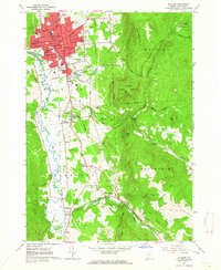 1961 Rutland1964 Print · USGSRutland at the start of the 1960s was a bustling rail and civic hub defined by its transition from urban streets to the Green Mountains. Researchers can trace the mid-century city layout, numerous neighborhood schools, and rural landmarks like the Appalachian Long Trail, Union Chapel, and Old Marsh Cem.5 unique versions available
 - 1964 Map of Glens Falls
 1964 Glens Falls1964 Print · USGSThe tri-state borderlands of New York, Vermont, and New Hampshire appear here in the mid-1960s. Researchers can trace the rail routes of the Rutland RR and find historic sites like Ticonderoga and Saratoga National Historical Park.
 - 1964 Map of West Rutland, 1965 Print
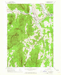 1964 West Rutland1965 Print · USGSRutland County's industrial and rural character is preserved here in the mid-1960s. Genealogists and historians can trace the rail lines of the Delaware and Hudson Railroad and find long-established sites like Clarendon Springs and Edmunds Cem.4 unique versions available
 - 1967 Map of Middletown Springs, 1972 Print
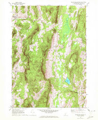 1967 Middletown Springs1972 Print · USGSMiddletown Springs and the surrounding Taconic foothills appear here during the late 1960s, a period of transition for these rural Vermont communities. Genealogists and local historians can locate family plots at Tinmouth Cem or Staples Cem and trace old homesteads near Chipman Lake.3 unique versions available
 - 1985 Map of Claremont, 1986 Print
 1985 Claremont1986 Print · USGSUpper Valley and Green Mountain life are captured here in the mid-eighties, centered on the river-linked hubs of Claremont and Springfield. Trace old family routes and rail lines like the Boston & Maine RR, or locate properties near Lake Sunapee and Mount Ascutney State Park.2 unique versions available
 - 1985 Map of Rutland, 1988 Print
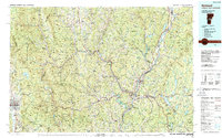 1985 Rutland1988 Print · USGSThe Upper Valley of the mid-1980s comes to life along the winding Connecticut River as it divides the Green Mountain and Granite states. Historians can trace the industrial rail hubs of White River Junction and the paths of the Appalachian Trail and Long Trail.
 - 1986 Map of Glens Falls
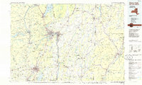 1986 Glens Falls1986 Print · USGSThe Upper Hudson Valley and Vermont borderlands come together in this mid-eighties survey of industrial river towns and mountain retreats. Genealogists and historians can trace the rail lines of the Delaware and Hudson Railway or locate landmarks like the Mount McGregor Correctional Facility and Saratoga Spa State Park.2 unique versions available
 - 1986 Map of Ticonderoga
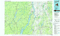 1986 Ticonderoga1986 Print · USGSThe Lake Champlain valley in the mid-eighties shows a landscape defined by Revolutionary War history and deep wilderness. Researchers can trace the Delaware and Hudson RR through the mountains or locate local landmarks like Fort Ticonderoga, St. Genevieve Cem, and the Ore Bed.
 - 1986 Map of Wallingford, 1987 Print
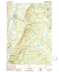 1986 Wallingford1987 Print · USGSVermont's Green Mountains were well-established as a recreational and industrial hub in the mid-1980s. Local researchers can trace the winding Appalachian Trail through the Green Mountain National Forest or locate valley landmarks like the Marble Quarry and Elfin Lake.
 - 1989 Map of Ticonderoga
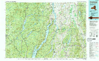 1989 Ticonderoga1989 Print · USGSThe Champlain Valley and Adirondack foothills meet in the late eighties, documenting a historic borderland defined by mountain lakes and timber. Genealogists and historians can trace the paths of the Delaware and Hudson RR or locate the Hubbardton Battlefield State Historic Site.2 unique versions available
 - 1989 Map of Glens Falls
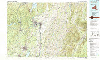 1989 Glens Falls1989 Print · USGSThe Upper Hudson Valley and the Vermont borderlands are captured here during the late eighties, showing a landscape of river-town industry and mountain recreation. Researchers can trace the Champlain Canal, the Delaware and Hudson RR, and historic sites like Saratoga National Historical Park.
 - 1996 Map of Rutland, 2000 Print
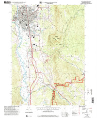 1996 Rutland2000 Print · USGSRutland and the Otter Creek valley are shown here in the mid-1990s, capturing the city alongside its rural foothills. Genealogists and local historians can trace family landmarks and civic sites like the Riverside Reformatory, Union Chapel, and Mount St Joseph Academy.
 - 1997 Map of Wallingford, 2000 Print
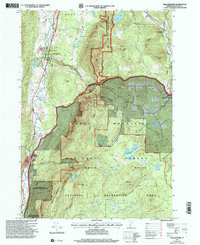 1997 Wallingford2000 Print · USGSThe Green Mountains and the Otter Creek valley meet in this Vermont landscape during the late twentieth century. Genealogists and hikers can trace the Appalachian Trail, locate the Marble Quarry, or find family landmarks like Homer Stone Mtn.
Showing maps 1-25 of 45
Top cities near Clarendon
- Rutland City historical maps
- Brandon historical maps
- Poultney historical maps
- Wallingford historical maps
- Dorset historical maps
- West Rutland historical maps
See more
Top neighborhoods of Clarendon
- Alfrecha historical maps
- Chippenhook historical maps
- East Clarendon historical maps
- Pierces Corner historical maps
- North Clarendon historical maps
- Clarendon Springs historical maps
Frequently asked questions
- What are the different types of historical maps available for Clarendon?
- What is the oldest map of Clarendon?
- Where can I purchase historical maps of Clarendon for my home or office?
- Where can I download high-res historical maps of Clarendon?
- Are there historical topographic maps available for Clarendon?
- Is there historical aerial imagery available for Clarendon?
- Where are historical maps of Clarendon sourced from?