1990s Maps of Shrewsbury, Vermont
Explore 4 historic maps of Shrewsbury from the 1990s. These maps offer a rare glimpse into what life looked like during the 1990s — showing old roads, neighborhoods, homes, and landmarks that have changed or disappeared over time.
Whether you're researching your family's past, planning a metal detecting trip, or studying how Shrewsbury's landscape evolved across the 1990s, these high-resolution maps are a powerful tool for exploring the history of this region.
- Focus on a specific era: All maps on this page are from the 1990s, giving you a focused view of this time period.
- See what’s changed: Compare century-old streets, trails, and buildings to today's modern landscape using overlays and satellite layers.
- Research with precision: Use these maps for genealogy, historical research, land use analysis, or educational projects.
- View, download, or print: Maps are fully viewable online in high resolution, and can be downloaded or printed for your own records.
Start exploring Shrewsbury's history through authentic maps from the 1990s. This is your window into the past.
Shrewsbury, VT maps
(4)- 1996 Map of Rutland, 2000 Print
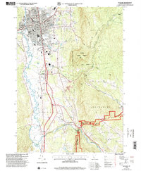 1996 Rutland2000 Print · USGSRutland and the Otter Creek valley are shown here in the mid-1990s, capturing the city alongside its rural foothills. Genealogists and local historians can trace family landmarks and civic sites like the Riverside Reformatory, Union Chapel, and Mount St Joseph Academy.
 - 1997 Map of Killington Peak, 2000 Print
 1997 Killington Peak2000 Print · USGSRutland County’s high peaks and forest lands are documented here during the late 1990s as the region solidified its role as a premier recreation destination. Genealogists and local historians can trace the foundations of North Shrewsbury through the Northam Sch and Northam Cem.
 - 1997 Map of Mount Holly, 2000 Print
 1997 Mount Holly2000 Print · USGSMount Holly and the Green Mountains are shown during the late twentieth century as recreation and conservation shaped the Vermont landscape. Genealogists can trace family names at Hammond Hill and Roger Hill, or locate local burials at various Cem sites near Belmont and Hortonville.
 - 1997 Map of Wallingford, 2000 Print
 1997 Wallingford2000 Print · USGSThe Green Mountains and the Otter Creek valley meet in this Vermont landscape during the late twentieth century. Genealogists and hikers can trace the Appalachian Trail, locate the Marble Quarry, or find family landmarks like Homer Stone Mtn.
End of results
Showing maps 1-4 of 4
Top cities near Shrewsbury
- Rutland City historical maps
- Brandon historical maps
- Woodstock historical maps
- Clarendon historical maps
- Ludlow Village historical maps
- Ludlow historical maps
See more
Top neighborhoods of Shrewsbury
Frequently asked questions
- What are the different types of historical maps available for Shrewsbury?
- What is the oldest map of Shrewsbury?
- Where can I purchase historical maps of Shrewsbury for my home or office?
- Where can I download high-res historical maps of Shrewsbury?
- Are there historical topographic maps available for Shrewsbury?
- Is there historical aerial imagery available for Shrewsbury?
- Where are historical maps of Shrewsbury sourced from?