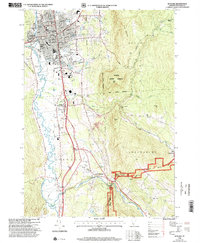
1996 Map of Rutland
USGS Topo · Published 2000About this map
The city of Rutland serves as the focal point of this late-century landscape, characterized by its dense civic infrastructure and the winding course of Otter Creek. The map details an established urban center featuring several parochial and public institutions, including St Peters Sch, Mount St Joseph Academy, and the Riverside Reformatory. As the terrain rises to the east toward East Mountain, the map reveals a transition into the dense woodlands of Aitken State Forest and the Rutland City Forest, where the topography becomes increasingly complex. To the south, the valley floor accommodates the Rutland State Airport and small settlements like North Clarendon and East Clarendon. The mapping of transport routes like Notch Road and the Lottery Mountain Scenic Recreation National Forest Trail illustrates the area's dual character as both a regional transportation hub and a gateway to the Green Mountains.
Find a feature on this map
58 named features on this map. Tap any name to fly to it.
Don’t see what you’re looking for? This feature index may not catch every label — zoom into the map to look around manually.
Map Details
Editions of this 1996 Rutland Map
This is the sole edition of this map. No revisions or reprints were ever made.
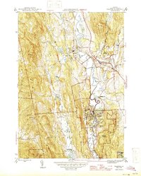
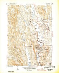
Other maps of this area

1891 · Rutland
USGS Topo · 1:62,500

1893 · Wallingford
USGS Topo · 1:62,500

1893 · Rutland
USGS Topo · 1:62,500

1894 · Pawlet
USGS Topo · 1:62,500

1895 · Castleton
USGS Topo · 1:62,500

1897 · Pawlet
USGS Topo · 1:62,500

1897 · Castleton
USGS Topo · 1:62,500

1903 · Mettawee
USGS Topo · 1:125,000
1944 · Proctor
USGS Topo · 1:31,680
1946 · Proctor
USGS Topo · 1:31,680