Old Maps of Berlin, Vermont for Metal Detecting
Plan your next treasure hunt with 35 historic maps of Berlin. Find old homesites, ghost towns, trails, and gathering spots that may be lost to time — perfect for identifying promising metal detecting locations.
- Locate forgotten sites: Uncover places like long-lost settlements, abandoned rail lines, or gathering spots.
- Plan better hunts: Use map overlays combined with LiDAR or satellite views to narrow in on historically rich areas.
- Made for detectorists: Thousands of hobbyists use these maps to discover relics, coins, and hidden history.
Use these historic maps to boost your research and find new opportunities beneath the surface of Berlin.
Berlin, VT maps
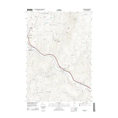
(35)- 1919 Map of Montpelier, 1958 Print
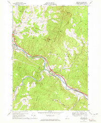
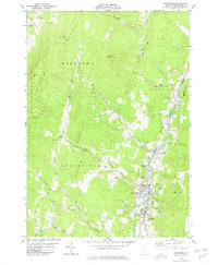
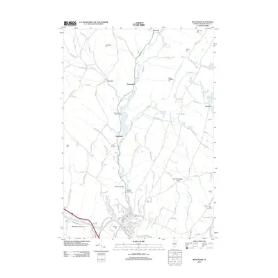
 1919 Montpelier1958 Print · USGSMontpelier and the Winooski River valley are shown here just after the Great War, when rail lines and early highways connected a landscape of small hill farms and mines. Genealogists can locate dozens of rural landmarks, including the Talc Mine, the Sodom PO, and the Green Mountain Cemetery.2 unique versions available
 - 1921 Map of Montpelier
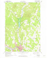
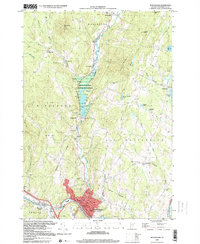
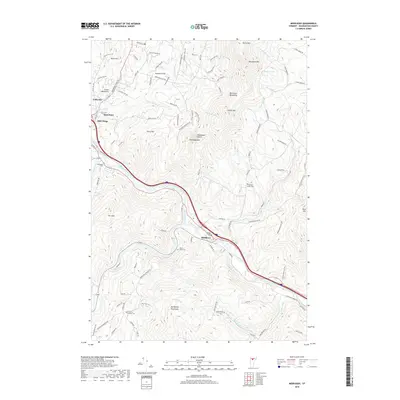
 1921 Montpelier1921 Print · USGSMontpelier and the Winooski valley are seen here in the early twenties, framed by the peaks of the Worcester Mountains. Genealogists and local historians can locate dozens of district schools and unique landmarks like the Talc Mine, Sodom PO, and the Central Vermont Ry.6 unique versions available
 - 1922 Map of Barre
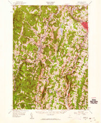
 1922 Barre1922 Print · USGSCentral Vermont in the early 1920s is revealed as a bustling landscape of granite quarries, hillside farms, and the historic Norwich University campus. Genealogists and historians can trace district schoolhouses, remote cemeteries like West Hill Cemetery, and industrial landmarks including the Talc Mine and numerous quarries.
 - 1924 Map of Barre
 1924 Barre1924 Print · USGSVermont's granite country and the Dog River valley are captured here in the mid-1920s, showing the early industrial roots of the region. Researchers can locate dozens of district schools, the Norwich University campus, and local industry sites like the Washington Granite Co and the Talc Mine.5 unique versions available
 - 1944 Map of Montpelier
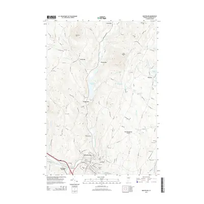
 1944 Montpelier1944 Print · USGSCentral Vermont in the mid-1940s is mapped here with a focus on its mountain settlements and river valley corridors. Genealogists can trace family roots through numerous district schools like Loomis Hill Sch and the location of the Talc Mine.
 - 1950 Map of Lake Champlain
 1950 Lake Champlain1950 Print · USGSThe Lake Champlain valley and its surrounding peaks are captured in detail during the late 1940s, showing the vital rail and road connections between New York and Vermont. Researchers can trace the routes of the Central Vermont Railway or locate old industrial centers like Mineville and Witherbee.2 unique versions available
 - 1957 Map of Barre, 1960 Print
 1957 Barre1960 Print · USGSCentral Vermont’s rugged spine is captured in the late fifties, showcasing the tight-knit valley towns and mountain camps of Washington County. Genealogists and historians can trace the Central Vermont rail line, find old schools like No 9 Sch, and locate the historic State Fish Hatchery near Roxbury.3 unique versions available
 - 1958 Map of Lake Champlain
 1958 Lake Champlain1958 Print · USGSThe Champlain Valley and surrounding high peaks are captured here in the late fifties, showcasing the cross-border region from the Adirondacks to the Green Mountains. Researchers can trace historic rail routes like the Rutland Railway or locate old valley settlements such as Keeseville and Vergennes.2 unique versions available
 - 1962 Map of Lake Champlain, 1975 Print
 1962 Lake Champlain1975 Print · USGSLake Champlain and the high peaks of the Adirondacks and Green Mountains are captured here during the mid-twentieth century. Researchers can trace the industrial legacy of the Lyon Mountain Mine and the rail corridors of the Central Vermont RR and Delaware & Hudson RR.3 unique versions available
 - 1968 Map of Middlesex, 1972 Print
 1968 Middlesex1972 Print · USGSThe Winooski River valley in the late sixties shows a landscape of traditional Vermont hamlets adapting to the arrival of the interstate. Researchers can trace historic family burial sites at Fairmount Cem or explore the rural layout of Kneeland Flat and Middlesex Center.2 unique versions available
 - 1968 Map of Montpelier, 1973 Print
 1968 Montpelier1973 Print · USGSThe Vermont state capital and surrounding townships of the late sixties are captured here in high detail. Researchers can trace the Central Vermont rail lines through the city or locate family plots at Green Mount Cemetery and North Branch Cem.2 unique versions available
 - 1978 Map of Barre West, 1979 Print
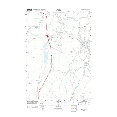
 1978 Barre West1979 Print · USGSCentral Vermont's granite and rail heritage is on full display in the late seventies as the industrial corridors between Barre and Montpelier continue to evolve. Researchers can locate numerous family burial sites like Hope Cem or trace the routes of the Central Vermont and Montpelier and Barre railroads.3 unique versions available
 - 1980 Map of Northfield
 1980 Northfield1980 Print · USGSThe Green Mountain valleys near Northfield and the Dog River are shown in detail during the late 1970s. Genealogists and local historians can trace family locations through Mount Hope Cem, the Norwich University campus, and local crossings like the Covered Bridge.2 unique versions available
 - 1988 Map of Montpelier
 1988 Montpelier1988 Print · USGSThe area surrounding Vermont’s capital city appears here during the early 1940s, showing the vital rail-and-river network. Genealogists can trace family names across a dozen district schools and rural sites like Middlesex Center and the Talc Mine.2 unique versions available
 - 1999 Map of Montpelier, 2000 Print
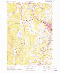
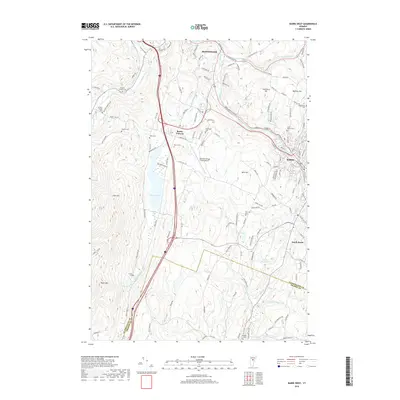
 1999 Montpelier2000 Print · USGSMontpelier and the surrounding hills are captured in the late 1990s, showcasing the capital's layout and its river-valley geography. Researchers can trace the grounds of the State Capitol, locate the Green Mount Cemetery, and find rural landmarks like The Old Meetinghouse Ch.
 - 2012 Map of Middlesex, 2012 Print
 2012 Middlesex2012 Print · USGSCovers Berlin, including Waterbury, Middlesex, and other nearby areas
 - 2012 Map of Northfield, 2012 Print
 2012 Northfield2012 Print · USGSCovers Berlin, including Northfield, Waitsfield, and other nearby areas
 - 2012 Map of Montpelier, 2012 Print
 2012 Montpelier2012 Print · USGSCovers Berlin, including Montpelier, East Montpelier, and other nearby areas
 - 2012 Map of Barre West, 2012 Print
 2012 Barre West2012 Print · USGSCovers Berlin, including Barre, Montpelier, and other nearby areas
 - 2015 Map of Northfield, 2015 Print
 2015 Northfield2015 Print · USGSCovers Berlin, including Northfield, Waitsfield, and other nearby areas
 - 2015 Map of Barre West, 2015 Print
 2015 Barre West2015 Print · USGSCovers Berlin, including Barre, Montpelier, and other nearby areas
 - 2015 Map of Middlesex, 2015 Print
 2015 Middlesex2015 Print · USGSCovers Berlin, including Waterbury, Middlesex, and other nearby areas
 - 2015 Map of Montpelier, 2015 Print
 2015 Montpelier2015 Print · USGSCovers Berlin, including Montpelier, East Montpelier, and other nearby areas
 - 2018 Map of Middlesex, 2018 Print
 2018 Middlesex2018 Print · USGSCovers Berlin, including Waterbury, Middlesex, and other nearby areas
 - 2018 Map of Barre West, 2018 Print
 2018 Barre West2018 Print · USGSCovers Berlin, including Barre, Montpelier, and other nearby areas
Showing maps 1-25 of 35
Top cities near Berlin
- Barre historical maps
- Montpelier historical maps
- Northfield historical maps
- Waterbury historical maps
- Stowe historical maps
- Randolph historical maps
See more
Top neighborhoods of Berlin
Frequently asked questions
- What are the different types of historical maps available for Berlin?
- What is the oldest map of Berlin?
- Where can I purchase historical maps of Berlin for my home or office?
- Where can I download high-res historical maps of Berlin?
- Are there historical topographic maps available for Berlin?
- Is there historical aerial imagery available for Berlin?
- Where are historical maps of Berlin sourced from?