1900s (20th Century) Maps of Mallard Lake, Albemarle County
Explore 7 historic maps of Mallard Lake from the 1900s (20th Century). These maps offer a rare glimpse into what life looked like during the 1900s — showing old roads, neighborhoods, homes, and landmarks that have changed or disappeared over time.
Whether you're researching your family's past, planning a metal detecting trip, or studying how Mallard Lake's landscape evolved across the 1900s, these high-resolution maps are a powerful tool for exploring the history of this region.
- Focus on a specific era: All maps on this page are from the 1900s, giving you a focused view of this time period.
- See what’s changed: Compare century-old streets, trails, and buildings to today's modern landscape using overlays and satellite layers.
- Research with precision: Use these maps for genealogy, historical research, land use analysis, or educational projects.
- View, download, or print: Maps are fully viewable online in high resolution, and can be downloaded or printed for your own records.
Start exploring Mallard Lake's history through authentic maps from the 1900s. This is your window into the past.
Mallard Lake, Albemarle County maps
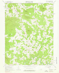
(7)- 1931 Map of University
 1931 University1931 Print · USGSAlbemarle County is shown here during the late Prohibition era, when the university and the railroad defined the local economy. Genealogists can trace family names through landmarks like the Miller School, Whitehall, and Mt Plains Ch.2 unique versions available
 - 1935 Map of University, 1962 Print
 1935 University1962 Print · USGSAlbemarle County is captured here in the mid-thirties as the new national park and Skyline Drive begin to reshape the Blue Ridge peaks. Genealogists can trace family names across dozens of rural institutions, from the Miller School to Meriwether Lewis Sch and Hillsboro.
 - 1949 Map of Charlottesville
 1949 Charlottesville1949 Print · USGSThe Shenandoah Valley and Blue Ridge appear in the late 1940s as a thriving corridor of rail and river commerce. Researchers can trace the mid-century footprints of Harrisonburg, Staunton, and Culpeper alongside the historic routes of the Southern Railway.2 unique versions available
 - 1956 Map of Charlottesville, 1966 Print
 1956 Charlottesville1966 Print · USGSThe Shenandoah Valley and Blue Ridge are captured in detail during the mid-1960s as the modern interstate system began to emerge. Genealogists and historians can trace rail-connected hubs like Waynesboro or follow the river paths of the Rapidan River and Rivanna River.4 unique versions available
 - 1965 Map of Free Union, 1976 Print
 1965 Free Union1976 Print · USGSAlbemarle and Greene Counties are captured here in the mid-1960s, showing a rural landscape defined by community churches and river confluences. Researchers can locate local landmarks like Prize Hill Ch, the Thompson Cem, and the winding paths of the Mechums River.2 unique versions available
 - 1977 Map of Free Union, 1982 Print
 1977 Free Union1982 Print · USGSAlbemarle County's rolling Piedmont and rising foothills are seen in the late seventies as a landscape of rural farmsteads and ancient watercourses. Genealogists can locate family lands near Free Union, Boonesville, and the banks of the Lynch River.
 - 1986 Map of Charlottesville
 1986 Charlottesville1986 Print · USGSCentral Virginia in the mid-eighties shows a landscape balanced between the growing city centers of the Piedmont and the protected ridges of the Blue Ridge. Trace the historic rail lines of the Chesapeake and Ohio Railway or locate local landmarks like Monticello Mountain and Bridgewater College.3 unique versions available
End of results
Showing maps 1-7 of 7
Frequently asked questions
- What are the different types of historical maps available for Mallard Lake?
- What is the oldest map of Mallard Lake?
- Where can I purchase historical maps of Mallard Lake for my home or office?
- Where can I download high-res historical maps of Mallard Lake?
- Are there historical topographic maps available for Mallard Lake?
- Is there historical aerial imagery available for Mallard Lake?
- Where are historical maps of Mallard Lake sourced from?