Old Maps of Albemarle County, Virginia
Explore 215 old maps of Albemarle County, spanning from 1891 to today. These high-resolution historic maps reveal how streets, neighborhoods, landmarks, and natural features evolved over time — perfect for genealogy, metal detecting, research, and local history exploration.
What you can do with these maps:
- See how Albemarle County changed over time: Compare historical maps to modern-day views to trace roads, homesites, rail lines & more.
- View detailed metadata: Each map includes creators, publishers, year, scale, and archive source.
- Overlay maps with satellite & LiDAR: Visualize the past alongside modern tools to explore terrain & human change.
- Trusted historical sources: Maps sourced from the USGS, Library of Congress, and other archives.
- Access maps your way: View online, download high-res files, or order prints for personal or research use.
Start exploring old maps of Albemarle County to uncover forgotten places, hidden landmarks, and the deep history beneath your feet.
Albemarle County, VA maps
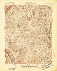
(215)- 1891 Map of Palmyra
 1891 Palmyra1891 Print · USGSCentral Virginia during the late nineteenth century was a landscape of river-driven industry and railroad expansion along the James. Genealogists and historians can locate old processing sites like Arvonia Slate Quarry, remote outposts like Boyds Tavern, and the track of the Richmond and Alleghany Railroad.
 - 1892 Map of Buckingham
 1892 Buckingham1892 Print · USGSCentral Virginia in the late nineteenth century was defined by its river-and-rail economy along the James River. Genealogists and historians can trace the foundations of local life through the Kleinburg School, the Soap Stone Quarry, and the Virginia Midland Railroad.7 unique versions available
 - 1892 Map of Gordonsville, 1899 Print
 1892 Gordonsville1899 Print · USGSCentral Virginia’s railway hubs and mountain gaps come alive in this late nineteenth-century survey. Genealogists and historians can trace the foundations of Charlottesville and the bustling rail junctions at Gordonsville and Orange.6 unique versions available
 - 1892 Map of Harrisonburg, 1901 Print
 1892 Harrisonburg1901 Print · USGSThe Shenandoah Valley during the 1890s reveals a landscape of thriving springs, mills, and emerging industry across Rockingham and Albemarle counties. Genealogists can trace family locations through sites like Meyerhoffer's Store, the Crimora Mine, and the University of Virginia Observatory.6 unique versions available
 - 1895 Map of Palmyra
 1895 Palmyra1895 Print · USGSThe James and Rivanna River valleys of central Virginia are captured here in the 1890s, revealing a landscape of rail-connected river towns and rural mills. Researchers can trace the Richmond and Alleghany Railroad and locate landmarks like the Arvon Slate Quarry or Flanagan Mill.
 - 1897 Map of Palmyra
 1897 Palmyra1897 Print · USGSCentral Virginia during the late 1880s is defined by its deep river valleys and the industrial reach of the James and Rivanna. Genealogists and historians can trace the growth of river towns like Scottsville or explore industrial roots at the Slate Quarry and Union Mills.7 unique versions available
 - 1929 Map of Covesville
 1929 Covesville1929 Print · USGSAlbemarle County’s soapstone industry and mountain communities are frozen in time just before the Depression. Genealogists and historians can trace family locations near Alberene, old schools like Red Hill Sch, and landmarks including Forest Lodge and Johnson Mill.3 unique versions available
 - 1931 Map of University
 1931 University1931 Print · USGSAlbemarle County is shown here during the late Prohibition era, when the university and the railroad defined the local economy. Genealogists can trace family names through landmarks like the Miller School, Whitehall, and Mt Plains Ch.2 unique versions available
 - 1934 Map of Waynesboro
 1934 Waynesboro1934 Print · USGSAugusta County settlements and Blue Ridge rail lines are captured here in the mid-1930s as the regional economy modernized. Local historians can trace old schools and churches from Fort Defiance to Lipscomb, including Old Stone Ch and the Blue Ridge Tunnel.2 unique versions available
 - 1935 Map of Charlottesville
 1935 Charlottesville1935 Print · USGSAlbemarle County's landscape is meticulously detailed in the mid-1930s, centered on the historic crossroads and river forks surrounding the city. Genealogists and local historians can trace family-named landmarks and essential community sites like Monticello, the Rosenwald Sch, and the rail junction at Barboursville.2 unique versions available
 - 1935 Map of Charlottesville And Vicinity
 1935 Charlottesville And Vicinity1935 Print · USGSCharlottesville and the Albemarle countryside are captured in detail in the mid-thirties, from the expanding university campus to the historic estates of the south. Researchers can trace the grounds of Monticello, locate local landmarks like Riverview Cemetery, and follow the old routes of the Southern Railway.
 - 1935 Map of Covesville, 1961 Print
 1935 Covesville1961 Print · USGSMid-century Albemarle County was defined by its soapstone industry and a dense network of country schools and chapels. Genealogists and historians can trace the foundations of local life through landmarks like Albermarle Soapstone Company, Cedar Vale Sch, and the riverside hub of Scottsville.
 - 1935 Map of University, 1962 Print
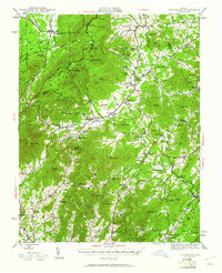
 1935 University1962 Print · USGSAlbemarle County is captured here in the mid-thirties as the new national park and Skyline Drive begin to reshape the Blue Ridge peaks. Genealogists can trace family names across dozens of rural institutions, from the Miller School to Meriwether Lewis Sch and Hillsboro.
 - 1937 Map of Elkton
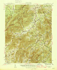
 1937 Elkton1937 Print · USGSThe Shenandoah Valley and Blue Ridge highlands are captured here in the 1930s as mountain missions and rural schools still served remote hollows. Genealogists can locate family landmarks like the Wyatt Shiflett Ch, Simmons Gap PO, and Blose Sch.3 unique versions available
 - 1939 Map of Charlottesville
 1939 Charlottesville1939 Print · USGSAlbemarle and Orange Counties come alive in the late 1930s, showing a Piedmont landscape defined by the Southwest Mountains and historic river valleys. Genealogists can locate family landmarks from Monticello to the Rosenwald Sch, alongside dozens of rural churches like Bethany Ch.3 unique versions available
 - 1939 Map of Waynesboro
 1939 Waynesboro1939 Print · USGSThe Shenandoah Valley meets the Blue Ridge in the late 1930s, showing a critical crossroads of rail and mountain passage. Genealogists can trace family names and institutions from the Augusta Military Academy at Fort Defiance to the Blue Ridge Tunnel near Waynesboro.3 unique versions available
 - 1943 Map of Lovingston, 1961 Print
 1943 Lovingston1961 Print · USGSThe Nelson County foothills and Blue Ridge summits are captured in the early 1940s, during a transitional period for Virginia's upland communities. Genealogists and historians can trace family locations near Lovingston or find rural landmarks like Locust Grove Ch, Woods Mill, and the Stage Bridge.2 unique versions available
 - 1943 Map of Scottsville, 1969 Print
 1943 Scottsville1969 Print · USGSCentral Virginia’s river valleys and historic estates are preserved in this mid-century portrait of the Albemarle and Fluvanna borderlands. Researchers can trace ancestral locations at Ash Lawn, follow the Chesapeake and Ohio line through Nicholas Siding, or locate rural landmarks like Jefferson Mill.
 - 1945 Map of Covesville
 1945 Covesville1945 Print · USGSAlbemarle County's river valleys and mountain foothills are shown here in the mid-1940s, a period defined by the convergence of rail and river commerce. Genealogists and historians can trace family locations near Alberene, Esmont, and the Mt Zion Ch, or locate old industrial sites like Johnson Mill.
 - 1946 Map of Scottsville
 1946 Scottsville1946 Print · USGSCentral Virginia during the mid-1940s is shown here as a landscape of river-bend towns and quiet country crossroads. Genealogists and historians can trace family locations through named landmarks like Jefferson Mill, Blenheim, and Antioch Ch, or follow the historic Three Chopt Road.2 unique versions available
 - 1946 Map of Lovingston
 1946 Lovingston1946 Print · USGSNelson County and the eastern slopes of the Blue Ridge are captured here in the mid-1940s, just as the regional road network was maturing. Genealogists can locate family landmarks and community hubs like Lovingston, Massies Mill, and the Dutch Creek Sch.2 unique versions available
 - 1947 Map of Roanoke, 1948 Print
 1947 Roanoke1948 Print · USGSCentral Virginia in the late 1940s reveals a region defined by its great mountain ridges and the powerful river-and-rail economy connecting Roanoke to Lynchburg. Researchers can trace the path of the Virginian RR and locate historic county seats like Charlotte Court House.2 unique versions available
 - 1949 Map of Charlottesville
 1949 Charlottesville1949 Print · USGSThe Shenandoah Valley and Blue Ridge appear in the late 1940s as a thriving corridor of rail and river commerce. Researchers can trace the mid-century footprints of Harrisonburg, Staunton, and Culpeper alongside the historic routes of the Southern Railway.2 unique versions available
 - 1949 Map of Charlottesville, 1962 Print
 1949 Charlottesville1962 Print · USGSMid-century Albemarle County is captured here during a period of steady growth, anchored by the expansion of the Charlottesville area and its surrounding ridges. Researchers can locate rural landmarks like Advance Mills, the Albemarle Training Sch, and the historic Spotswood Trail.
 - 1956 Map of Charlottesville, 1966 Print
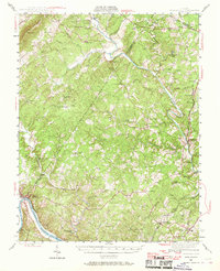
 1956 Charlottesville1966 Print · USGSThe Shenandoah Valley and Blue Ridge are captured in detail during the mid-1960s as the modern interstate system began to emerge. Genealogists and historians can trace rail-connected hubs like Waynesboro or follow the river paths of the Rapidan River and Rivanna River.4 unique versions available
Showing maps 1-25 of 215
Top cities of Albemarle County
- Hollymead historical maps
- University of Virginia historical maps
- Crozet historical maps
- Pantops historical maps
- Rivanna historical maps
- Rio historical maps
See more
Frequently asked questions
- What are the different types of historical maps available for Albemarle County?
- What is the oldest map of Albemarle County?
- Where can I purchase historical maps of Albemarle County for my home or office?
- Where can I download high-res historical maps of Albemarle County?
- Are there historical topographic maps available for Albemarle County?
- Is there historical aerial imagery available for Albemarle County?
- Where are historical maps of Albemarle County sourced from?