Old Maps of Rivanna, Virginia
Explore 48 old maps of Rivanna, spanning from 1891 to today. These high-resolution historic maps reveal how streets, neighborhoods, landmarks, and natural features evolved over time — perfect for genealogy, metal detecting, research, and local history exploration.
What you can do with these maps:
- See how Rivanna changed over time: Compare historical maps to modern-day views to trace roads, homesites, rail lines & more.
- View detailed metadata: Each map includes creators, publishers, year, scale, and archive source.
- Overlay maps with satellite & LiDAR: Visualize the past alongside modern tools to explore terrain & human change.
- Trusted historical sources: Maps sourced from the USGS, Library of Congress, and other archives.
- Access maps your way: View online, download high-res files, or order prints for personal or research use.
Start exploring old maps of Rivanna to uncover forgotten places, hidden landmarks, and the deep history beneath your feet.
Rivanna, VA maps
(48)- 1891 Map of Palmyra
 1891 Palmyra1891 Print · USGSCentral Virginia during the late nineteenth century was a landscape of river-driven industry and railroad expansion along the James. Genealogists and historians can locate old processing sites like Arvonia Slate Quarry, remote outposts like Boyds Tavern, and the track of the Richmond and Alleghany Railroad.
 - 1892 Map of Gordonsville, 1899 Print
 1892 Gordonsville1899 Print · USGSCentral Virginia’s railway hubs and mountain gaps come alive in this late nineteenth-century survey. Genealogists and historians can trace the foundations of Charlottesville and the bustling rail junctions at Gordonsville and Orange.6 unique versions available
 - 1895 Map of Palmyra
 1895 Palmyra1895 Print · USGSThe James and Rivanna River valleys of central Virginia are captured here in the 1890s, revealing a landscape of rail-connected river towns and rural mills. Researchers can trace the Richmond and Alleghany Railroad and locate landmarks like the Arvon Slate Quarry or Flanagan Mill.
 - 1897 Map of Palmyra
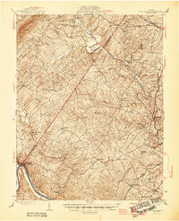
 1897 Palmyra1897 Print · USGSCentral Virginia during the late 1880s is defined by its deep river valleys and the industrial reach of the James and Rivanna. Genealogists and historians can trace the growth of river towns like Scottsville or explore industrial roots at the Slate Quarry and Union Mills.7 unique versions available
 - 1935 Map of Charlottesville
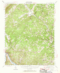
 1935 Charlottesville1935 Print · USGSAlbemarle County's landscape is meticulously detailed in the mid-1930s, centered on the historic crossroads and river forks surrounding the city. Genealogists and local historians can trace family-named landmarks and essential community sites like Monticello, the Rosenwald Sch, and the rail junction at Barboursville.2 unique versions available
 - 1939 Map of Charlottesville
 1939 Charlottesville1939 Print · USGSAlbemarle and Orange Counties come alive in the late 1930s, showing a Piedmont landscape defined by the Southwest Mountains and historic river valleys. Genealogists can locate family landmarks from Monticello to the Rosenwald Sch, alongside dozens of rural churches like Bethany Ch.3 unique versions available
 - 1943 Map of Scottsville, 1969 Print
 1943 Scottsville1969 Print · USGSCentral Virginia’s river valleys and historic estates are preserved in this mid-century portrait of the Albemarle and Fluvanna borderlands. Researchers can trace ancestral locations at Ash Lawn, follow the Chesapeake and Ohio line through Nicholas Siding, or locate rural landmarks like Jefferson Mill.
 - 1946 Map of Scottsville
 1946 Scottsville1946 Print · USGSCentral Virginia during the mid-1940s is shown here as a landscape of river-bend towns and quiet country crossroads. Genealogists and historians can trace family locations through named landmarks like Jefferson Mill, Blenheim, and Antioch Ch, or follow the historic Three Chopt Road.2 unique versions available
 - 1947 Map of Roanoke, 1948 Print
 1947 Roanoke1948 Print · USGSCentral Virginia in the late 1940s reveals a region defined by its great mountain ridges and the powerful river-and-rail economy connecting Roanoke to Lynchburg. Researchers can trace the path of the Virginian RR and locate historic county seats like Charlotte Court House.2 unique versions available
 - 1949 Map of Charlottesville
 1949 Charlottesville1949 Print · USGSThe Shenandoah Valley and Blue Ridge appear in the late 1940s as a thriving corridor of rail and river commerce. Researchers can trace the mid-century footprints of Harrisonburg, Staunton, and Culpeper alongside the historic routes of the Southern Railway.2 unique versions available
 - 1949 Map of Charlottesville, 1962 Print
 1949 Charlottesville1962 Print · USGSMid-century Albemarle County is captured here during a period of steady growth, anchored by the expansion of the Charlottesville area and its surrounding ridges. Researchers can locate rural landmarks like Advance Mills, the Albemarle Training Sch, and the historic Spotswood Trail.
 - 1956 Map of Charlottesville, 1966 Print
 1956 Charlottesville1966 Print · USGSThe Shenandoah Valley and Blue Ridge are captured in detail during the mid-1960s as the modern interstate system began to emerge. Genealogists and historians can trace rail-connected hubs like Waynesboro or follow the river paths of the Rapidan River and Rivanna River.4 unique versions available
 - 1959 Map of Roanoke
 1959 Roanoke1959 Print · USGSCentral Virginia and the Blue Ridge appear in great detail during the late fifties, showcasing the transition from mountain industry to Piedmont farmland. Trace the path of the Norfolk and Western railroad or find old river towns like Appomattox and Amelia Court House.
 - 1963 Map of Roanoke
 1963 Roanoke1963 Print · USGSCentral Virginia and the Blue Ridge front appear here in the early sixties, caught between their deep railroad roots and new postwar developments. Genealogists and historians can trace the rail lines of the Norfolk and Western through towns like Bedford and Altavista, or locate family landmarks near Smith Mountain Lake.
 - 1964 Map of Charlottesville East, 1965 Print
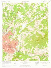 1964 Charlottesville East1965 Print · USGSCharlottesville and the surrounding Albemarle hills are captured here in the mid-sixties, just as the local landscape was being reshaped by new infrastructure. Genealogists and historians can locate Monticello, trace the vanished streets of Vinegar Hill, or find family names at Michie Tavern Cem and Griffin Cem.2 unique versions available
 - 1964 Map of Keswick, 1965 Print
 1964 Keswick1965 Print · USGSAlbemarle County's rural landscape is captured here in the mid-1960s, defined by the rise of the Southwestern Mountains and the busy Chesapeake and Ohio railroad. Researchers can trace family sites and old roads near Walkers Parish Ch, Cismont, and the Shackelford Cem.5 unique versions available
 - 1967 Map of Boyd Tavern, 1968 Print
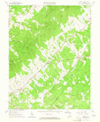
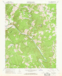 1967 Boyd Tavern1968 Print · USGSFluvanna County's rural landscape is captured here in the late sixties as the Rivanna River snakes through a region of old mills and crossroads. Genealogists can trace family footprints near historic sites like Boyd Tavern, Union Mills, and Haden Chapel.4 unique versions available
 - 1967 Map of Simeon, 1969 Print
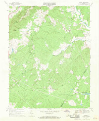 1967 Simeon1969 Print · USGSAlbemarle County is shown in the mid-sixties, capturing the rural character of the Piedmont hills before modern suburban expansion. Genealogists and historians can trace the estates at Ash Lawn and Blenheim alongside local landmarks like Middle Oak Ch.2 unique versions available
 - 1971 Map of Roanoke, 1977 Print
 1971 Roanoke1977 Print · USGSThe Virginia Piedmont and Blue Ridge mountains meet in this early 1970s landscape of river valleys and rail hubs. Researchers can trace historic transportation routes and landmarks like the Appomattox Court House Nat Hist Pk, the Peaks of Otter, and Amelia Court House.2 unique versions available
 - 1972 Map of Charlottesville East, 1974 Print
 1972 Charlottesville East1974 Print · USGSAlbemarle County comes into sharp focus during the early 1970s as the suburbs and road networks expand toward the Piedmont slopes. Researchers can trace the watercourses of the Rivanna River and the elevations of Southwestern Mountain.
 - 1973 Map of Charlottesville East, 1974 Print
 1973 Charlottesville East1974 Print · USGSThe Charlottesville area in the early seventies shows a balance of historical preservation and suburban growth. Trace the grounds of Monticello and the Jefferson Tomb, or locate family sites like Moon Cem and Chapman Grove Ch.3 unique versions available
 - 1977 Map of Keswick, 1982 Print
 1977 Keswick1982 Print · USGSAlbemarle County's Piedmont landscape is documented in the late seventies through detailed aerial photo-rectification. Researchers can trace land boundaries and rural homesteads around Keswick, Cismont, and the winding path of Mechunk Creek.
 - 1977 Map of Charlottesville East, 1982 Print
 1977 Charlottesville East1982 Print · USGSAlbemarle County in the late seventies is captured here just as the suburban footprint of the city was expanding into the surrounding hills. Genealogists and local historians can trace the rural tracts around Shadwell or follow the riverbanks at Eastham.
 - 1979 Map of Simeon, 1982 Print
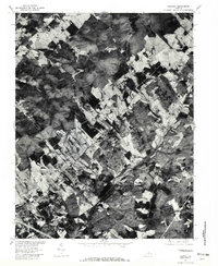
 1979 Simeon1982 Print · USGSThe rural Albemarle County landscape near the Rivanna River is captured here in the late seventies through detailed aerial photography. Genealogists and land researchers can pinpoint exact farmsteads and field lines near Overton, Blenheim, and the waters of Fluvanna Ruritan Lake.
 - 1979 Map of Boyd Tavern, 1982 Print
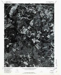 1979 Boyd Tavern1982 Print · USGSThe Fluvanna County countryside underwent significant transformation by the late seventies, as seen in the development of Lake Monticello. Researchers can trace the growing suburban footprint near Nahor and Wildwood along the Rivanna River.
Showing maps 1-25 of 48
Top cities near Rivanna
- Charlottesville historical maps
- Lake Monticello historical maps
- Hollymead historical maps
- University of Virginia historical maps
- Pantops historical maps
- Rio historical maps
See more
Frequently asked questions
- What are the different types of historical maps available for Rivanna?
- What is the oldest map of Rivanna?
- Where can I purchase historical maps of Rivanna for my home or office?
- Where can I download high-res historical maps of Rivanna?
- Are there historical topographic maps available for Rivanna?
- Is there historical aerial imagery available for Rivanna?
- Where are historical maps of Rivanna sourced from?