1970s Maps of Albemarle County, Virginia
Explore 33 historic maps of Albemarle County from the 1970s. These maps offer a rare glimpse into what life looked like during the 1970s — showing old roads, neighborhoods, homes, and landmarks that have changed or disappeared over time.
Whether you're researching your family's past, planning a metal detecting trip, or studying how Albemarle County's landscape evolved across the 1970s, these high-resolution maps are a powerful tool for exploring the history of this region.
- Focus on a specific era: All maps on this page are from the 1970s, giving you a focused view of this time period.
- See what’s changed: Compare century-old streets, trails, and buildings to today's modern landscape using overlays and satellite layers.
- Research with precision: Use these maps for genealogy, historical research, land use analysis, or educational projects.
- View, download, or print: Maps are fully viewable online in high resolution, and can be downloaded or printed for your own records.
Start exploring Albemarle County's history through authentic maps from the 1970s. This is your window into the past.
Albemarle County, VA maps
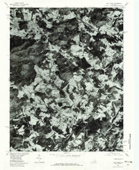
(33)- 1970 Map of Gordonsville, 1972 Print
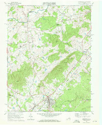 1970 Gordonsville1972 Print · USGSGordonsville and the surrounding Virginia Piedmont are captured here in the early seventies as a vital rail crossroads. Researchers can trace family history through sites like James Madison Sch, Blue Run Ch, and the many cemeteries near Old Somerset.3 unique versions available
 - 1970 Map of Boswells Tavern, 1972 Print
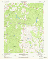 1970 Boswells Tavern1972 Print · USGSLouisa and Albemarle counties are captured in the early seventies as traditional rural communities evolved alongside the South Anna River. Researchers can locate established landmarks like Boswells Tavern, the Green Springs Sch, and Pleasant Plain Ch.4 unique versions available
 - 1971 Map of Roanoke, 1977 Print
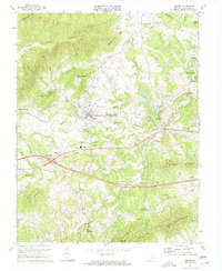
 1971 Roanoke1977 Print · USGSThe Virginia Piedmont and Blue Ridge mountains meet in this early 1970s landscape of river valleys and rail hubs. Researchers can trace historic transportation routes and landmarks like the Appomattox Court House Nat Hist Pk, the Peaks of Otter, and Amelia Court House.2 unique versions available
 - 1972 Map of Charlottesville West, 1974 Print
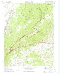
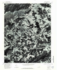
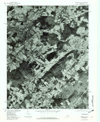
 1972 Charlottesville West1974 Print · USGSAlbemarle County comes into sharp focus in the early seventies through this detailed aerial orthophotomap of the Piedmont. Researchers can trace the mid-century expansion of local infrastructure along Route 250 and examine the wooded slopes of the Ragge Mountains.
 - 1972 Map of Waynesboro East, 1974 Print
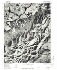
 1972 Waynesboro East1974 Print · USGSWaynesboro and the surrounding valley floor are captured at the start of the seventies as the city grew toward the mountains. Trace the development of Waynesboro and the wooded slopes of the Blue Ridge through detailed aerial photography.
 - 1972 Map of Charlottesville East, 1974 Print
 1972 Charlottesville East1974 Print · USGSAlbemarle County comes into sharp focus during the early 1970s as the suburbs and road networks expand toward the Piedmont slopes. Researchers can trace the watercourses of the Rivanna River and the elevations of Southwestern Mountain.
 - 1973 Map of Charlottesville West, 1974 Print
 1973 Charlottesville West1974 Print · USGSAlbemarle County and the western reaches of Charlottesville appear here during a period of rapid institutional growth in the early seventies. Genealogists and historians can trace family-named summits like Turners Mtn and Clark Mtn or locate local landmarks including Olivet Ch and Sherwood Farms.3 unique versions available
 - 1973 Map of Crozet, 1974 Print
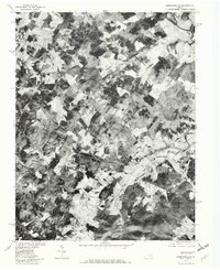
 1973 Crozet1974 Print · USGSAlbemarle County in the early 1970s shows the growth of the Crozet area alongside deep-rooted rural institutions. Genealogists can locate family landmarks like Miller School, the Hillsboro Cem, and old stops on the Chesapeake and Ohio railroad.2 unique versions available
 - 1973 Map of Waynesboro East, 1974 Print
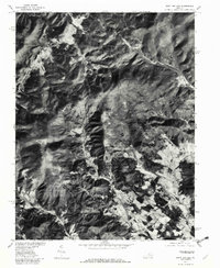
 1973 Waynesboro East1974 Print · USGSThe Blue Ridge mountains meet the Shenandoah Valley in the early 1970s, showcasing a landscape defined by historic rail and high-ridge trails. Trace local genealogy and industry through the Blue Ridge Tunnel, the Greenwood School, and Critzers Shop.2 unique versions available
 - 1973 Map of Charlottesville East, 1974 Print
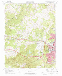
 1973 Charlottesville East1974 Print · USGSThe Charlottesville area in the early seventies shows a balance of historical preservation and suburban growth. Trace the grounds of Monticello and the Jefferson Tomb, or locate family sites like Moon Cem and Chapman Grove Ch.3 unique versions available
 - 1977 Map of Keswick, 1982 Print
 1977 Keswick1982 Print · USGSAlbemarle County's Piedmont landscape is documented in the late seventies through detailed aerial photo-rectification. Researchers can trace land boundaries and rural homesteads around Keswick, Cismont, and the winding path of Mechunk Creek.
 - 1977 Map of Earlysville, 1982 Print
 1977 Earlysville1982 Print · USGSThe rural landscapes of Albemarle County are captured during the late 1970s, showing the agricultural heart of the Virginia Piedmont. Researchers can trace historic property boundaries and river crossings near Earlysville, Advance Mills, and the slopes of Piney Mountain.
 - 1977 Map of Boswells Tavern, 1982 Print
 1977 Boswells Tavern1982 Print · USGSLouisa County in the late seventies is revealed through this aerial survey, showing the land's transition between forest and farm. Genealogists and local historians can trace the rural layouts of Boswells Tavern, Waldrop, and Meltons.
 - 1977 Map of Waynesboro East, 1982 Print
 1977 Waynesboro East1982 Print · USGSThe eastern Blue Ridge and the city of Waynesboro are captured in high detail at the end of the seventies. Genealogists and historians can trace the rural layouts of Newtown and Afton or locate landmarks like Rockfish Gap and Skyline Drive.
 - 1977 Map of Crozet, 1982 Print
 1977 Crozet1982 Print · USGSWestern Albemarle County comes into sharp focus during the late seventies, showing the traditional crossroads and farmsteads of the Blue Ridge foothills. Genealogists and local historians can trace family lands near White Hall, Crozet, and the banks of Mechums River.
 - 1977 Map of Charlottesville West, 1982 Print
 1977 Charlottesville West1982 Print · USGSWestern Albemarle County at the end of the seventies is seen here through detailed aerial imagery of the developing countryside. Researchers can trace the layout of Farmington or locate the rural outskirts of Owensville and Millington.
 - 1977 Map of Charlottesville East, 1982 Print
 1977 Charlottesville East1982 Print · USGSAlbemarle County in the late seventies is captured here just as the suburban footprint of the city was expanding into the surrounding hills. Genealogists and local historians can trace the rural tracts around Shadwell or follow the riverbanks at Eastham.
 - 1977 Map of Barboursville, 1982 Print
 1977 Barboursville1982 Print · USGSThe Virginia Piedmont's agricultural landscape is seen in detail during the late seventies, showing the rural communities of Orange and Greene counties. Trace historic family lands and farmstead locations near Barboursville, Eheart, and the winding Preddy Creek.
 - 1977 Map of Mc Gaheysville, 1982 Print
 1977 Mc Gaheysville1982 Print · USGSRockingham County in the late seventies is shown in remarkable detail through this aerial orthophotoquad. Genealogists and local historians can trace the property lines near Mc Gaheysville, Berrytown, and the South Fork Shenandoah River.
 - 1977 Map of Swift Run Gap, 1982 Print
 1977 Swift Run Gap1982 Print · USGSGreene County’s mountain passes and valley settlements are captured in the late seventies just as the landscape balanced traditional farming and parkland. Researchers can trace rural road networks and family-named landmarks like Bacon Hollow, Haneytown, and Dyke.
 - 1977 Map of Free Union, 1982 Print
 1977 Free Union1982 Print · USGSAlbemarle County's rolling Piedmont and rising foothills are seen in the late seventies as a landscape of rural farmsteads and ancient watercourses. Genealogists can locate family lands near Free Union, Boonesville, and the banks of the Lynch River.
 - 1977 Map of Crimora, 1982 Print
 1977 Crimora1982 Print · USGSAugusta County, Virginia, is seen from above in the late 1970s as the South River winds past valley settlements. Genealogists and local historians can trace the homesteads around Crimora and Harriston or follow the path of Skyline Drive along the ridge.
 - 1977 Map of Gordonsville, 1982 Print
 1977 Gordonsville1982 Print · USGSGordonsville and the surrounding Virginia Piedmont appear in sharp detail during the late seventies, showing the area's rural character and rail-town roots. Researchers can trace land tracts near Gordonsville and Somerset or locate family sites along Blue Run.
 - 1977 Map of Browns Cove, 1982 Print
 1977 Browns Cove1982 Print · USGSThe foothills of the Blue Ridge Mountains appear in the late 1970s as a mix of high-altitude wilderness and valley farmsteads. Trace early settlements at Browns Cove and Doylesville alongside the winding path of Skyline Drive.
 - 1979 Map of Simeon, 1982 Print
 1979 Simeon1982 Print · USGSThe rural Albemarle County landscape near the Rivanna River is captured here in the late seventies through detailed aerial photography. Genealogists and land researchers can pinpoint exact farmsteads and field lines near Overton, Blenheim, and the waters of Fluvanna Ruritan Lake.
Showing maps 1-25 of 33
Top cities of Albemarle County
- Hollymead historical maps
- University of Virginia historical maps
- Crozet historical maps
- Pantops historical maps
- Rivanna historical maps
- Rio historical maps
See more
Frequently asked questions
- What are the different types of historical maps available for Albemarle County?
- What is the oldest map of Albemarle County?
- Where can I purchase historical maps of Albemarle County for my home or office?
- Where can I download high-res historical maps of Albemarle County?
- Are there historical topographic maps available for Albemarle County?
- Is there historical aerial imagery available for Albemarle County?
- Where are historical maps of Albemarle County sourced from?