Old Maps of Mill Creek, Albemarle County for Genealogy
Trace your family roots with 18 historic maps of Mill Creek. These high-res maps reveal old neighborhoods, homesites, landmarks, and streets — helping you uncover where your ancestors lived and how the area evolved over time.
- Explore historic neighborhoods: Identify where your relatives may have lived in the 1800s or 1900s.
- Compare maps over time: Trace the changes in streets, buildings, and landmarks for multi-generational research.
- Perfect for genealogy & ancestry research: Used by family historians and researchers to map out lineage and migration.
These maps are an incredible resource for exploring your personal connection to Mill Creek's past.
Mill Creek, Albemarle County maps
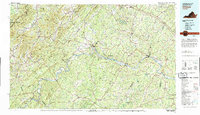
(18)- 1892 Map of Buckingham
 1892 Buckingham1892 Print · USGSCentral Virginia in the late nineteenth century was defined by its river-and-rail economy along the James River. Genealogists and historians can trace the foundations of local life through the Kleinburg School, the Soap Stone Quarry, and the Virginia Midland Railroad.7 unique versions available
 - 1929 Map of Covesville
 1929 Covesville1929 Print · USGSAlbemarle County’s soapstone industry and mountain communities are frozen in time just before the Depression. Genealogists and historians can trace family locations near Alberene, old schools like Red Hill Sch, and landmarks including Forest Lodge and Johnson Mill.3 unique versions available
 - 1935 Map of Charlottesville And Vicinity
 1935 Charlottesville And Vicinity1935 Print · USGSCharlottesville and the Albemarle countryside are captured in detail in the mid-thirties, from the expanding university campus to the historic estates of the south. Researchers can trace the grounds of Monticello, locate local landmarks like Riverview Cemetery, and follow the old routes of the Southern Railway.
 - 1935 Map of Covesville, 1961 Print
 1935 Covesville1961 Print · USGSMid-century Albemarle County was defined by its soapstone industry and a dense network of country schools and chapels. Genealogists and historians can trace the foundations of local life through landmarks like Albermarle Soapstone Company, Cedar Vale Sch, and the riverside hub of Scottsville.
 - 1945 Map of Covesville
 1945 Covesville1945 Print · USGSAlbemarle County's river valleys and mountain foothills are shown here in the mid-1940s, a period defined by the convergence of rail and river commerce. Genealogists and historians can trace family locations near Alberene, Esmont, and the Mt Zion Ch, or locate old industrial sites like Johnson Mill.
 - 1947 Map of Roanoke, 1948 Print
 1947 Roanoke1948 Print · USGSCentral Virginia in the late 1940s reveals a region defined by its great mountain ridges and the powerful river-and-rail economy connecting Roanoke to Lynchburg. Researchers can trace the path of the Virginian RR and locate historic county seats like Charlotte Court House.2 unique versions available
 - 1959 Map of Roanoke
 1959 Roanoke1959 Print · USGSCentral Virginia and the Blue Ridge appear in great detail during the late fifties, showcasing the transition from mountain industry to Piedmont farmland. Trace the path of the Norfolk and Western railroad or find old river towns like Appomattox and Amelia Court House.
 - 1960 Map of Charlottesville And Vicinity
 1960 Charlottesville And Vicinity1960 Print · USGSCharlottesville and the rolling Albemarle County hills are captured here in the mid-twentieth century, centered on the University of Virginia. Genealogists and historians can trace the estates of Monticello and Ash Lawn alongside local landmarks like Riverview Cemetery and Hickory Hill Ch.
 - 1963 Map of Roanoke
 1963 Roanoke1963 Print · USGSCentral Virginia and the Blue Ridge front appear here in the early sixties, caught between their deep railroad roots and new postwar developments. Genealogists and historians can trace the rail lines of the Norfolk and Western through towns like Bedford and Altavista, or locate family landmarks near Smith Mountain Lake.
 - 1967 Map of Alberene, 1968 Print
 1967 Alberene1968 Print · USGSAlbemarle County's mountain ridges and river valleys are captured here during the late sixties, showcasing a landscape of rural settlements and emerging suburbs. Genealogists can trace family footprints through numerous small cemeteries, local churches like Grace Ch, and landmarks such as Powell Corner and Red Hill.2 unique versions available
 - 1971 Map of Roanoke, 1977 Print
 1971 Roanoke1977 Print · USGSThe Virginia Piedmont and Blue Ridge mountains meet in this early 1970s landscape of river valleys and rail hubs. Researchers can trace historic transportation routes and landmarks like the Appomattox Court House Nat Hist Pk, the Peaks of Otter, and Amelia Court House.2 unique versions available
 - 1979 Map of Dillwyn, 1982 Print
 1979 Dillwyn1982 Print · USGSCentral Virginia in the late seventies is defined by the winding James River and the rural communities of the Piedmont. Trace old transportation corridors and family-named ridges from Dillwyn and Buckingham to the Blue Ridge foothills.
 - 1979 Map of Alberene, 1982 Print
 1979 Alberene1982 Print · USGSAlbemarle County appears in photographic detail in the late seventies, showing the rural homesteads and wooded hills of the central Virginia Piedmont. Researchers can trace land use around Alberene, Carters Bridge, and Powell Corner.
 - 2010 Map of Alberene, 2010 Print
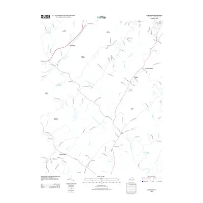
 2010 Alberene2010 Print · USGSCovers Mill Creek, including Alberene, Arrowhead, and other nearby areas
 - 2013 Map of Alberene, 2013 Print
 2013 Alberene2013 Print · USGSCovers Mill Creek, including Alberene, Arrowhead, and other nearby areas
 - 2016 Map of Alberene, 2016 Print
 2016 Alberene2016 Print · USGSCovers Mill Creek, including Alberene, Arrowhead, and other nearby areas
 - 2019 Map of Alberene, 2019 Print
 2019 Alberene2019 Print · USGSCovers Mill Creek, including Alberene, Arrowhead, and other nearby areas
 - 2022 Map of Alberene, 2022 Print
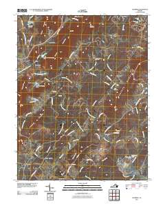
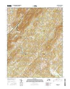
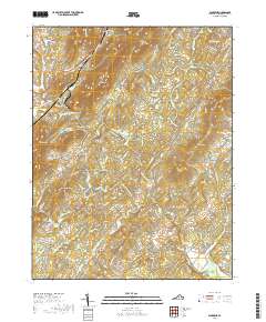
 2022 Alberene2022 Print · USGSAlbemarle County's foothills come into focus in this recent survey of the historic soapstone district and the surrounding agricultural estates. Genealogists and historians can locate family landmarks like the Johnson Family Cem, Hardware Baptist Church Cem, and the venerable Estouteville Farm.
End of results
Showing maps 1-18 of 18
Frequently asked questions
- What are the different types of historical maps available for Mill Creek?
- What is the oldest map of Mill Creek?
- Where can I purchase historical maps of Mill Creek for my home or office?
- Where can I download high-res historical maps of Mill Creek?
- Are there historical topographic maps available for Mill Creek?
- Is there historical aerial imagery available for Mill Creek?
- Where are historical maps of Mill Creek sourced from?