1950s Maps of Angelo, Virginia
Explore 3 historic maps of Angelo from the 1950s. These maps offer a rare glimpse into what life looked like during the 1950s — showing old roads, neighborhoods, homes, and landmarks that have changed or disappeared over time.
Whether you're researching your family's past, planning a metal detecting trip, or studying how Angelo's landscape evolved across the 1950s, these high-resolution maps are a powerful tool for exploring the history of this region.
- Focus on a specific era: All maps on this page are from the 1950s, giving you a focused view of this time period.
- See what’s changed: Compare century-old streets, trails, and buildings to today's modern landscape using overlays and satellite layers.
- Research with precision: Use these maps for genealogy, historical research, land use analysis, or educational projects.
- View, download, or print: Maps are fully viewable online in high resolution, and can be downloaded or printed for your own records.
Start exploring Angelo's history through authentic maps from the 1950s. This is your window into the past.
Angelo, VA maps
(3)- 1950 Map of Amherst, 1960 Print
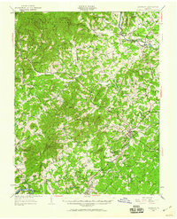 1950 Amherst1960 Print · USGSAmherst and the surrounding Blue Ridge foothills are documented here at mid-century, just as rural communities and mountain gaps remained largely unchanged. Genealogists can trace family locations through Dodds Store, Mt Moriah Ch, and the Sweet Briar College campus.
 - 1952 Map of Amherst
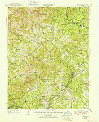 1952 Amherst1952 Print · USGSAmherst County and the Blue Ridge heights are captured here in the early fifties before modern development reshaped the rural landscape. Genealogists can trace family lines through dozens of local landmarks like Dodds Store, Indian Mission, and Pleasant Grove Ch.
 - 1959 Map of Roanoke
 1959 Roanoke1959 Print · USGSCentral Virginia and the Blue Ridge appear in great detail during the late fifties, showcasing the transition from mountain industry to Piedmont farmland. Trace the path of the Norfolk and Western railroad or find old river towns like Appomattox and Amelia Court House.
End of results
Showing maps 1-3 of 3
Top cities near Angelo
- Lynchburg historical maps
- Timberlake historical maps
- Forest historical maps
- Madison Heights historical maps
- Amherst historical maps
- Appomattox historical maps
See more
Frequently asked questions
- What are the different types of historical maps available for Angelo?
- What is the oldest map of Angelo?
- Where can I purchase historical maps of Angelo for my home or office?
- Where can I download high-res historical maps of Angelo?
- Are there historical topographic maps available for Angelo?
- Is there historical aerial imagery available for Angelo?
- Where are historical maps of Angelo sourced from?