Old Maps of McCowan Spring, Virginia for Academic Research
Study the evolution of McCowan Spring with 12 high-resolution historic maps. Whether you're teaching, researching, or modeling changes in land use, these maps provide essential visual documentation of urban, environmental, and geographic change.
- Analyze long-term change: Track patterns in development, transportation, and natural features.
- Ideal for environmental or urban studies: Support academic projects with primary historical map data.
- Use in the classroom or lab: Educators and researchers rely on these maps to bring historical context to life.
These maps are a powerful tool for teaching, research, and visualizing how McCowan Spring has changed over the decades.
McCowan Spring, VA maps
(12)- 1901 Map of Monterey, 1905 Print
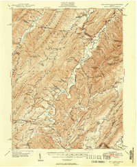
 1901 Monterey1905 Print · USGSThe high Allegheny ridges of Highland and Bath Counties are shown at the turn of the century when isolated valley settlements were linked by winding mountain gaps. Genealogists can trace early homesteads and commerce centers like Cleeks Mills, Mountaingrove, and New Hampden.8 unique versions available
 - 1946 Map of Williamsville, 1964 Print
 1946 Williamsville1964 Print · USGSThe mountain valleys of Bath and Highland counties are captured here in the mid-1940s, showing a landscape of forest ridges and river settlements. Genealogists and hikers can locate old landmarks like Lockridge Memorial Ch, the Flood Sch, and the Duncan Knob Lookout Tower.
 - 1949 Map of Charlottesville
 1949 Charlottesville1949 Print · USGSThe Shenandoah Valley and Blue Ridge appear in the late 1940s as a thriving corridor of rail and river commerce. Researchers can trace the mid-century footprints of Harrisonburg, Staunton, and Culpeper alongside the historic routes of the Southern Railway.2 unique versions available
 - 1949 Map of Williamsville
 1949 Williamsville1949 Print · USGSThe ridges and valleys of Bath and Highland Counties come alive in this mid-century survey, documenting a time of remote mountain settlements and forest lookouts. Trace the locations of Starr Chapel, Flood Sch, and the high-elevation Duncan Knob Lookout Tower.2 unique versions available
 - 1956 Map of Charlottesville, 1966 Print
 1956 Charlottesville1966 Print · USGSThe Shenandoah Valley and Blue Ridge are captured in detail during the mid-1960s as the modern interstate system began to emerge. Genealogists and historians can trace rail-connected hubs like Waynesboro or follow the river paths of the Rapidan River and Rivanna River.4 unique versions available
 - 1969 Map of Green Valley, 1970 Print
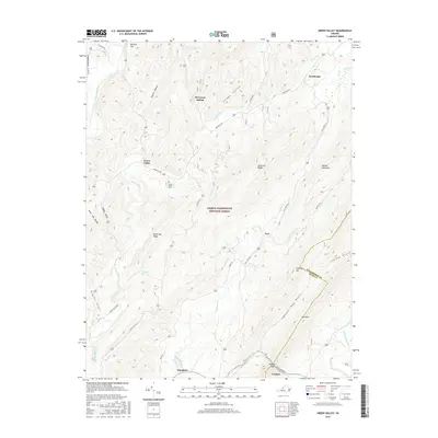
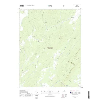
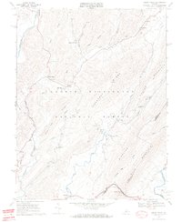 1969 Green Valley1970 Print · USGSBath County's mountain gaps and river valleys are shown here in the late sixties as the region maintained its rural character. Genealogists can locate family landmarks like McCowan Spring, Cloverdale Ch, and the small settlement of Armstrong.5 unique versions available
 - 1986 Map of Staunton
 1986 Staunton1986 Print · USGSThe Shenandoah Valley and Allegheny Highlands meet in the mid-1980s, revealing a landscape of historic mountain towns and thermal resorts. Genealogists and historians can trace institutional landmarks like Mary Baldwin College or follow the legacy of the Chesapeake and Ohio Railroad through Craigsville and Swoope.2 unique versions available
 - 2011 Map of Green Valley, 2011 Print
 2011 Green Valley2011 Print · USGSCovers McCowan Spring, including Goshen, Hotchkiss, and other nearby areas
 - 2013 Map of Green Valley, 2013 Print
 2013 Green Valley2013 Print · USGSCovers McCowan Spring, including Goshen, Hotchkiss, and other nearby areas
 - 2016 Map of Green Valley, 2016 Print
 2016 Green Valley2016 Print · USGSCovers McCowan Spring, including Goshen, Hotchkiss, and other nearby areas
 - 2019 Map of Green Valley, 2019 Print
 2019 Green Valley2019 Print · USGSCovers McCowan Spring, including Goshen, Hotchkiss, and other nearby areas
 - 2022 Map of Green Valley, 2022 Print
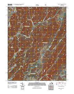
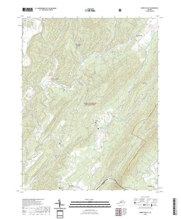 2022 Green Valley2022 Print · USGSBath and Rockbridge Counties remain deeply forested and sparsely settled in this modern topographic survey. Researchers can trace rural lineages through numerous local sites including Bethel Chapel Cem, the settlement at Hotchkiss, and landmarks like McCowan Spring.
End of results
Showing maps 1-12 of 12
Top cities near McCowan Spring
Frequently asked questions
- What are the different types of historical maps available for McCowan Spring?
- What is the oldest map of McCowan Spring?
- Where can I purchase historical maps of McCowan Spring for my home or office?
- Where can I download high-res historical maps of McCowan Spring?
- Are there historical topographic maps available for McCowan Spring?
- Is there historical aerial imagery available for McCowan Spring?
- Where are historical maps of McCowan Spring sourced from?