Old Maps of Chesapeake, Virginia for Hiking & Exploration
Hike through history with 51 historic maps of Chesapeake. Explore old trails, ghost towns, and forgotten backroads — perfect for outdoor adventurers and local explorers.
- Rediscover forgotten places: Map out old mining camps, roads, and footpaths that no longer exist on modern maps.
- Layer with modern tools: Combine with LiDAR or satellite views to plan hikes through historical terrain.
- Made for exploration: Popular among hikers, overlanders, and local history lovers.
Use these maps to find adventure and explore the hidden past of Chesapeake.
Chesapeake, VA maps
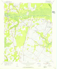
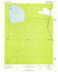
(51)- 1907 Map of Norfolk
 1907 Norfolk1907 Print · USGSCoastal Virginia is mapped here at the dawn of the twentieth century, during the bustle of the great Jamestown Exposition. Researchers can trace the early rail-and-canal economy through the Albemarle and Chesapeake Canal, the Navy Yard, and historic outposts like the Cape Henry Light.
 - 1918 Map of Cape Henry, 1961 Print
 1918 Cape Henry1961 Print · USGSThe Virginia coast at the close of the First World War shows a landscape of tidal inlets and rail-dependent settlements before modern expansion. Researchers can locate early landmarks like Old Donation Church, London Bridge, and the Dam Neck Mills.
 - 1919 Map of Cape Henry
 1919 Cape Henry1919 Print · USGSIn the years following the Great War, the Virginia coast was a mix of quiet truck farms and emerging resorts. Researchers can trace ancestral lands through dozens of named crossroads like Kempsville and Oceana, or find old houses of worship such as Old Donation Church.7 unique versions available
 - 1921 Map of Newport News
 1921 Newport News1921 Print · USGSThe Virginia tidewater area comes alive in the early twentieth century, showing a landscape defined by maritime industry and massive military installations. Genealogists and historians can trace rail lines and early settlements from Camp Stuart down to Jolliff School and the Dismal Swamp.4 unique versions available
 - 1939 Map of Moyock, 1959 Print
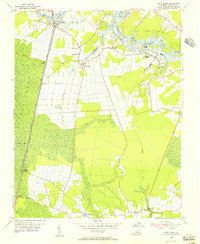
 1939 Moyock1959 Print · USGSThe Virginia and North Carolina borderlands come to life in this pre-war survey of the tidewater region, where the Intracoastal Waterway meets the coastal swamps. Researchers can trace family roots through numerous landmarks like Moyock Cem, Pungo Ferry, and the Willow Grove Sch.
 - 1940 Map of Lake Drummond, 1964 Print
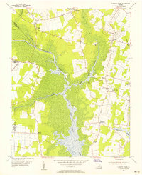
 1940 Lake Drummond1964 Print · USGSThe Great Dismal Swamp and its drainage canals are captured here in the 1940s, showing a landscape defined by timber extraction and transit. Genealogists and historians can trace old schools and landings from Jacks Camp to Wallaceton Sch and the Lumber RR.
 - 1944 Map of Norfolk South
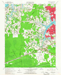
 1944 Norfolk South1944 Print · USGSThe Hampton Roads waterfront at the height of World War II reveals a landscape defined by naval power and rail-to-sea industry. Genealogists and historians can trace neighborhood growth in Craddock, locate family sites near Hope Chapel, or map the early footprints of Portlock and Berkley.
 - 1945 Map of Lake Drummond
 1945 Lake Drummond1945 Print · USGSThe Dismal Swamp straddles the Virginia-North Carolina line in the 1940s, revealing a landscape defined by timber extraction and historic waterways. Researchers can trace the Intracoastal Waterway, the Lumber RR, and local centers like Wallaceton and Deep Creek.
 - 1946 Map of Moyock
 1946 Moyock1946 Print · USGSThe Virginia and North Carolina borderlands come alive in the mid-1940s, showing a landscape of rail-connected crossroads and tidal waterways. Genealogists can locate family landmarks like Moyock Cem, St Brides, and the Willow Grove Sch.2 unique versions available
 - 1948 Map of Norfolk South
 1948 Norfolk South1948 Print · USGSMid-century Hampton Roads is defined here by its massive naval installations and complex rail-to-river freight networks. Genealogists and historians can trace neighborhood growth in Alexander Park, locate family plots in Elmwood Cemetery, or follow the industrial lines of the Belt Line and Virginian railroads.2 unique versions available
 - 1948 Map of Kempsville
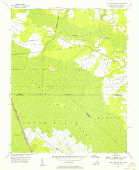
 1948 Kempsville1948 Print · USGSPrincess Anne County in the late nineteen-forties exhibits a mix of rural homesteads and early suburban development linked by the Norfolk Southern line. Researchers can locate family landmarks like Tipperton Place, Bethel Ch and Cem, and the Princess Anne Co Training Sch.
 - 1952 Map of Bowers Hill
 1952 Bowers Hill1952 Print · USGSIn the early 1950s, the border of Nansemond and Norfolk counties was a landscape of tide-water branches and heavy rail. Genealogists can trace family footprints around Pughsville, Sunray, and numerous rural landmarks like Glebe Ch and Florence School.
 - 1953 Map of Norfolk, 1954 Print
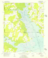
 1953 Norfolk1954 Print · USGSCoastal Virginia and northeastern North Carolina appear here during the post-war industrial boom, showing the critical rail-and-sea connections of Hampton Roads. Genealogists can trace family roots through rural landmarks like Gethsemane Ch, the Caledonia State Prison Farm, and the vast interior of the Dismal Swamp.4 unique versions available
 - 1954 Map of Fentress, 1956 Print
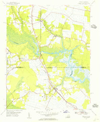
 1954 Fentress1956 Print · USGSSoutheastern Virginia at the mid-century shows a landscape shaped by canal traffic and growing military infrastructure. Trace early local roads and family landmarks like Fentress, Hickory Ground, and the Great Bridge Lock.4 unique versions available
 - 1954 Map of Lake Drummond NW, 1956 Print
 1954 Lake Drummond NW1956 Print · USGSThe Great Dismal Swamp and its historic drainage network are captured here in the mid-1950s. Trace the paths of the Washington Ditch and Big Entry Ditch or the route of the Norfolk and Western railroad.2 unique versions available
 - 1954 Map of Pleasant Ridge, 1956 Print
 1954 Pleasant Ridge1956 Print · USGSCoastal Virginia in the mid-fifties is captured here during a period of rural stability and maritime importance. Genealogists and local historians can trace family-named landmarks and old post offices such as Back Bay (Backbay P O), Dawley Corners, and Camels Chapel.7 unique versions available
 - 1954 Map of Deep Creek, 1956 Print
 1954 Deep Creek1956 Print · USGSCoastal Virginia in the mid-fifties is defined here by the meeting of the eastern Dismal Swamp and the Intracoastal Waterway. Genealogists and local historians can trace early settlements and family landmarks such as Camden Mills, West Landing, and the Mt Lebanon Ch.3 unique versions available
 - 1954 Map of Lake Drummond, 1956 Print
 1954 Lake Drummond1956 Print · USGSThe Dismal Swamp interior and its border with North Carolina are captured here in the mid-fifties, showing the intersection of historic waterways and early settlements. Trace the vital connections between Lake Drummond, the Feeder Ditch, and the Dismal Swamp Canal near Wallaceton.2 unique versions available
 - 1954 Map of Creeds, 1956 Print
 1954 Creeds1956 Print · USGSCoastal Virginia and North Carolina are mapped here in the mid-1950s, showing the intersection of river life and rural farming. Researchers can trace family roots at Kala Ch, find the location of the Creeds Sch, or locate the Creeds Field (Abandoned).4 unique versions available
 - 1954 Map of Lake Drummond SE, 1956 Print
 1954 Lake Drummond SE1956 Print · USGSThe Virginia and North Carolina borderlands are captured here in the mid-fifties, revealing the intricate water systems of the Dismal Swamp. Genealogists and historians can trace old landmarks like Gertie Sch and the Old Railroad Grade near Cornland.3 unique versions available
 - 1954 Map of Moyock, 1956 Print
 1954 Moyock1956 Print · USGSCoastal Virginia and North Carolina met at the rail and river crossings of the mid-fifties, before modern expansion altered the rural landscape. Genealogists and local historians can trace family locations near Saint Brides, Moyock, and several rural churches like Willow Grove Ch.5 unique versions available
 - 1955 Map of Kempsville, 1958 Print
 1955 Kempsville1958 Print · USGSCoastal Virginia during the mid-fifties shows the evolving landscape of Princess Anne County as urban expansion meets old rural communities. Genealogists and historians can trace family-named sites like Whitehurst Landing, Barrets Corner, and Old Donation Ch.
 - 1955 Map of Bowers Hill, 1958 Print
 1955 Bowers Hill1958 Print · USGSCoastal Virginia in the mid-fifties shows a landscape of tidal creeks and burgeoning suburbs bridged by a massive rail network. Researchers can trace family sites at Pughsville, find old rural landmarks like Glebe Church, or locate the historic Portsmouth Airfield.
 - 1955 Map of Norfolk South, 1958 Print
 1955 Norfolk South1958 Print · USGSCoastal Virginia during the mid-fifties reveals a bustling maritime economy centered on the Elizabeth River and its industrial branches. Trace the evolution of neighborhoods and naval sites like the Norfolk Naval Shipyard or Virginia State College.
 - 1965 Map of Bowers Hill, 1967 Print
 1965 Bowers Hill1967 Print · USGSSoutheastern Virginia at the height of the mid-century suburban boom shows the convergence of the Dismal Swamp with a growing transportation hub. Researchers can trace the development of Nansemond Shores or locate the old Sunray settlement near the Seaboard Air Line rail corridors.4 unique versions available
Showing maps 1-25 of 51
Top cities of Chesapeake
Frequently asked questions
- What are the different types of historical maps available for Chesapeake?
- What is the oldest map of Chesapeake?
- Where can I purchase historical maps of Chesapeake for my home or office?
- Where can I download high-res historical maps of Chesapeake?
- Are there historical topographic maps available for Chesapeake?
- Is there historical aerial imagery available for Chesapeake?
- Where are historical maps of Chesapeake sourced from?