1960s Maps of Brandy Station, Virginia
Explore 3 historic maps of Brandy Station from the 1960s. These maps offer a rare glimpse into what life looked like during the 1960s — showing old roads, neighborhoods, homes, and landmarks that have changed or disappeared over time.
Whether you're researching your family's past, planning a metal detecting trip, or studying how Brandy Station's landscape evolved across the 1960s, these high-resolution maps are a powerful tool for exploring the history of this region.
- Focus on a specific era: All maps on this page are from the 1960s, giving you a focused view of this time period.
- See what’s changed: Compare century-old streets, trails, and buildings to today's modern landscape using overlays and satellite layers.
- Research with precision: Use these maps for genealogy, historical research, land use analysis, or educational projects.
- View, download, or print: Maps are fully viewable online in high resolution, and can be downloaded or printed for your own records.
Start exploring Brandy Station's history through authentic maps from the 1960s. This is your window into the past.
Brandy Station, VA maps
(3)- 1961 Map of Washington
 1961 Washington1961 Print · USGSThe mid-Atlantic region in the late fifties is presented in remarkable detail, from the Blue Ridge foothills to the Chesapeake Eastern Shore. Researchers can trace historic river landings and military sites like Mount Vernon, Fort Belvoir, and Point Lookout.2 unique versions available
 - 1966 Map of Brandy Station, 1968 Print
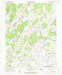 1966 Brandy Station1968 Print · USGSBrandy Station and the surrounding Virginia Piedmont are captured here in the mid-sixties, showing a landscape defined by its river forks and rail corridor. Genealogists and historians can trace old community hubs like Lakota, the Rixeyville Sch, and prominent landmarks such as Fleetwood Hill.3 unique versions available
 - 1968 Map of Culpeper, 1970 Print
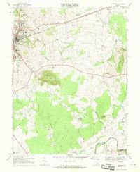 1968 Culpeper1970 Print · USGSCulpeper and its surrounding rural communities are captured here in the late sixties, just before the expansion of the modern era. Researchers can trace local genealogy and land use through landmarks like Stevensburg, the National Cem, and St Stephens Ch.
End of results
Showing maps 1-3 of 3
Top cities near Brandy Station
- Culpeper historical maps
- Warrenton historical maps
- Lake of the Woods historical maps
- Bealeton historical maps
- Orange historical maps
- Remington historical maps
See more
Frequently asked questions
- What are the different types of historical maps available for Brandy Station?
- What is the oldest map of Brandy Station?
- Where can I purchase historical maps of Brandy Station for my home or office?
- Where can I download high-res historical maps of Brandy Station?
- Are there historical topographic maps available for Brandy Station?
- Is there historical aerial imagery available for Brandy Station?
- Where are historical maps of Brandy Station sourced from?