Old Maps of Broyhill-McLean Estates, Fairfax County for Metal Detecting
Plan your next treasure hunt with 16 historic maps of Broyhill-McLean Estates. Find old homesites, ghost towns, trails, and gathering spots that may be lost to time — perfect for identifying promising metal detecting locations.
- Locate forgotten sites: Uncover places like long-lost settlements, abandoned rail lines, or gathering spots.
- Plan better hunts: Use map overlays combined with LiDAR or satellite views to narrow in on historically rich areas.
- Made for detectorists: Thousands of hobbyists use these maps to discover relics, coins, and hidden history.
Use these historic maps to boost your research and find new opportunities beneath the surface of Broyhill-McLean Estates.
Broyhill-McLean Estates, Fairfax County maps
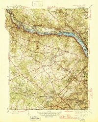
(16)- 1890 Map of Mt. Vernon
 1890 Mt. Vernon1890 Print · USGSCovers Broyhill-McLean Estates, including Washington, Arlington, and other nearby areas
 - 1891 Map of Mt. Vernon
 1891 Mt. Vernon1891 Print · USGSCovers Broyhill-McLean Estates, including Washington, Arlington, and other nearby areas
 - 1894 Map of Mt. Vernon, 1904 Print
 1894 Mt. Vernon1904 Print · USGSCovers Broyhill-McLean Estates, including Washington, Arlington, and other nearby areas6 unique versions available
 - 1897 Map of Mt. Vernon
 1897 Mt. Vernon1897 Print · USGSCovers Broyhill-McLean Estates, including Washington, Arlington, and other nearby areas2 unique versions available
 - 1900 Map of Washington
 1900 Washington1900 Print · USGSCovers Broyhill-McLean Estates, including Washington, Arlington, and other nearby areas2 unique versions available
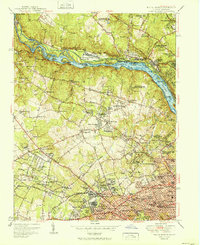
 - 1945 Map of Falls Church
 1945 Falls Church1945 Print · USGSCovers Broyhill-McLean Estates, including Bethesda, McLean, and other nearby areas2 unique versions available
 - 1948 Map of Washington
 1948 Washington1948 Print · USGSCovers Broyhill-McLean Estates, including Washington, Arlington, and other nearby areas2 unique versions available
 - 1951 Map of Falls Church
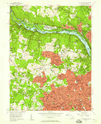
 1951 Falls Church1951 Print · USGSCovers Broyhill-McLean Estates, including Bethesda, McLean, and other nearby areas
 - 1956 Map of Falls Church, 1958 Print
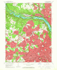
 1956 Falls Church1958 Print · USGSCovers Broyhill-McLean Estates, including Bethesda, McLean, and other nearby areas2 unique versions available
 - 1957 Map of Washington, 1966 Print
 1957 Washington1966 Print · USGSCovers Broyhill-McLean Estates, including Washington, Arlington, and other nearby areas5 unique versions available
 - 1961 Map of Washington
 1961 Washington1961 Print · USGSCovers Broyhill-McLean Estates, including Washington, Arlington, and other nearby areas2 unique versions available
 - 1965 Map of Falls Church, 1966 Print
 1965 Falls Church1966 Print · USGSCovers Broyhill-McLean Estates, including Bethesda, McLean, and other nearby areas5 unique versions available
 - 1982 Map of Washington West, 1983 Print
 1982 Washington West1983 Print · USGSCovers Broyhill-McLean Estates, including Washington, Arlington, and other nearby areas
 - 1986 Map of Washington West
 1986 Washington West1986 Print · USGSCovers Broyhill-McLean Estates, including Washington, Arlington, and other nearby areas2 unique versions available
 - 1989 Map of Washington
 1989 Washington1989 Print · USGSCovers Broyhill-McLean Estates, including Washington, Arlington, and other nearby areas
 - 1994 Map of Falls Church, 1998 Print
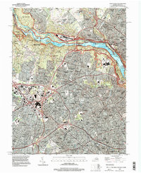 1994 Falls Church1998 Print · USGSCovers Broyhill-McLean Estates, including Bethesda, McLean, and other nearby areas
End of results
Showing maps 1-16 of 16
Frequently asked questions
- What are the different types of historical maps available for Broyhill-McLean Estates?
- What is the oldest map of Broyhill-McLean Estates?
- Where can I purchase historical maps of Broyhill-McLean Estates for my home or office?
- Where can I download high-res historical maps of Broyhill-McLean Estates?
- Are there historical topographic maps available for Broyhill-McLean Estates?
- Is there historical aerial imagery available for Broyhill-McLean Estates?
- Where are historical maps of Broyhill-McLean Estates sourced from?