1950s Maps of Newington, Fairfax County
Explore 6 historic maps of Newington from the 1950s. These maps offer a rare glimpse into what life looked like during the 1950s — showing old roads, neighborhoods, homes, and landmarks that have changed or disappeared over time.
Whether you're researching your family's past, planning a metal detecting trip, or studying how Newington's landscape evolved across the 1950s, these high-resolution maps are a powerful tool for exploring the history of this region.
- Focus on a specific era: All maps on this page are from the 1950s, giving you a focused view of this time period.
- See what’s changed: Compare century-old streets, trails, and buildings to today's modern landscape using overlays and satellite layers.
- Research with precision: Use these maps for genealogy, historical research, land use analysis, or educational projects.
- View, download, or print: Maps are fully viewable online in high resolution, and can be downloaded or printed for your own records.
Start exploring Newington's history through authentic maps from the 1950s. This is your window into the past.
Newington, Fairfax County maps
(6)- 1951 Map of Annandale
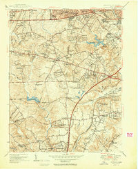 1951 Annandale1951 Print · USGSPost-war Fairfax County is seen here during a period of rapid suburbanization and growth. Genealogists and local historians can trace early residential clusters like Tremont Gardens and locate landmarks such as Falls Church Airport and Sydenstricker Chapel.2 unique versions available
 - 1951 Map of Belvoir, 1953 Print
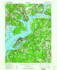
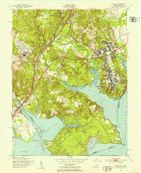 1951 Belvoir1953 Print · USGSThe Potomac shoreline in the early fifties shows a transition from historic estates to expanding military facilities. Genealogists can trace family landmarks like Woodlawn Mansion, Laceys Hill Cem, and the settlement at Accotink.2 unique versions available
 - 1956 Map of Annandale, 1958 Print
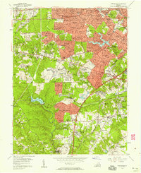 1956 Annandale1958 Print · USGSNorthern Virginia is transitioning into a modern suburban hub in the mid-fifties as new neighborhoods rise near Seven Corners. Trace the development of Baileys Crossroads or locate early landmarks like Wakefield Chapel and the Falls Church Airpark.
 - 1956 Map of Belvoir, 1959 Print
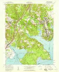 1956 Belvoir1959 Print · USGSFairfax County in the mid-fifties is captured here as a landscape of military expansion, riverfront estates, and early highway development. Researchers can trace family roots through Pohick Ch, Gunston Sch, and the historical grounds of Gunston Hall.
 - 1956 Map of Indian Head, 1961 Print
 1956 Indian Head1961 Print · USGSThe Potomac shoreline in the mid-fifties is a landscape of federal reservations and tobacco-country heritage. Researchers can trace historic river landings like Proctors Wharf and significant sites such as the Indian Head Powder Factory or the Habre de Venture estate.2 unique versions available
 - 1957 Map of Washington, 1966 Print
 1957 Washington1966 Print · USGSThe mid-Atlantic region during the mid-fifties and early sixties reveals a landscape of growing suburbs and vital military outposts. Researchers can trace historic river towns and shorelines from Alexandria to the Hooper Islands and St Clements Island.5 unique versions available
End of results
Showing maps 1-6 of 6
Frequently asked questions
- What are the different types of historical maps available for Newington?
- What is the oldest map of Newington?
- Where can I purchase historical maps of Newington for my home or office?
- Where can I download high-res historical maps of Newington?
- Are there historical topographic maps available for Newington?
- Is there historical aerial imagery available for Newington?
- Where are historical maps of Newington sourced from?