2020s Maps of Ferrum, Virginia
Explore 2 historic maps of Ferrum from the 2020s. These maps offer a rare glimpse into what life looked like during the 2020s — showing old roads, neighborhoods, homes, and landmarks that have changed or disappeared over time.
Whether you're researching your family's past, planning a metal detecting trip, or studying how Ferrum's landscape evolved across the 2020s, these high-resolution maps are a powerful tool for exploring the history of this region.
- Focus on a specific era: All maps on this page are from the 2020s, giving you a focused view of this time period.
- See what’s changed: Compare century-old streets, trails, and buildings to today's modern landscape using overlays and satellite layers.
- Research with precision: Use these maps for genealogy, historical research, land use analysis, or educational projects.
- View, download, or print: Maps are fully viewable online in high resolution, and can be downloaded or printed for your own records.
Start exploring Ferrum's history through authentic maps from the 2020s. This is your window into the past.
Ferrum, VA maps
(2)- 2022 Map of Rocky Mount, 2022 Print
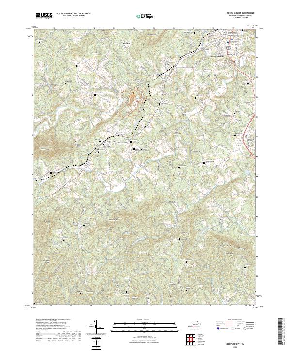 2022 Rocky Mount2022 Print · USGSRocky Mount and its surrounding Franklin County foothills are documented here in the early twenty-first century. Genealogists and local historians can trace dozens of family burial sites and rural landmarks, including the Tanyard Cemetery, Antioch Baptist Church, and the Franklin County Courthouse.
 - 2022 Map of Ferrum, 2022 Print
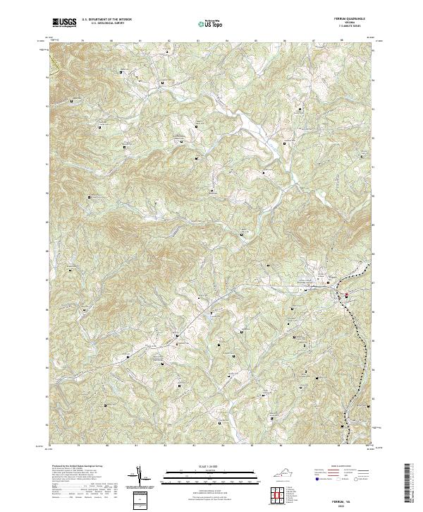 2022 Ferrum2022 Print · USGSThe foothills of the Blue Ridge come into sharp focus here in the early 2020s, centered on the campus of Ferrum College. Researchers can trace generations of local history through dozens of family-named sites like Phoebe Needles Cem and the James Harvey Bridges Cem.
End of results
Showing maps 1-2 of 2
Top cities near Ferrum
- Collinsville historical maps
- Rocky Mount historical maps
- Stanleytown historical maps
- Henry Fork historical maps
- Bassett historical maps
- Oak Level historical maps
See more
Frequently asked questions
- What are the different types of historical maps available for Ferrum?
- What is the oldest map of Ferrum?
- Where can I purchase historical maps of Ferrum for my home or office?
- Where can I download high-res historical maps of Ferrum?
- Are there historical topographic maps available for Ferrum?
- Is there historical aerial imagery available for Ferrum?
- Where are historical maps of Ferrum sourced from?