1900s (20th Century) Maps of Grayson County, Virginia
Explore 44 historic maps of Grayson County from the 1900s (20th Century). These maps offer a rare glimpse into what life looked like during the 1900s — showing old roads, neighborhoods, homes, and landmarks that have changed or disappeared over time.
Whether you're researching your family's past, planning a metal detecting trip, or studying how Grayson County's landscape evolved across the 1900s, these high-resolution maps are a powerful tool for exploring the history of this region.
- Focus on a specific era: All maps on this page are from the 1900s, giving you a focused view of this time period.
- See what’s changed: Compare century-old streets, trails, and buildings to today's modern landscape using overlays and satellite layers.
- Research with precision: Use these maps for genealogy, historical research, land use analysis, or educational projects.
- View, download, or print: Maps are fully viewable online in high resolution, and can be downloaded or printed for your own records.
Start exploring Grayson County's history through authentic maps from the 1900s. This is your window into the past.
Grayson County, VA maps
(44)- 1909 Map of Abingdon
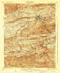
 1909 Abingdon1909 Print · USGSSouthwest Virginia at the first decade's end shows a valley landscape defined by the iron rail and steep ridges. Genealogists and historians can trace the early layouts of Abingdon and Glade Spring, or locate landmarks like Dove Mills and the County Farm.2 unique versions available
 - 1911 Map of Abingdon
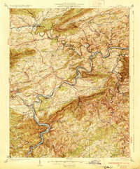
 1911 Abingdon1911 Print · USGSSouthwest Virginia's rugged corridors are captured here during the height of the mountain rail era. Genealogists and historians can trace old homesteads and local landmarks such as Whites Mill, Valley Church, and the County Farm near Abingdon.5 unique versions available
 - 1930 Map of Speedwell
 1930 Speedwell1930 Print · USGSWythe County is captured here in the late twenties, showing the intersection of vital transit corridors and mountain wilderness. Researchers can trace the early Appalachian Trail or locate family roots at St Paul Ch and Slate Spring Sch.
 - 1930 Map of Independence
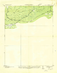
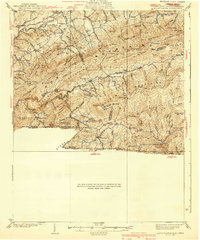
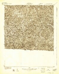 1930 Independence1930 Print · USGSGrayson County and the North Carolina borderlands are captured here during the 1930s, showing a landscape of high ridges and deep river bends. Genealogists can trace family names through landmarks like Moyers Store, Bennington Mill, and numerous river crossings like Moore Ferry.
 - 1930 Map of Max Meadows
 1930 Max Meadows1930 Print · USGSThe industrial and riverine corridor of Wythe and Carroll counties comes alive in the late 1920s, showcasing a network of mining towns and rail lines. Trace family roots and local history through landmarks like Fort Chiswell, the Boom Furnace, and the ferry crossing at Carter Ferry.3 unique versions available
 - 1931 Map of Rural Retreat
 1931 Rural Retreat1931 Print · USGSSouthwestern Virginia in the early 1930s is defined by its ridge-and-valley terrain and the rail-and-road corridor of the Norfolk and Western. Genealogists can trace local landmarks like Wasson Cem, Roberts Mill, and the Old Iron Mine near Sugar Grove.
 - 1931 Map of Galax
 1931 Galax1931 Print · USGSThe Blue Ridge foothills of Virginia and North Carolina come into focus during the early 1930s as the rail-and-river economy develops. Genealogists and researchers can trace family landmarks like Bishop Cem, McKnights Mill, and the early river crossings at Blair Ferry.
 - 1933 Map of Independence
 1933 Independence1933 Print · USGSGrayson County in the early thirties is captured here as a landscape of river crossings and mountain settlements. Genealogists and local historians can trace family roots through numerous landmarks like Boyer Ferry, Grayson Mill, and Cox Chapel.3 unique versions available
 - 1933 Map of Galax
 1933 Galax1933 Print · USGSCarroll County and the surrounding Blue Ridge highlands are captured in the early 1930s, showing a landscape defined by river ferries and rail spurs. Genealogists can trace early homesteads and community hubs like Pipers Gap PO, Lambsburg, and the Dixon Ferry crossing on the New River.3 unique versions available
 - 1935 Map of Mouth of Wilson
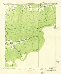
 1935 Mouth of Wilson1935 Print · USGSGrayson County was a landscape of high ridges and river crossings in the mid-1930s. Researchers can trace family sites at Youngs Chapel, find early crossings like Halsey Ferry, and locate old mountain schoolhouses like Oak Hill Sch and Fairwood Sch.
 - 1935 Map of Grayson
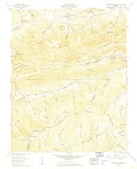
 1935 Grayson1935 Print · USGSThe high tri-state ridges of Washington County, Tennessee, and neighboring Virginia are shown here just before the mid-century. Genealogists and hikers can trace old mountain paths through Cut Laurel Gap, find the State Line Sch, and locate the Norfolk and Western rail line near Green Cove.
 - 1935 Map of Park
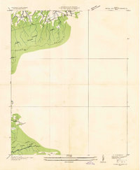
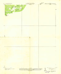
 1935 Park1935 Print · USGSThe high-country borderlands of North Carolina and Virginia appear here in the mid-1930s just as early aerial mapping began. Researchers can locate the mountain settlement of Park and trace the drainage of Green Creek through the Unaka National Forest.
 - 1935 Map of Mount Rogers
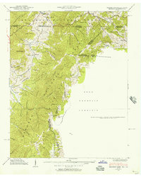
 1935 Mount Rogers1935 Print · USGSThe high peaks of Grayson and Smyth Counties are documented here in the mid-1930s as the Appalachian Trail was being established across Mount Rogers. Genealogists and historians can trace the foundations of mountain life at Konnarock, the Iron Mountain Boys Sch, and Taylors Valley.
 - 1935 Map of Cedar Springs
 1935 Cedar Springs1935 Print · USGSSouthwest Virginia's high ridges and hollows come into focus during the mid-1930s as the Smyth and Wythe county line is surveyed. Researchers can trace the exact locations of local landmarks like Lindamood Sch, Union Chapel, and the paths through Glade Hollow.
 - 1935 Map of Trout Dale
 1935 Trout Dale1935 Print · USGSGrayson and Smyth Counties are shown in the mid-1930s as a high-altitude landscape of national forest and developing highways. Researchers can trace the early route of the Appalachian Trail and find family-named landmarks like Houndshell Branch and Slabtown Br.
 - 1935 Map of Whitetop Mountain
 1935 Whitetop Mountain1935 Print · USGSThe high peaks of Southwest Virginia appear here in the mid-1930s, featuring the summits and gaps of the Blue Ridge. Researchers can trace the early route of the Appalachian Trail and locate mountain landmarks like Konnarock Sch, Elk Garden, and Stony Creek Ch.
 - 1935 Map of Middle Fox Creek
 1935 Middle Fox Creek1935 Print · USGSThe Smyth and Grayson county line is captured during the mid-1930s as the regional landscape was being documented for the Tennessee Valley Authority. Researchers can trace early routes through Houndshell Gap and locate landmarks like Hemp Patch and the Appalachian Trail.
 - 1938 Map of Grayson, 1957 Print
 1938 Grayson1957 Print · USGSThe Appalachian high country at the junction of Tennessee, Virginia, and North Carolina comes into focus in the late 1930s. Genealogists and historians can trace rail-side life along the Norfolk and Western and locate landmarks like Waldener Grove Ch and the Sutherland Cem.
 - 1939 Map of Speedwell
 1939 Speedwell1939 Print · USGSThe mountain valleys of Wythe County are captured here in the late 1930s, showing a landscape of scattered rural schools and early industrial sites. Genealogists can locate family landmarks like Rowe Crossroads or trace the early path of the APPALACHIAN TRAILS past Little Wythe Furnace.3 unique versions available
 - 1939 Map of Mount Rogers
 1939 Mount Rogers1939 Print · USGSThe Virginia and Tennessee borderlands come alive in this survey from the 1930s, showing the mountain communities and logging-era geography of the High Country. Researchers can locate the Konnarock Girls Sch, family-named mill sites like Loves Mill, and the early path of the Appalachian Trail.3 unique versions available
 - 1940 Map of Mouth of Wilson
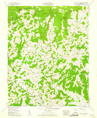
 1940 Mouth of Wilson1940 Print · USGSGrayson County's high ridges and river valleys were home to a dense network of mountain communities in the 1930s. Genealogists and historians can trace long-gone rural institutions like the COUNTY HOME, Cornell Store, and schools such as Razor Ridge Sch or Bethel Sch.3 unique versions available
 - 1953 Map of Winston-Salem, 1974 Print
 1953 Winston-Salem1974 Print · USGSThe North Carolina Piedmont and Virginia highlands meet in the mid-1950s, a landscape defined by the tobacco and textile hubs of the Blue Ridge foothills. Researchers can trace the rail-and-river geography connecting Winston-Salem to mountain towns like Mount Airy and Galax.2 unique versions available
 - 1955 Map of Winston-Salem
 1955 Winston-Salem1955 Print · USGSThe Central Blue Ridge and Piedmont transition are captured here in the mid-fifties, from the industrial hub of Winston-Salem to the high peaks of Southwest Virginia. Genealogists can trace family landmarks like Richmond Hill Ch, Siloam Ch, and the old rail stops along the Southern Railway.
 - 1959 Map of Whitetop Mountain, 1960 Print
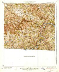
 1959 Whitetop Mountain1960 Print · USGSThe high ridges of Smyth and Grayson Counties are captured here in the late fifties, dominated by the peaks of the Blue Ridge. Researchers can trace remote mountain genealogy through sites like Stony Battery, Rowland Creek Cem, and Bethel Ch.4 unique versions available
 - 1959 Map of Middle Fox Creek, 1960 Print
 1959 Middle Fox Creek1960 Print · USGSGrayson County's highland terrain is captured here in the late fifties, showcasing a landscape of high ridges and deep family roots. Researchers can locate numerous remote mountain burial sites and country churches, including Holdaway Cem, Burton Chapel, and Honey Grove Church.4 unique versions available
Showing maps 1-25 of 44
Top cities of Grayson County
- Independence historical maps
- Fries historical maps
- Baywood historical maps
- Stevens Creek historical maps
- Hilltown historical maps
- Troutdale historical maps
Frequently asked questions
- What are the different types of historical maps available for Grayson County?
- What is the oldest map of Grayson County?
- Where can I purchase historical maps of Grayson County for my home or office?
- Where can I download high-res historical maps of Grayson County?
- Are there historical topographic maps available for Grayson County?
- Is there historical aerial imagery available for Grayson County?
- Where are historical maps of Grayson County sourced from?