2020s Maps of Grayson County, Virginia
Explore 18 historic maps of Grayson County from the 2020s. These maps offer a rare glimpse into what life looked like during the 2020s — showing old roads, neighborhoods, homes, and landmarks that have changed or disappeared over time.
Whether you're researching your family's past, planning a metal detecting trip, or studying how Grayson County's landscape evolved across the 2020s, these high-resolution maps are a powerful tool for exploring the history of this region.
- Focus on a specific era: All maps on this page are from the 2020s, giving you a focused view of this time period.
- See what’s changed: Compare century-old streets, trails, and buildings to today's modern landscape using overlays and satellite layers.
- Research with precision: Use these maps for genealogy, historical research, land use analysis, or educational projects.
- View, download, or print: Maps are fully viewable online in high resolution, and can be downloaded or printed for your own records.
Start exploring Grayson County's history through authentic maps from the 2020s. This is your window into the past.
Grayson County, VA maps
(18)- 2022 Map of Sparta West, 2022 Print
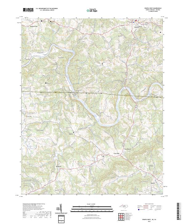 2022 Sparta West2022 Print · USGSThe North Carolina and Virginia state line bisects this modern study of the Blue Ridge plateau and the winding New River valley. Genealogists can trace family roots through numerous local burial sites like Elk Creek Cem and Saddle Creek Cem or the streets of Independence.
 - 2022 Map of Sparta East, 2022 Print
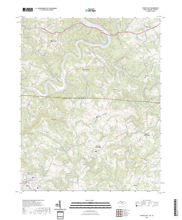 2022 Sparta East2022 Print · USGSThe Blue Ridge landscape surrounding Sparta is documented here in the early twenty-first century, spanning the border into Virginia. Researchers can locate numerous local landmarks including the Alleghany County Courthouse, Edwards Crossroads, and several family burial sites like the Randolph Collins Cem.
 - 2022 Map of Park, 2022 Print
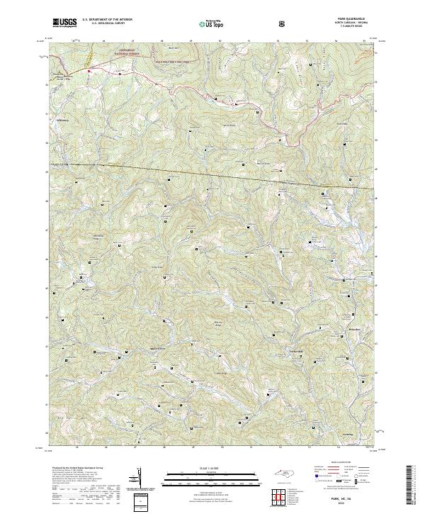 2022 Park2022 Print · USGSThe high mountain borderlands of North Carolina and Virginia are captured here in the early twenty-first century, showcasing a landscape of isolated ridges and family heritage. Researchers can trace ancestral locations through dozens of family-named sites like Byars Cem, Sullivan Family Cem, and the historic Virginia Creeper Trl.
 - 2022 Map of Cumberland Knob, 2022 Print
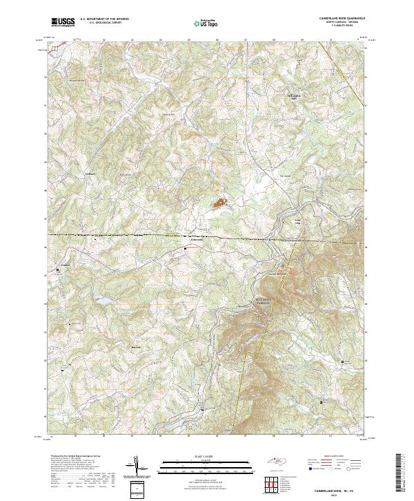 2022 Cumberland Knob2022 Print · USGSThe high country along the North Carolina and Virginia border is documented here in the early twenty-first century. Researchers can trace ancestral sites at Savannah Cem and McKnights Mill or explore the terrain surrounding Cumberland Knob.
 - 2022 Map of Grayson, 2022 Print
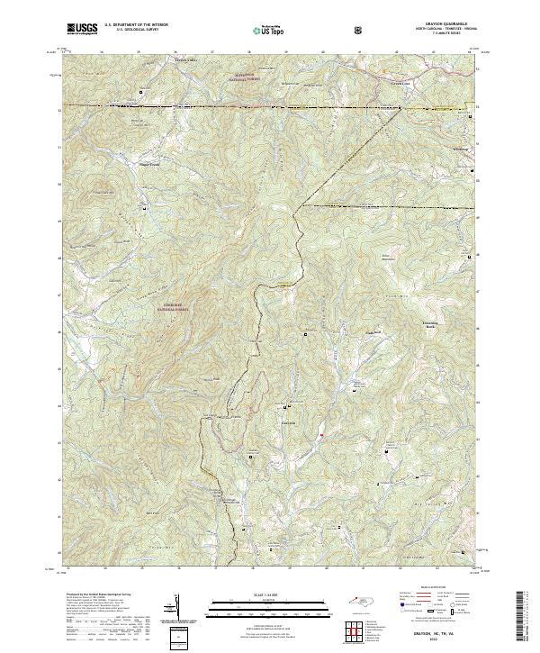 2022 Grayson2022 Print · USGSThe high country of the Blue Ridge and Iron Mountains comes alive in this modern survey of the tri-state border. Genealogists can trace family names at Shumate Family Cem, Taylor-Cox Cem, and the Allen Cem near Grayson.
 - 2022 Map of Grassy Creek, 2022 Print
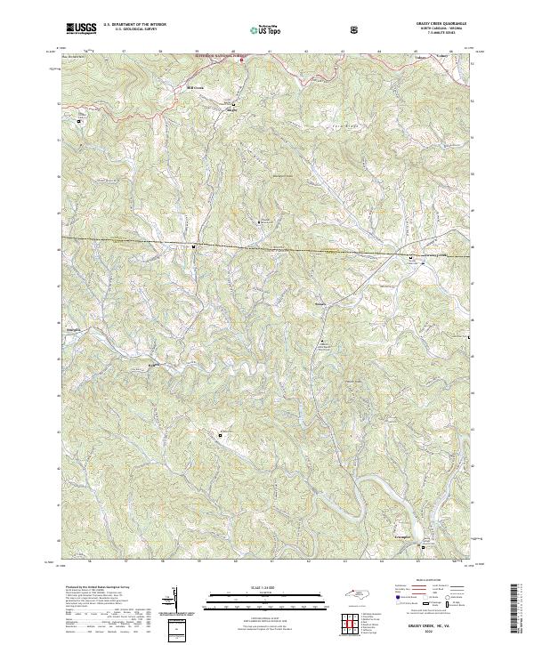 2022 Grassy Creek2022 Print · USGSThe North Carolina-Virginia borderlands are captured here in the early twenty-first century, showing the rural communities of Ashe and Grayson counties. Genealogists can trace family names at the Dickson Cemetery, Grassy Creek Cemetery, and Healing Springs Church Cemetery.
 - 2022 Map of Middle Fox Creek, 2022 Print
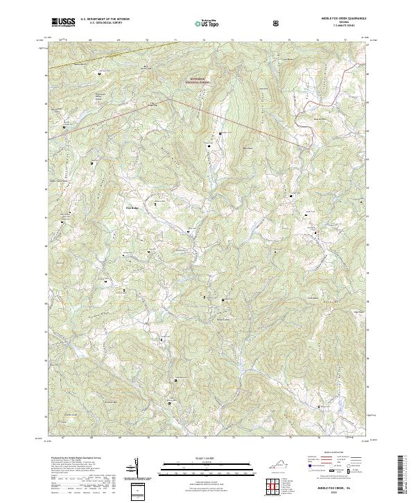 2022 Middle Fox Creek2022 Print · USGSGrayson County highland communities are documented here as they appeared in the early 2020s. Genealogists can trace family burial sites like Old Parks Cem and Cornett Cem near Flat Ridge.
 - 2022 Map of Speedwell, 2022 Print
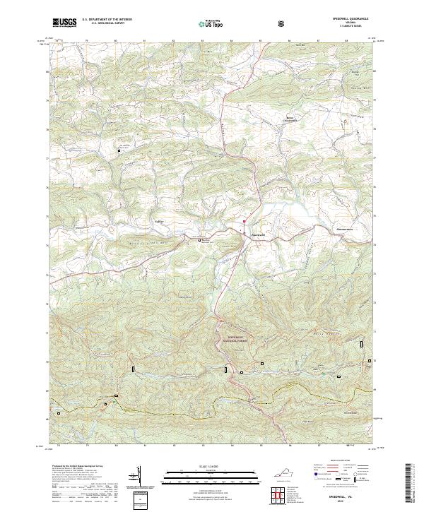 2022 Speedwell2022 Print · USGSThe rural valleys and mountain ridges of Wythe County are documented here as they appeared in 2022. Researchers can locate long-standing landmarks such as Speedwell, the Zion Lutheran Church Cem, and the high reaches of Horse Heaven.
 - 2022 Map of Mouth of Wilson, 2022 Print
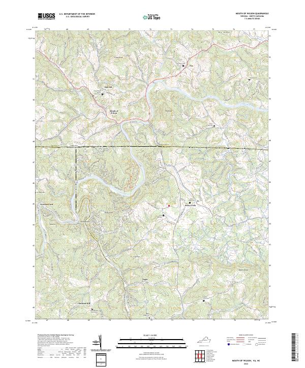 2022 Mouth of Wilson2022 Print · USGSThe Virginia-North Carolina state line bisects this river-carved landscape as it appeared in recent years. Researchers can trace rural lineages through numerous local burial grounds and churches such as Young Chapel Baptist Church, Rocky Ridge Cem, and Potato Creek Cem.
 - 2022 Map of Elk Creek, 2022 Print
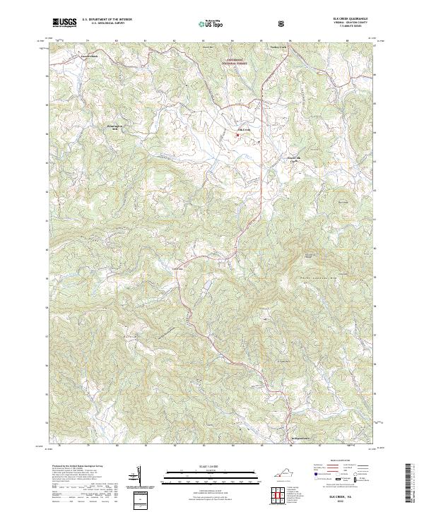 2022 Elk Creek2022 Print · USGSGrayson County's high country is captured here in the early 2020s, centered on the Elk Creek valley and the town of Independence. Genealogists and hikers can trace old routes like Old Kentucky Rd and find landmarks like Bennington Mill and Comers Rock.
 - 2022 Map of Brierpatch Mountain, 2022 Print
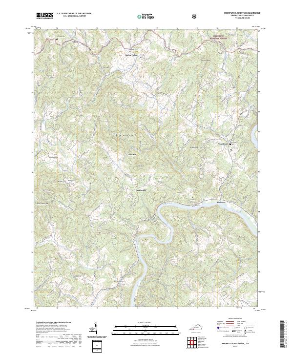 2022 Brierpatch Mountain2022 Print · USGSGrayson County's high ridges and river bends are captured here as they appeared in the early twenty-first century. Researchers can trace family history through sites like Jerusalem Cem, the settlement of Fallville, and the historic Clito Mill along Elk Creek.
 - 2022 Map of Trout Dale, 2022 Print
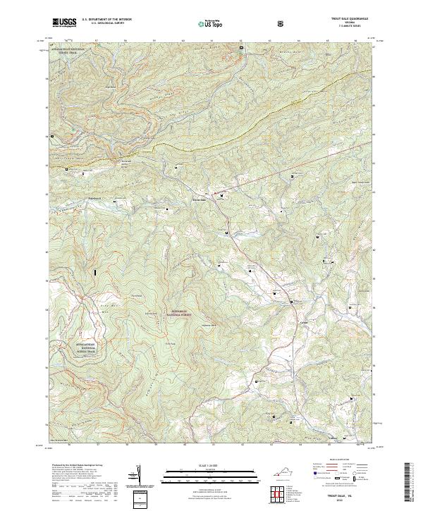 2022 Trout Dale2022 Print · USGSGrayson County's high ridges and mountain gaps are captured here in the early twenty-first century. Genealogists can trace family names at Trout Dale Cem, Campbell Cem, and Ross Cem while hikers follow the Appalachian National Scenic Trail.
 - 2022 Map of Cripple Creek, 2022 Print
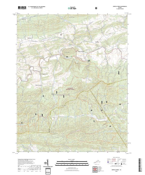 2022 Cripple Creek2022 Print · USGSThe iron-rich valleys of Southwest Virginia come alive in this survey of the borders where Wythe, Carroll, and Grayson counties converge. Researchers can trace industrial history at Eagle Furnace and Noble Furnace or locate family sites near Davis Cem and Shiloh.
 - 2022 Map of Cedar Springs, 2022 Print
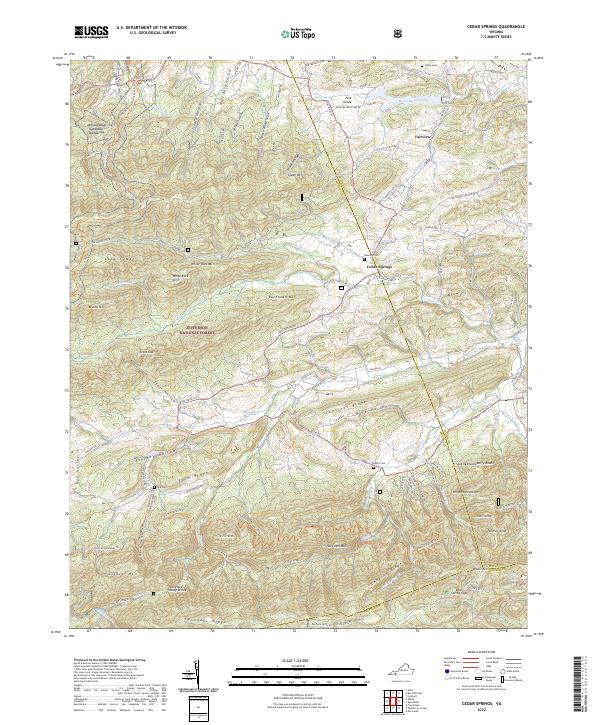 2022 Cedar Springs2022 Print · USGSSmyth and Wythe counties meet here in the 2020s, showing a landscape defined by mountain ridges and the Appalachian Trail. Researchers can find family burial sites like Keesling Cemetery and landmarks such as Rural Retreat Lake.
 - 2022 Map of Whitetop Mountain, 2022 Print
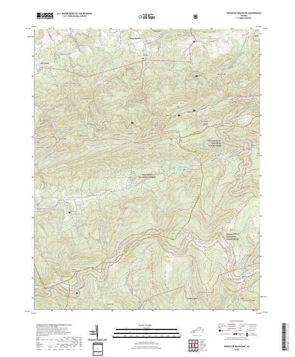 2022 Whitetop Mountain2022 Print · USGSThe Virginia Highlands are captured here in the early twenty-first century, featuring the high-elevation terrain of the Jefferson National Forest. Researchers can trace the Appalachian National Scenic Trl past landmarks like Mt Rogers and find historic family sites including Rowland Creek Cem.
 - 2022 Map of Austinville, 2022 Print
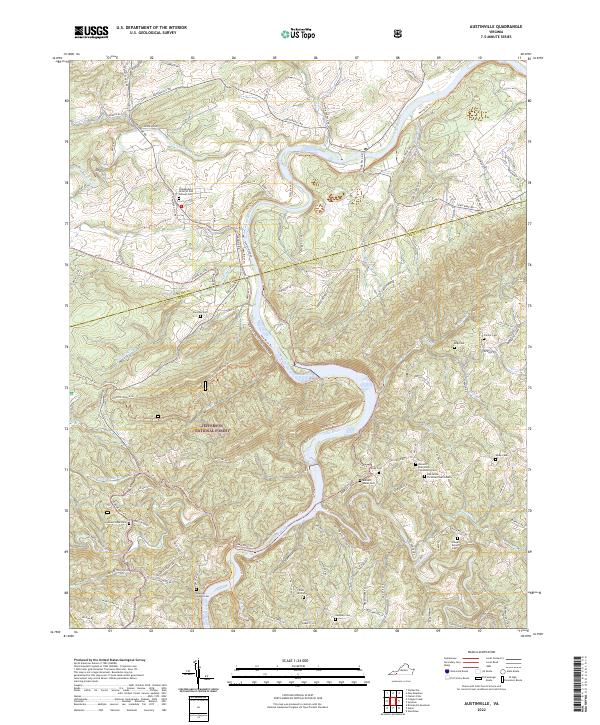 2022 Austinville2022 Print · USGSThe New River and Cripple Creek converge at the Wythe and Carroll County border in this contemporary study of Virginia's Blue Ridge highlands. Genealogists can locate numerous family-named burial grounds like Burnett - Hanks Cem, Frazier Cem, and the Independent Order of Odd Fellows Cem.
 - 2022 Map of Lambsburg, 2022 Print
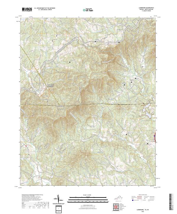 2022 Lambsburg2022 Print · USGSThe Blue Ridge Parkway winds along the Virginia-North Carolina border during the early 2020s, tracing the high ridges of the Blue Ridge Mountains. Researchers can locate numerous family burial sites and rural churches like Fellowship Tabernacle Cem, Zion Hill Cem, and Parish Cem tucked among the headwaters of Stewarts Creek.
 - 2022 Map of Galax, 2022 Print
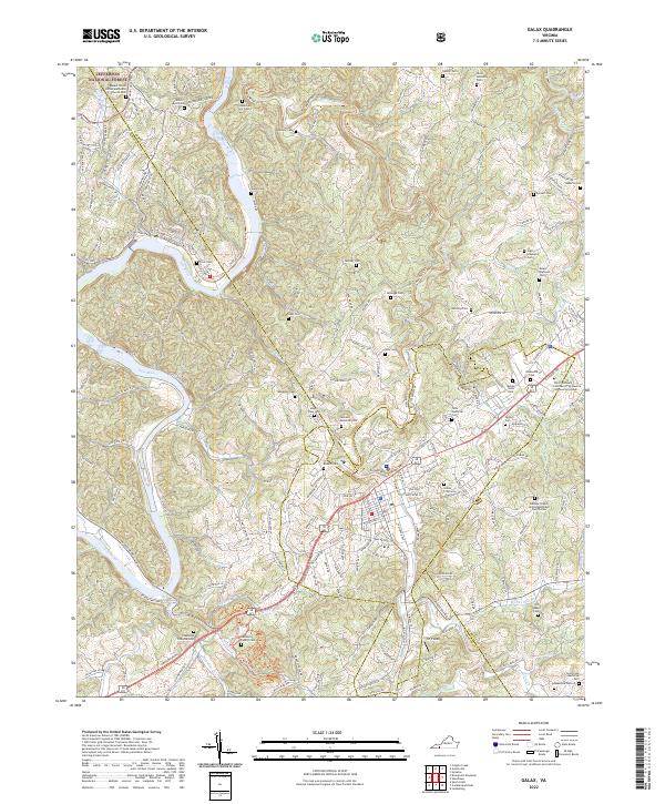 2022 Galax2022 Print · USGSThe river town of Fries and the fringes of the Jefferson National Forest are documented here in the early 2020s. Genealogists and local historians can trace modern access to numerous family-named landmarks and the traditional riverfront settlement.
End of results
Showing maps 1-18 of 18
Top cities of Grayson County
- Independence historical maps
- Fries historical maps
- Baywood historical maps
- Stevens Creek historical maps
- Hilltown historical maps
- Troutdale historical maps
Frequently asked questions
- What are the different types of historical maps available for Grayson County?
- What is the oldest map of Grayson County?
- Where can I purchase historical maps of Grayson County for my home or office?
- Where can I download high-res historical maps of Grayson County?
- Are there historical topographic maps available for Grayson County?
- Is there historical aerial imagery available for Grayson County?
- Where are historical maps of Grayson County sourced from?