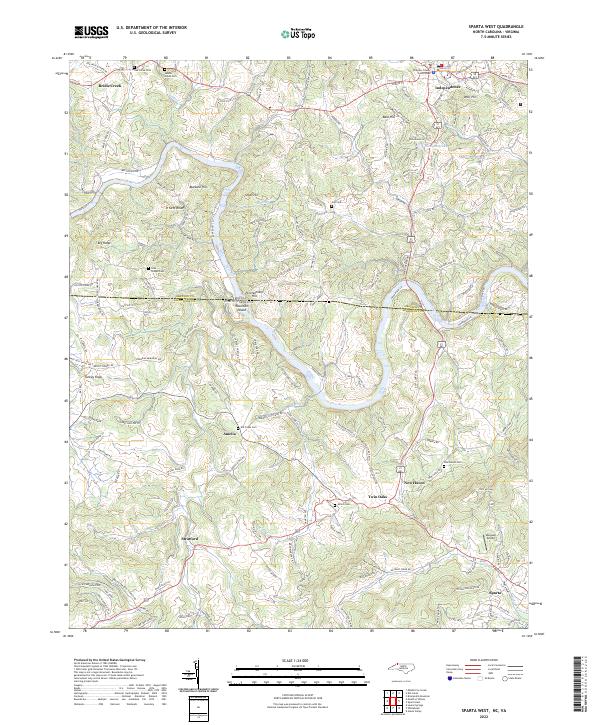
2022 Map of Sparta West
USGS Topo · Published 2022About this map
The New River meanders across the border between North Carolina and Virginia in this contemporary survey, weaving through a landscape of high ridges and rural settlements. On the Virginia side, the town of Independence serves as a focal point, anchored by the Grayson County Courthouse. South of the state line, the terrain is marked by prominent elevations like Penitentiary Hill and the unique landform of Mountain Island, situated near the confluence where Rock Cr meets the larger river. Smaller communities such as Twin Oaks, Amelia, and Stratford are connected by a network of winding roads that follow the natural topography. Genealogists will find a wealth of local history preserved in numerous burial grounds, including Oak Grove Cem, Coxs Chapel Cem, and Shiloh Cem. The presence of Maxwell Airport near the southern edge at Sparta highlights the transition from traditional river-valley settlement to modern infrastructure.
Find a feature on this map
149 named features on this map. Tap any name to fly to it.
Don’t see what you’re looking for? This feature index may not catch every label — zoom into the map to look around manually.
Map Details
Editions of this 2022 Sparta West Map
This is the sole edition of this map. No revisions or reprints were ever made.
Other maps of this area

1889 · Wytheville
USGS Topo · 1:125,000

1889 · Wilkesboro
USGS Topo · 1:125,000

1891 · Wilkesboro
USGS Topo · 1:125,000

1892 · Wytheville
USGS Topo · 1:125,000

1930 · Independence
USGS Topo · 1:48,000

1933 · Independence
USGS Topo · 1:62,500

1935 · Mouth of Wilson
USGS Topo · 1:48,000

1935 · Middle Fox Creek
USGS Topo · 1:24,000

1940 · Mouth of Wilson
USGS Topo · 1:62,500

1953 · Winston-Salem
USGS Topo · 1:250,000