
1935 Map of Middle Fox Creek
USGS Topo · Published 1935About this map
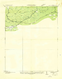
Iron Mountain and the surrounding high country of the Unaka National Forest dominate this 1935 advance sheet, compiled from aerial photography by the Tennessee Valley Authority and the Geological Survey. The map focuses on a specific stretch of the Smyth and Grayson county line during the early years of the Appalachian Trail. This early survey work captures the primitive infrastructure of the region before significant modern development, emphasizing natural gaps and drainage patterns. Notable landmarks include the crossing at Houndshell Gap and the watercourse of Houndshell Branch, while the curious name Hemp Patch suggests a history of localized cultivation or naming traditions in these mountain hollows. The presence of the Appalachian Trail as a primary feature reflects the era's emerging focus on conservation and recreational infrastructure in the Blue Ridge.
Find a feature on this map
10 named features on this map. Tap any name to fly to it.
Don’t see what you’re looking for? This feature index may not catch every label — zoom into the map to look around manually.
Map Details
Editions of this 1935 Middle Fox Creek Map
This is the sole edition of this map. No revisions or reprints were ever made.
Other maps of this area

1889 · Wytheville
USGS Topo · 1:125,000

1892 · Wytheville
USGS Topo · 1:125,000

1930 · Speedwell
USGS Topo · 1:62,500

1930 · Independence
USGS Topo · 1:48,000

1931 · Rural Retreat
USGS Topo · 1:48,000

1933 · Independence
USGS Topo · 1:62,500

1935 · Mouth of Wilson
USGS Topo · 1:48,000

1935 · Cedar Springs
USGS Topo · 1:24,000
1935 · Trout Dale
USGS Topo · 1:24,000
1935 · Atkins
USGS Topo · 1:24,000