Old Maps of Otterdam Mobile Home Park, Virginia for Academic Research
Study the evolution of Otterdam Mobile Home Park with 11 high-resolution historic maps. Whether you're teaching, researching, or modeling changes in land use, these maps provide essential visual documentation of urban, environmental, and geographic change.
- Analyze long-term change: Track patterns in development, transportation, and natural features.
- Ideal for environmental or urban studies: Support academic projects with primary historical map data.
- Use in the classroom or lab: Educators and researchers rely on these maps to bring historical context to life.
These maps are a powerful tool for teaching, research, and visualizing how Otterdam Mobile Home Park has changed over the decades.
Otterdam Mobile Home Park, VA maps
(11)- 1919 Map of Jarratt
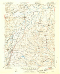
 1919 Jarratt1919 Print · USGSSoutheastern Virginia at the close of the Great War was a busy crossroads of the Atlantic Coast Line and Virginian railroads. Genealogists and local historians can trace family locations near the Russian Church, identify the site of Harrells Mill, or locate old post offices like Comans Well.3 unique versions available
 - 1951 Map of Jarratt, 1952 Print
 1951 Jarratt1952 Print · USGSThe rural Virginia landscape of Sussex and Greensville counties is shown here in the early 1950s, centered on the railroad crossing at Jarratt. Genealogists and historians can trace family locations near landmarks like Winfields Mill, Peagram Cem, and the old Fort Nottoway.2 unique versions available
 - 1953 Map of Norfolk, 1954 Print
 1953 Norfolk1954 Print · USGSCoastal Virginia and northeastern North Carolina appear here during the post-war industrial boom, showing the critical rail-and-sea connections of Hampton Roads. Genealogists can trace family roots through rural landmarks like Gethsemane Ch, the Caledonia State Prison Farm, and the vast interior of the Dismal Swamp.4 unique versions available
 - 1966 Map of Jarratt, 1968 Print
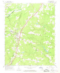 1966 Jarratt1968 Print · USGSThe rail junction at Jarratt and the surrounding swamps of Southside Virginia are captured here in the mid-sixties. Genealogists and local historians can trace family locations near Jefferson Sch or rural landmarks like Harrells Mill and Bethlehem Ch.4 unique versions available
 - 1984 Map of Emporia, 1986 Print
 1984 Emporia1986 Print · USGSSouthside Virginia and the North Carolina borderlands are captured here in the mid-1980s, centered on the transit hub of Emporia. Researchers can trace old rail corridors like the Seaboard System or locate historic sites including Fort Christanna and White Oak Ch.
 - 1990 Map of Emporia
 1990 Emporia1990 Print · USGSThe Southside Virginia borderlands are captured here in the late twentieth century, showing the critical rail and river networks of the region. Genealogists and local historians can trace family roots through rural communities like Alberta, Boykins, and Dolphin along the Meherrin River.
 - 2011 Map of Jarratt, 2011 Print
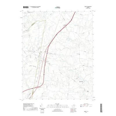
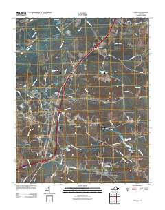 2011 Jarratt2011 Print · USGSCovers Otterdam Mobile Home Park, including Jarratt, Owens, and other nearby areas
 - 2013 Map of Jarratt, 2013 Print
 2013 Jarratt2013 Print · USGSCovers Otterdam Mobile Home Park, including Jarratt, Owens, and other nearby areas
 - 2016 Map of Jarratt, 2016 Print
 2016 Jarratt2016 Print · USGSCovers Otterdam Mobile Home Park, including Jarratt, Owens, and other nearby areas
 - 2019 Map of Jarratt, 2019 Print
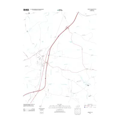
 2019 Jarratt2019 Print · USGSCovers Otterdam Mobile Home Park, including Jarratt, Owens, and other nearby areas
 - 2022 Map of Jarratt, 2022 Print
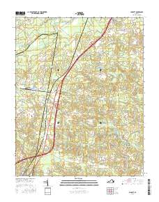
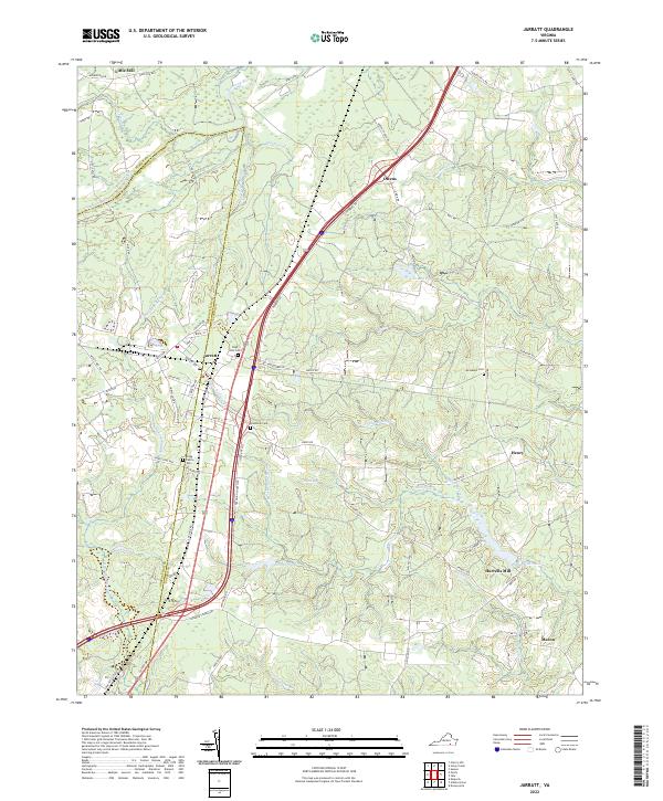 2022 Jarratt2022 Print · USGSJarratt and the Sussex-Greensville county line are captured here in the early twenty-first century, showing a landscape defined by deep swamp drainage and river crossings. Genealogists can locate several remote burial sites including High Hills Cem and Hassidiah Cem near the Nottoway River.
End of results
Showing maps 1-11 of 11
Top cities near Otterdam Mobile Home Park
Frequently asked questions
- What are the different types of historical maps available for Otterdam Mobile Home Park?
- What is the oldest map of Otterdam Mobile Home Park?
- Where can I purchase historical maps of Otterdam Mobile Home Park for my home or office?
- Where can I download high-res historical maps of Otterdam Mobile Home Park?
- Are there historical topographic maps available for Otterdam Mobile Home Park?
- Is there historical aerial imagery available for Otterdam Mobile Home Park?
- Where are historical maps of Otterdam Mobile Home Park sourced from?