Old Maps of Plato, Virginia for Academic Research
Study the evolution of Plato with 12 high-resolution historic maps. Whether you're teaching, researching, or modeling changes in land use, these maps provide essential visual documentation of urban, environmental, and geographic change.
- Analyze long-term change: Track patterns in development, transportation, and natural features.
- Ideal for environmental or urban studies: Support academic projects with primary historical map data.
- Use in the classroom or lab: Educators and researchers rely on these maps to bring historical context to life.
These maps are a powerful tool for teaching, research, and visualizing how Plato has changed over the decades.
Plato, VA maps
(12)- 1953 Map of Greensboro, 1981 Print
 1953 Greensboro1981 Print · USGSThe Piedmont borderlands of North Carolina and Virginia show a landscape defined by new reservoirs and old rail lines. Trace family roots and the changing river geography through Elon College, the John H Kerr Reservoir, and South Boston.
 - 1954 Map of Greensboro
 1954 Greensboro1954 Print · USGSThe Piedmont borderlands of North Carolina and Virginia come alive in this mid-fifties study of a region defined by its rivers and rails. Researchers can trace the growing Buggs Island Lake or follow the paths of the Southern Ry and Seaboard Air Line RR through towns like Oxford and Reidsville.
 - 1954 Map of Riceville, 1956 Print
 1954 Riceville1956 Print · USGSCentral Virginia in the mid-1950s is captured here, showing the rural landscape along the Banister River. Local researchers can locate family landmarks like Henrys Mill, the Carter Glass Sch, and County Line Cem Ch.
 - 1962 Map of Greensboro
 1962 Greensboro1962 Print · USGSThe Piedmont region along the Virginia and North Carolina border comes alive in the early 1960s, showing a landscape defined by industry and new reservoirs. Trace the path of the Virginian RR or explore the early development of Greensboro and Durham.
 - 1966 Map of Greensboro
 1966 Greensboro1966 Print · USGSThe North Carolina and Virginia Piedmont thrives during the mid-sixties, showcasing a landscape of textile hubs and expanding river reservoirs. Researchers can trace the rail corridors of the Southern Railway, find local landmarks like Elon College, or locate the extensive Camp Butner Military Reservation.
 - 1968 Map of Vernon Hill, 1971 Print
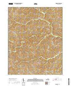
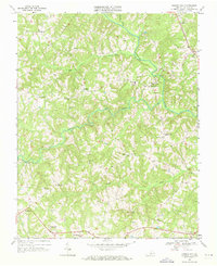 1968 Vernon Hill1971 Print · USGSHalifax County in the late sixties remained a landscape of dispersed hamlets and river-bottom farms along the Banister River. Local historians can trace the foundations of communities like Vernon Hill, Meadville, and Plato alongside rural landmarks like Nunleys Bridge.3 unique versions available
 - 1984 Map of Danville
 1984 Danville1984 Print · USGSThe Virginia and North Carolina borderlands in the mid-1980s reveal a landscape of industrial river towns and rural Piedmont crossroads. Genealogists and historians can trace family sites near Highland Burial Park, find local landmarks like the Patrick Henry Monument, and locate old settlements like Callands or Milton.
 - 2011 Map of Vernon Hill, 2011 Print
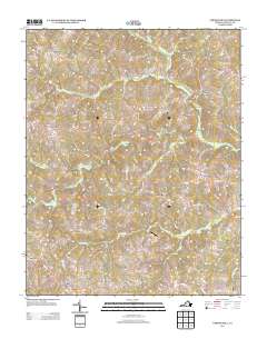
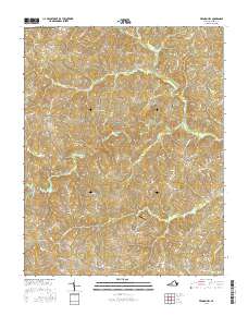
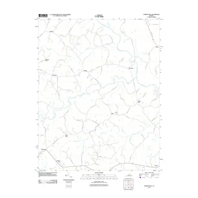 2011 Vernon Hill2011 Print · USGSCovers Plato, including High Rock, Rodden, and other nearby areas
 - 2013 Map of Vernon Hill, 2013 Print
 2013 Vernon Hill2013 Print · USGSCovers Plato, including High Rock, Rodden, and other nearby areas
 - 2016 Map of Vernon Hill, 2016 Print
 2016 Vernon Hill2016 Print · USGSCovers Plato, including High Rock, Rodden, and other nearby areas
 - 2019 Map of Vernon Hill, 2019 Print
 2019 Vernon Hill2019 Print · USGSCovers Plato, including High Rock, Rodden, and other nearby areas
 - 2022 Map of Vernon Hill, 2022 Print
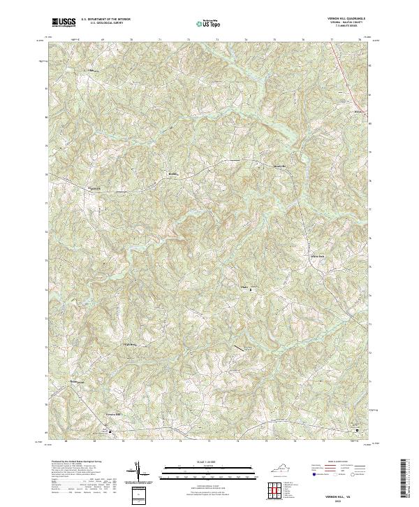 2022 Vernon Hill2022 Print · USGSHalifax County at the start of the 2020s remains a landscape of quiet rural crossroads and winding river valleys. Genealogists and local historians can trace family locations near Vernon Hill and find sites like Mount Vernon Baptist Church Cem or the small Fox Fire Airport.
End of results
Showing maps 1-12 of 12
Top cities near Plato
- South Boston historical maps
- Halifax historical maps
- Mountain Road historical maps
- Riverdale historical maps
- Cluster Springs historical maps
Frequently asked questions
- What are the different types of historical maps available for Plato?
- What is the oldest map of Plato?
- Where can I purchase historical maps of Plato for my home or office?
- Where can I download high-res historical maps of Plato?
- Are there historical topographic maps available for Plato?
- Is there historical aerial imagery available for Plato?
- Where are historical maps of Plato sourced from?