Old Maps of Cattail Run, Virginia for Genealogy
Trace your family roots with 15 historic maps of Cattail Run. These high-res maps reveal old neighborhoods, homesites, landmarks, and streets — helping you uncover where your ancestors lived and how the area evolved over time.
- Explore historic neighborhoods: Identify where your relatives may have lived in the 1800s or 1900s.
- Compare maps over time: Trace the changes in streets, buildings, and landmarks for multi-generational research.
- Perfect for genealogy & ancestry research: Used by family historians and researchers to map out lineage and migration.
These maps are an incredible resource for exploring your personal connection to Cattail Run's past.
Cattail Run, VA maps
(15)- 1920 Map of King William
 1920 King William1920 Print · USGSCoastal Virginia during the late teens and early twenties reveals a landscape of river-bend settlements and tidal swamps. Researchers can trace the Pamunkey Indian Reservation, early river crossings like Piping Tree Ferry, and rail depots at Tunstall.4 unique versions available
 - 1943 Map of Richmond, 1972 Print
 1943 Richmond1972 Print · USGSCoastal Virginia and the state capital are shown in detail during the mid-century era of infrastructure expansion. Genealogists and historians can trace the grounds of Richmond Nat Battlefield Park, locate the Yorktown Nat Cem, or follow the many rural routes through Amelia Court House and Tappahannock.
 - 1949 Map of Quinton
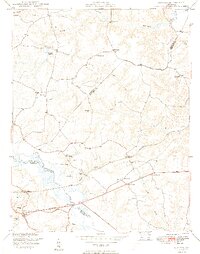 1949 Quinton1949 Print · USGSNew Kent County and the surrounding tri-county area are shown here just after the war, defined by the swampy headwaters of the Chickahominy River. Researchers can trace old crossroads at Blacks Store, local family milling sites like Parsleys Mill, and numerous country schools and churches.2 unique versions available
 - 1949 Map of Richmond, 1951 Print
 1949 Richmond1951 Print · USGSCoastal Virginia in the years following World War II remained a landscape of historic river towns and expanding military bases. Genealogists and historians can trace the rail lines of the Southern Ry and locate established landmarks from Camp Lee to the remote reaches of Dragon Swamp.
 - 1959 Map of Richmond
 1959 Richmond1959 Print · USGSMid-century Virginia is captured here at its most vital rail and river junctions, from the capital city to the Chesapeake Bay. Genealogists and historians can trace the development of colonial settlements like Williamsburg and military landmarks including Fort Monroe and Camp Lee.
 - 1964 Map of Richmond
 1964 Richmond1964 Print · USGSCoastal and central Virginia are mapped during the mid-twentieth century, showing the critical intersection of rail, river, and military life. Genealogists can trace family roots through rural county seats like Amelia or find vanished coastal neighborhoods near Phoebus and Hilton Village.
 - 1965 Map of Quinton, 1968 Print
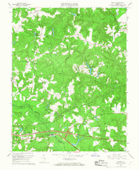 1965 Quinton1968 Print · USGSNew Kent and Hanover counties appear here in the mid-sixties, where the winding Chickahominy River meets a landscape of old millponds and emerging suburbs. Genealogists can trace family landmarks like Alexanders Corner or find records at Black Creek Ch and Tabernacle Cem.5 unique versions available
 - 1973 Map of Richmond, 1974 Print
 1973 Richmond1974 Print · USGSThe Virginia Tidewater and Piedmont come alive in the early seventies, showcasing a region defined by its great rivers and massive military installations. Researchers can trace the mid-century growth of Richmond or locate family sites near Amelia Court House and Highland Springs.2 unique versions available
 - 1974 Map of Quinton, 1977 Print
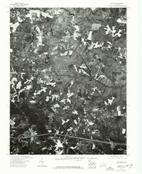 1974 Quinton1977 Print · USGSNew Kent County comes into sharp focus during the mid-1970s, documented through high-resolution aerial photography of its timbered tracts and farmsteads. Local historians can trace the early road network and land divisions surrounding the settlement of Quinton.
 - 1984 Map of Richmond, 1986 Print
 1984 Richmond1986 Print · USGSCentral Virginia during the mid-eighties shows a landscape of rapid suburban expansion centered on the state capital and its historic riverfront. Genealogists and historians can trace institutional sites like Randolph-Macon College, the grounds of Fort Lee, and small community landmarks like Hebron Ch.3 unique versions available
 - 2010 Map of Quinton, 2010 Print
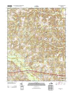
 2010 Quinton2010 Print · USGSCovers Cattail Run, including Westwood, Woodlawn, and other nearby areas
 - 2013 Map of Quinton, 2013 Print
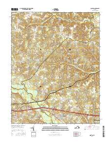
 2013 Quinton2013 Print · USGSCovers Cattail Run, including Westwood, Woodlawn, and other nearby areas
 - 2016 Map of Quinton, 2016 Print
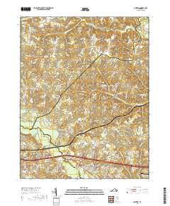
 2016 Quinton2016 Print · USGSCovers Cattail Run, including Westwood, Woodlawn, and other nearby areas
 - 2019 Map of Quinton, 2019 Print
 2019 Quinton2019 Print · USGSCovers Cattail Run, including Westwood, Woodlawn, and other nearby areas
 - 2022 Map of Quinton, 2022 Print
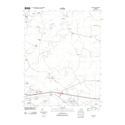
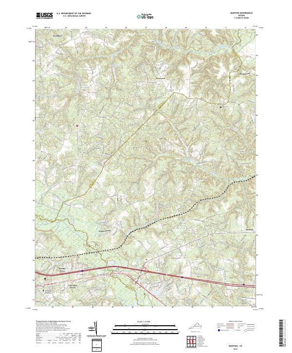 2022 Quinton2022 Print · USGSThe borderlands of New Kent and Henrico counties are captured in the early twenty-first century as suburban growth meets rural farmland. Researchers can locate family burial sites at Tabernacle Cem or trace the drainage of the Chickahominy River through Cattail Swamp.
End of results
Showing maps 1-15 of 15
Top cities near Cattail Run
- Mechanicsville historical maps
- Highland Springs historical maps
- Montrose historical maps
- Central Garage historical maps
- King William historical maps
Frequently asked questions
- What are the different types of historical maps available for Cattail Run?
- What is the oldest map of Cattail Run?
- Where can I purchase historical maps of Cattail Run for my home or office?
- Where can I download high-res historical maps of Cattail Run?
- Are there historical topographic maps available for Cattail Run?
- Is there historical aerial imagery available for Cattail Run?
- Where are historical maps of Cattail Run sourced from?