Old Maps of Bowman Acres, Henrico County for Metal Detecting
Plan your next treasure hunt with 16 historic maps of Bowman Acres. Find old homesites, ghost towns, trails, and gathering spots that may be lost to time — perfect for identifying promising metal detecting locations.
- Locate forgotten sites: Uncover places like long-lost settlements, abandoned rail lines, or gathering spots.
- Plan better hunts: Use map overlays combined with LiDAR or satellite views to narrow in on historically rich areas.
- Made for detectorists: Thousands of hobbyists use these maps to discover relics, coins, and hidden history.
Use these historic maps to boost your research and find new opportunities beneath the surface of Bowman Acres.
Bowman Acres, Henrico County maps
(16)- 1890 Map of Goochland
 1890 Goochland1890 Print · USGSCovers Bowman Acres, including Tuckahoe, Short Pump, and other nearby areas
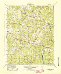
 - 1892 Map of Goochland
 1892 Goochland1892 Print · USGSCovers Bowman Acres, including Tuckahoe, Short Pump, and other nearby areas8 unique versions available
 - 1936 Map of Glen Allen
 1936 Glen Allen1936 Print · USGSCovers Bowman Acres, including Short Pump, Glen Allen, and other nearby areas2 unique versions available
 - 1941 Map of Glen Allen
 1941 Glen Allen1941 Print · USGSCovers Bowman Acres, including Short Pump, Glen Allen, and other nearby areas2 unique versions available
 - 1943 Map of Johnsons Springs, 1961 Print
 1943 Johnsons Springs1961 Print · USGSCovers Bowman Acres, including Rockville, Homewood Park, and other nearby areas
 - 1943 Map of Richmond, 1972 Print
 1943 Richmond1972 Print · USGSCovers Bowman Acres, including Richmond, Hampton, and other nearby areas
 - 1944 Map of Johnsons Springs
 1944 Johnsons Springs1944 Print · USGSCovers Bowman Acres, including Rockville, Homewood Park, and other nearby areas
 - 1949 Map of Richmond, 1951 Print
 1949 Richmond1951 Print · USGSCovers Bowman Acres, including Richmond, Hampton, and other nearby areas
 - 1959 Map of Richmond
 1959 Richmond1959 Print · USGSCovers Bowman Acres, including Richmond, Hampton, and other nearby areas
 - 1963 Map of Hylas, 1965 Print
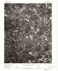
 1963 Hylas1965 Print · USGSCovers Bowman Acres, including Rockville, Homewood Park, and other nearby areas3 unique versions available
 - 1963 Map of Glen Allen, 1965 Print
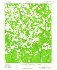
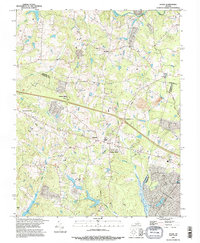
 1963 Glen Allen1965 Print · USGSCovers Bowman Acres, including Short Pump, Glen Allen, and other nearby areas7 unique versions available
 - 1964 Map of Richmond
 1964 Richmond1964 Print · USGSCovers Bowman Acres, including Richmond, Hampton, and other nearby areas
 - 1973 Map of Richmond, 1974 Print
 1973 Richmond1974 Print · USGSCovers Bowman Acres, including Richmond, Hampton, and other nearby areas2 unique versions available
 - 1974 Map of Glen Allen, 1977 Print
 1974 Glen Allen1977 Print · USGSCovers Bowman Acres, including Short Pump, Glen Allen, and other nearby areas
 - 1984 Map of Richmond, 1986 Print
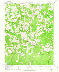
 1984 Richmond1986 Print · USGSCovers Bowman Acres, including Richmond, Tuckahoe, and other nearby areas3 unique versions available
 - 1994 Map of Hylas, 1996 Print
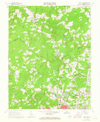
 1994 Hylas1996 Print · USGSCovers Bowman Acres, including Rockville, Homewood Park, and other nearby areas
End of results
Showing maps 1-16 of 16
Frequently asked questions
- What are the different types of historical maps available for Bowman Acres?
- What is the oldest map of Bowman Acres?
- Where can I purchase historical maps of Bowman Acres for my home or office?
- Where can I download high-res historical maps of Bowman Acres?
- Are there historical topographic maps available for Bowman Acres?
- Is there historical aerial imagery available for Bowman Acres?
- Where are historical maps of Bowman Acres sourced from?