Old Maps of St Ives at Wellesley, Henrico County for Hiking & Exploration
Hike through history with 12 historic maps of St Ives at Wellesley. Explore old trails, ghost towns, and forgotten backroads — perfect for outdoor adventurers and local explorers.
- Rediscover forgotten places: Map out old mining camps, roads, and footpaths that no longer exist on modern maps.
- Layer with modern tools: Combine with LiDAR or satellite views to plan hikes through historical terrain.
- Made for exploration: Popular among hikers, overlanders, and local history lovers.
Use these maps to find adventure and explore the hidden past of St Ives at Wellesley.
St Ives at Wellesley, Henrico County maps
(12)- 1890 Map of Goochland
 1890 Goochland1890 Print · USGSCovers St Ives at Wellesley, including Tuckahoe, Short Pump, and other nearby areas
 - 1892 Map of Goochland
 1892 Goochland1892 Print · USGSCovers St Ives at Wellesley, including Tuckahoe, Short Pump, and other nearby areas8 unique versions available
 - 1943 Map of Johnsons Springs, 1961 Print
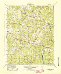
 1943 Johnsons Springs1961 Print · USGSCovers St Ives at Wellesley, including Rockville, Homewood Park, and other nearby areas
 - 1943 Map of Richmond, 1972 Print
 1943 Richmond1972 Print · USGSCovers St Ives at Wellesley, including Richmond, Hampton, and other nearby areas
 - 1944 Map of Johnsons Springs
 1944 Johnsons Springs1944 Print · USGSCovers St Ives at Wellesley, including Rockville, Homewood Park, and other nearby areas
 - 1949 Map of Richmond, 1951 Print
 1949 Richmond1951 Print · USGSCovers St Ives at Wellesley, including Richmond, Hampton, and other nearby areas
 - 1959 Map of Richmond
 1959 Richmond1959 Print · USGSCovers St Ives at Wellesley, including Richmond, Hampton, and other nearby areas
 - 1963 Map of Hylas, 1965 Print
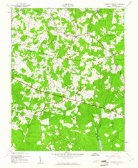
 1963 Hylas1965 Print · USGSCovers St Ives at Wellesley, including Rockville, Homewood Park, and other nearby areas3 unique versions available
 - 1964 Map of Richmond
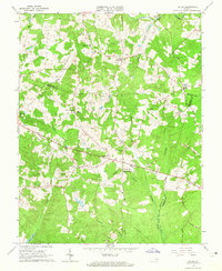
 1964 Richmond1964 Print · USGSCovers St Ives at Wellesley, including Richmond, Hampton, and other nearby areas
 - 1973 Map of Richmond, 1974 Print
 1973 Richmond1974 Print · USGSCovers St Ives at Wellesley, including Richmond, Hampton, and other nearby areas2 unique versions available
 - 1984 Map of Richmond, 1986 Print
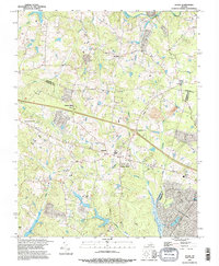
 1984 Richmond1986 Print · USGSCovers St Ives at Wellesley, including Richmond, Tuckahoe, and other nearby areas3 unique versions available
 - 1994 Map of Hylas, 1996 Print
 1994 Hylas1996 Print · USGSCovers St Ives at Wellesley, including Rockville, Homewood Park, and other nearby areas
End of results
Showing maps 1-12 of 12
Frequently asked questions
- What are the different types of historical maps available for St Ives at Wellesley?
- What is the oldest map of St Ives at Wellesley?
- Where can I purchase historical maps of St Ives at Wellesley for my home or office?
- Where can I download high-res historical maps of St Ives at Wellesley?
- Are there historical topographic maps available for St Ives at Wellesley?
- Is there historical aerial imagery available for St Ives at Wellesley?
- Where are historical maps of St Ives at Wellesley sourced from?