Old Maps of Steveston, Henrico County for Genealogy
Trace your family roots with 16 historic maps of Steveston. These high-res maps reveal old neighborhoods, homesites, landmarks, and streets — helping you uncover where your ancestors lived and how the area evolved over time.
- Explore historic neighborhoods: Identify where your relatives may have lived in the 1800s or 1900s.
- Compare maps over time: Trace the changes in streets, buildings, and landmarks for multi-generational research.
- Perfect for genealogy & ancestry research: Used by family historians and researchers to map out lineage and migration.
These maps are an incredible resource for exploring your personal connection to Steveston's past.
Steveston, Henrico County maps
(16)- 1890 Map of Goochland
 1890 Goochland1890 Print · USGSCovers Steveston, including Tuckahoe, Short Pump, and other nearby areas
 - 1892 Map of Goochland
 1892 Goochland1892 Print · USGSCovers Steveston, including Tuckahoe, Short Pump, and other nearby areas8 unique versions available
 - 1936 Map of Richmond West
 1936 Richmond West1936 Print · USGSCovers Steveston, including Tuckahoe, Bon Air, and other nearby areas2 unique versions available
 - 1936 Map of Glen Allen
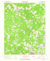
 1936 Glen Allen1936 Print · USGSCovers Steveston, including Short Pump, Glen Allen, and other nearby areas2 unique versions available
 - 1941 Map of Glen Allen
 1941 Glen Allen1941 Print · USGSCovers Steveston, including Short Pump, Glen Allen, and other nearby areas2 unique versions available
 - 1942 Map of Westhampton
 1942 Westhampton1942 Print · USGSCovers Steveston, including Tuckahoe, Bon Air, and other nearby areas2 unique versions available
 - 1943 Map of Richmond, 1972 Print
 1943 Richmond1972 Print · USGSCovers Steveston, including Richmond, Hampton, and other nearby areas
 - 1949 Map of Richmond, 1951 Print
 1949 Richmond1951 Print · USGSCovers Steveston, including Richmond, Hampton, and other nearby areas
 - 1959 Map of Richmond
 1959 Richmond1959 Print · USGSCovers Steveston, including Richmond, Hampton, and other nearby areas
 - 1963 Map of Glen Allen, 1965 Print
 1963 Glen Allen1965 Print · USGSCovers Steveston, including Short Pump, Glen Allen, and other nearby areas7 unique versions available
 - 1964 Map of Richmond
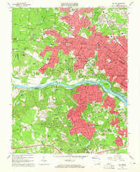
 1964 Richmond1964 Print · USGSCovers Steveston, including Richmond, Hampton, and other nearby areas
 - 1964 Map of Bon Air, 1965 Print
 1964 Bon Air1965 Print · USGSCovers Steveston, including Tuckahoe, Bon Air, and other nearby areas8 unique versions available
 - 1973 Map of Richmond, 1974 Print
 1973 Richmond1974 Print · USGSCovers Steveston, including Richmond, Hampton, and other nearby areas2 unique versions available
 - 1974 Map of Bon Air, 1977 Print
 1974 Bon Air1977 Print · USGSCovers Steveston, including Tuckahoe, Bon Air, and other nearby areas
 - 1974 Map of Glen Allen, 1977 Print
 1974 Glen Allen1977 Print · USGSCovers Steveston, including Short Pump, Glen Allen, and other nearby areas
 - 1984 Map of Richmond, 1986 Print
 1984 Richmond1986 Print · USGSCovers Steveston, including Richmond, Tuckahoe, and other nearby areas3 unique versions available
End of results
Showing maps 1-16 of 16
Frequently asked questions
- What are the different types of historical maps available for Steveston?
- What is the oldest map of Steveston?
- Where can I purchase historical maps of Steveston for my home or office?
- Where can I download high-res historical maps of Steveston?
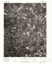
- Are there historical topographic maps available for Steveston?
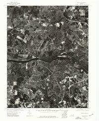
- Is there historical aerial imagery available for Steveston?
- Where are historical maps of Steveston sourced from?