Old Maps of Isle of Wight County, Virginia for Academic Research
Study the evolution of Isle of Wight County with 72 high-resolution historic maps. Whether you're teaching, researching, or modeling changes in land use, these maps provide essential visual documentation of urban, environmental, and geographic change.
- Analyze long-term change: Track patterns in development, transportation, and natural features.
- Ideal for environmental or urban studies: Support academic projects with primary historical map data.
- Use in the classroom or lab: Educators and researchers rely on these maps to bring historical context to life.
These maps are a powerful tool for teaching, research, and visualizing how Isle of Wight County has changed over the decades.
Isle of Wight County, VA maps
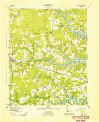
(72)- 1907 Map of Norfolk
 1907 Norfolk1907 Print · USGSCovers Isle of Wight County, including Virginia Beach, Chesapeake, and other nearby areas
 - 1907 Map of Yorktown
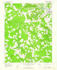
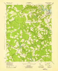
 1907 Yorktown1907 Print · USGSCovers Isle of Wight County, including Smithfield, Rushmere, and other nearby areas6 unique versions available
 - 1919 Map of Smithfield
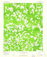
 1919 Smithfield1919 Print · USGSCovers Isle of Wight County, including Smithfield, Carrollton, and other nearby areas4 unique versions available
 - 1919 Map of Surry
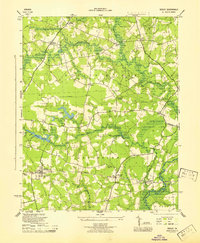
 1919 Surry1919 Print · USGSCovers Isle of Wight County, including Claremont, Dendron, and other nearby areas3 unique versions available
 - 1920 Map of Holland
 1920 Holland1920 Print · USGSCovers Isle of Wight County, including Franklin, Camptown, and other nearby areas2 unique versions available
 - 1920 Map of Ivor
 1920 Ivor1920 Print · USGSCovers Isle of Wight County, including Windsor, Wakefield, and other nearby areas2 unique versions available
 - 1921 Map of Newport News
 1921 Newport News1921 Print · USGSCovers Isle of Wight County, including Norfolk, Newport News, and other nearby areas4 unique versions available
 - 1943 Map of Holland
 1943 Holland1943 Print · USGSCovers Isle of Wight County, including Franklin, Camptown, and other nearby areas
 - 1943 Map of Yorktown
 1943 Yorktown1943 Print · USGSCovers Isle of Wight County, including Smithfield, Rushmere, and other nearby areas
 - 1943 Map of Richmond, 1972 Print
 1943 Richmond1972 Print · USGSCovers Isle of Wight County, including Richmond, Hampton, and other nearby areas
 - 1944 Map of Windsor
 1944 Windsor1944 Print · USGSCovers Isle of Wight County, including Windsor, Lake Prince Farms, and other nearby areas2 unique versions available
 - 1944 Map of Smithfield, 1961 Print
 1944 Smithfield1961 Print · USGSCovers Isle of Wight County, including Smithfield, Isle of Wight, and other nearby areas
 - 1944 Map of Sedley, 1961 Print
 1944 Sedley1961 Print · USGSCovers Isle of Wight County, including Sedley, Burdette, and other nearby areas
 - 1944 Map of Raynor, 1961 Print
 1944 Raynor1961 Print · USGSCovers Isle of Wight County, including Whitley, Gwaltney Crossroads, and other nearby areas
 - 1944 Map of Zuni, 1961 Print
 1944 Zuni1961 Print · USGSCovers Isle of Wight County, including Windsor, Rhodes, and other nearby areas
 - 1945 Map of Zuni
 1945 Zuni1945 Print · USGSCovers Isle of Wight County, including Windsor, Rhodes, and other nearby areas
 - 1945 Map of Raynor
 1945 Raynor1945 Print · USGSCovers Isle of Wight County, including Whitley, Gwaltney Crossroads, and other nearby areas
 - 1945 Map of Sedley
 1945 Sedley1945 Print · USGSCovers Isle of Wight County, including Sedley, Burdette, and other nearby areas
 - 1945 Map of Smithfield
 1945 Smithfield1945 Print · USGSCovers Isle of Wight County, including Smithfield, Isle of Wight, and other nearby areas
 - 1948 Map of Bacons Castle, 1953 Print
 1948 Bacons Castle1953 Print · USGSCovers Isle of Wight County, including Rushmere, Poolesville, and other nearby areas
 - 1949 Map of Chuckatuck
 1949 Chuckatuck1949 Print · USGSCovers Isle of Wight County, including Russell Point, Princeview Point, and other nearby areas
 - 1949 Map of Richmond, 1951 Print
 1949 Richmond1951 Print · USGSCovers Isle of Wight County, including Richmond, Hampton, and other nearby areas
 - 1950 Map of Blackstone
 1950 Blackstone1950 Print · USGSCovers Isle of Wight County, including Smithfield, Carrollton, and other nearby areas
 - 1950 Map of Mulberry Island, 1953 Print
 1950 Mulberry Island1953 Print · USGSCovers Isle of Wight County, including Smithfield, Wendwood, and other nearby areas
 - 1950 Map of Cobham Bay, 1953 Print
 1950 Cobham Bay1953 Print · USGSCovers Isle of Wight County, including Grove, Highgate, and other nearby areas
Showing maps 1-25 of 72
Top cities of Isle of Wight County
- Smithfield historical maps
- Carrollton historical maps
- Windsor historical maps
- Benns Church historical maps
- Rushmere historical maps
- Camptown historical maps
See more
Frequently asked questions
- What are the different types of historical maps available for Isle of Wight County?
- What is the oldest map of Isle of Wight County?
- Where can I purchase historical maps of Isle of Wight County for my home or office?
- Where can I download high-res historical maps of Isle of Wight County?
- Are there historical topographic maps available for Isle of Wight County?
- Is there historical aerial imagery available for Isle of Wight County?
- Where are historical maps of Isle of Wight County sourced from?