2020s Maps of Lunenburg County, Virginia
Explore 12 historic maps of Lunenburg County from the 2020s. These maps offer a rare glimpse into what life looked like during the 2020s — showing old roads, neighborhoods, homes, and landmarks that have changed or disappeared over time.
Whether you're researching your family's past, planning a metal detecting trip, or studying how Lunenburg County's landscape evolved across the 2020s, these high-resolution maps are a powerful tool for exploring the history of this region.
- Focus on a specific era: All maps on this page are from the 2020s, giving you a focused view of this time period.
- See what’s changed: Compare century-old streets, trails, and buildings to today's modern landscape using overlays and satellite layers.
- Research with precision: Use these maps for genealogy, historical research, land use analysis, or educational projects.
- View, download, or print: Maps are fully viewable online in high resolution, and can be downloaded or printed for your own records.
Start exploring Lunenburg County's history through authentic maps from the 2020s. This is your window into the past.
Lunenburg County, VA maps
(12)- 2022 Map of Kenbridge East, 2022 Print
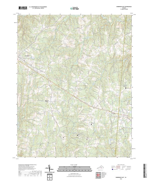 2022 Kenbridge East2022 Print · USGSLunenburg County in the twenty-first century maintains its quiet rural character and deep agricultural roots. Genealogists and historians can trace old homesteads and family sites like the Wilkinson Cem, Manson Cem, and the settlement at Dundas.
 - 2022 Map of Kenbridge West, 2022 Print
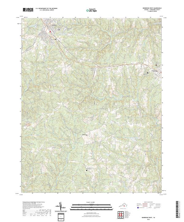 2022 Kenbridge West2022 Print · USGSLunenburg County's rural character is preserved in this contemporary survey of the area between Victoria and Kenbridge. Genealogists and historians can locate several local burial sites like Oakwood Cem and Unity Baptist Church Cem, or trace the winding course of Flat Rock Cr.
 - 2022 Map of Chase City, 2022 Print
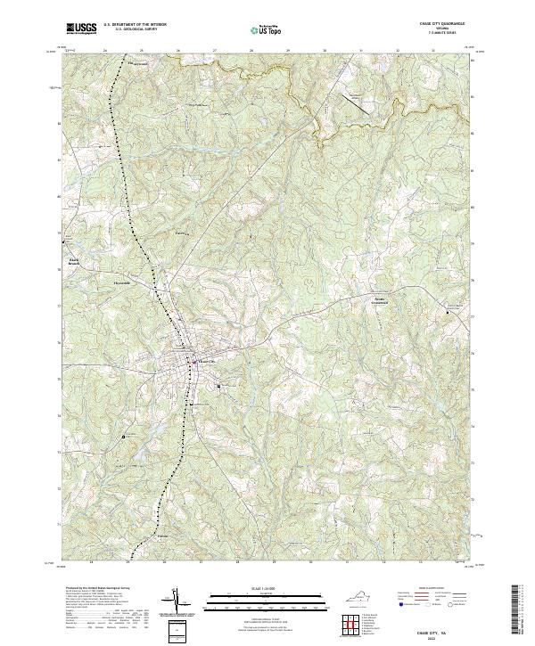 2022 Chase City2022 Print · USGSMecklenburg County's rural character is preserved in this recent survey of the region surrounding Chase City. Genealogists and local researchers can trace the locations of several community landmarks, including Woodlawn Cem, Bethlehem Cem, and the Tobacco Heritage Tr.
 - 2022 Map of Meherrin, 2022 Print
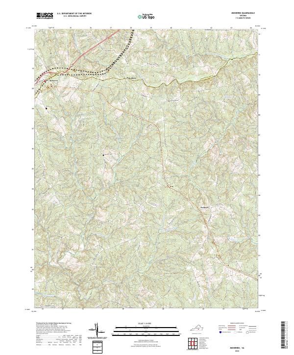 2022 Meherrin2022 Print · USGSMeherrin and the surrounding Lunenburg County countryside are documented here in the early twenty-first century as historic rail routes transition to recreation. Genealogists and local historians can locate Bruce Cem, Nutbush, and the headwaters of the N Meherrin River.
 - 2022 Map of Rubermont, 2022 Print
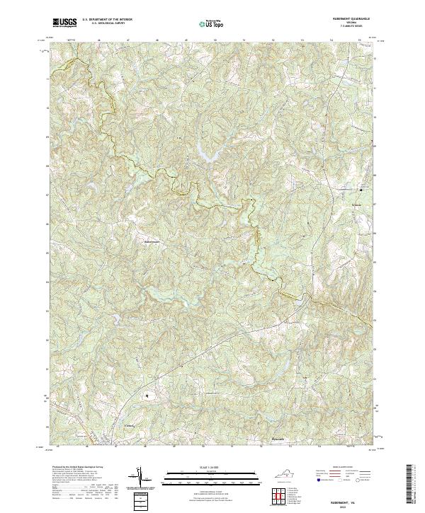 2022 Rubermont2022 Print · USGSLunenburg and Nottoway counties are shown here in the contemporary era, centered on the winding Nottoway River. Researchers can trace local landmarks like Saint Marks Cem and the historic path of Lewiston Plank Rd near the town of Victoria.
 - 2022 Map of Blackstone West, 2022 Print
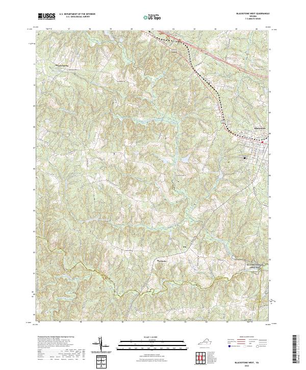 2022 Blackstone West2022 Print · USGSNottoway County in the early 2020s shows the enduring layout of its Southside Virginia crossroads and river valleys. Researchers can trace the family lands and settlements surrounding Blackstone, Irby, and Sneads Spring, or locate the Lakeview Cem near town.
 - 2022 Map of Forksville, 2022 Print
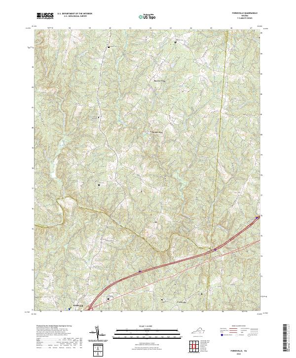 2022 Forksville2022 Print · USGSLunenburg and Mecklenburg counties are captured here in the early 2020s, centered on the Meherrin River valley. Genealogists and local historians can locate numerous family sites like Hite Cem and rural hubs such as Stones Mill or Forksville.
 - 2022 Map of Fort Mitchell, 2022 Print
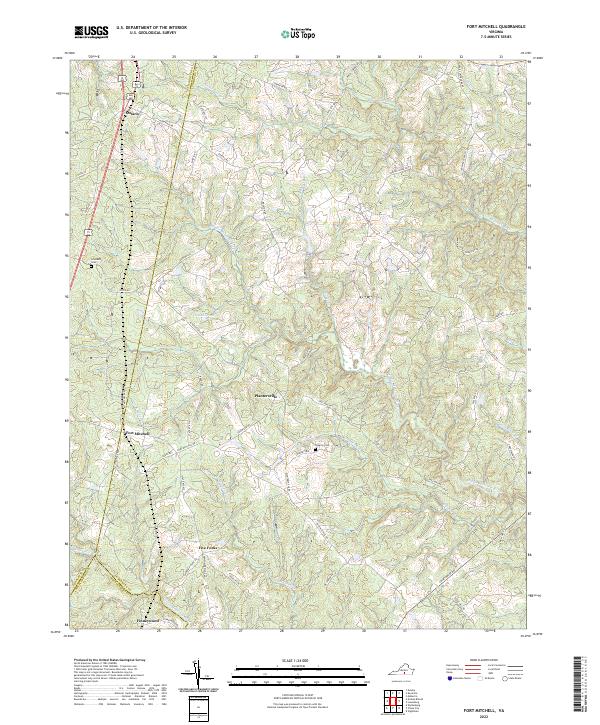 2022 Fort Mitchell2022 Print · USGSLunenburg County at the start of the 2020s remains a landscape of historic crossroads and river-fed ridges. Researchers can trace local lineage through Friendship Cem or explore the rural hubs of Fort Mitchell, Five Forks, and Ontario.
 - 2022 Map of Wightman, 2022 Print
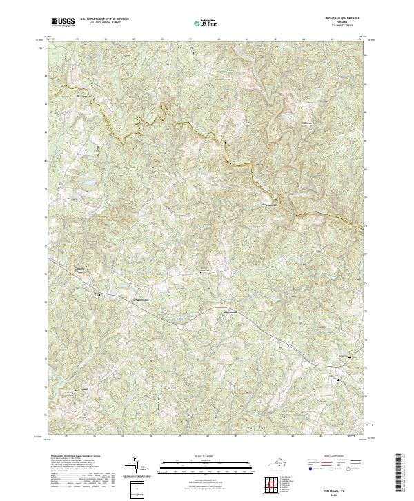 2022 Wightman2022 Print · USGSMecklenburg and Lunenburg counties meet in this contemporary survey of the Meherrin River forks. Researchers can locate family landmarks like Reekes Mill, Mount Horeb Cem, and the rural crossroads of Gregory Corner.
 - 2022 Map of Lunenburg, 2022 Print
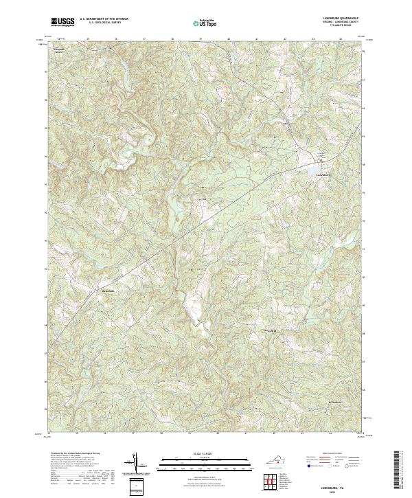 2022 Lunenburg2022 Print · USGSLunenburg County's rural landscape at the start of the 2020s shows the enduring patterns of Virginia's historic Piedmont settlements. Researchers can trace ancestral road networks like Old Mansion Rd and locate the historic Lunenburg County Courthouse and Loves Mill.
 - 2022 Map of North View, 2022 Print
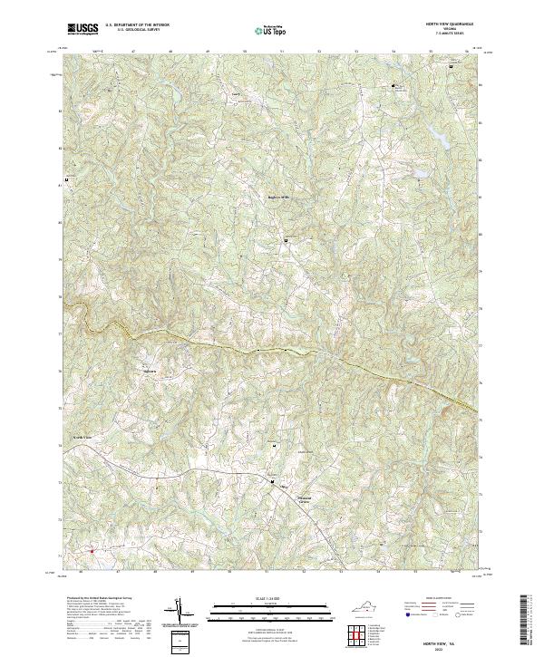 2022 North View2022 Print · USGSLunenburg County’s southern reaches are shown in the early 2020s, where the Meherrin River divides a landscape of historic crossroads and small settlements. Researchers can trace family sites through numerous burial grounds like Tabernacle Cem and Bailey Cem, or follow the path of the Tobacco Heritage Trl.
 - 2022 Map of Keysville, 2022 Print
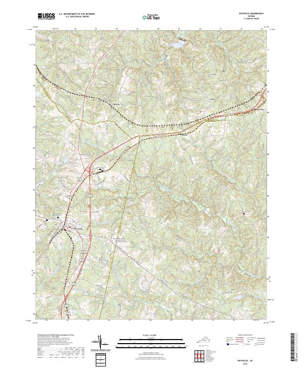 2022 Keysville2022 Print · USGSThe town of Keysville and the Southside Virginia Community College - John H Daniel Campus anchor this modern survey of the Virginia Piedmont. Genealogists can trace family landmarks at Ash Camp Memorial Cem and Mount Ellis Cem while following the Tobacco Heritage Trl.
End of results
Showing maps 1-12 of 12
Top cities of Lunenburg County
Frequently asked questions
- What are the different types of historical maps available for Lunenburg County?
- What is the oldest map of Lunenburg County?
- Where can I purchase historical maps of Lunenburg County for my home or office?
- Where can I download high-res historical maps of Lunenburg County?
- Are there historical topographic maps available for Lunenburg County?
- Is there historical aerial imagery available for Lunenburg County?
- Where are historical maps of Lunenburg County sourced from?