Old Maps of South Hill, Virginia for Academic Research
Study the evolution of South Hill with 12 high-resolution historic maps. Whether you're teaching, researching, or modeling changes in land use, these maps provide essential visual documentation of urban, environmental, and geographic change.
- Analyze long-term change: Track patterns in development, transportation, and natural features.
- Ideal for environmental or urban studies: Support academic projects with primary historical map data.
- Use in the classroom or lab: Educators and researchers rely on these maps to bring historical context to life.
These maps are a powerful tool for teaching, research, and visualizing how South Hill has changed over the decades.
South Hill, VA maps
(12)- 1953 Map of Greensboro, 1981 Print
 1953 Greensboro1981 Print · USGSThe Piedmont borderlands of North Carolina and Virginia show a landscape defined by new reservoirs and old rail lines. Trace family roots and the changing river geography through Elon College, the John H Kerr Reservoir, and South Boston.
 - 1954 Map of Greensboro
 1954 Greensboro1954 Print · USGSThe Piedmont borderlands of North Carolina and Virginia come alive in this mid-fifties study of a region defined by its rivers and rails. Researchers can trace the growing Buggs Island Lake or follow the paths of the Southern Ry and Seaboard Air Line RR through towns like Oxford and Reidsville.
 - 1955 Map of Kenbridge, 1957 Print
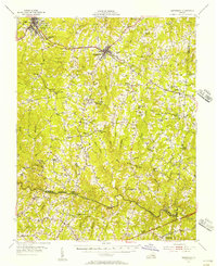 1955 Kenbridge1957 Print · USGSSouthside Virginia's rural heartland thrives in the mid-fifties, shaped by the Virginian railroad and a landscape of crossroads hamlets. Genealogists and local historians can trace family roots through numerous sites like Whittles Mill, St Mark Ch, and Lochleven Sch.
 - 1962 Map of Greensboro
 1962 Greensboro1962 Print · USGSThe Piedmont region along the Virginia and North Carolina border comes alive in the early 1960s, showing a landscape defined by industry and new reservoirs. Trace the path of the Virginian RR or explore the early development of Greensboro and Durham.
 - 1966 Map of Greensboro
 1966 Greensboro1966 Print · USGSThe North Carolina and Virginia Piedmont thrives during the mid-sixties, showcasing a landscape of textile hubs and expanding river reservoirs. Researchers can trace the rail corridors of the Southern Railway, find local landmarks like Elon College, or locate the extensive Camp Butner Military Reservation.
 - 1966 Map of Forksville, 1968 Print
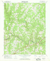 1966 Forksville1968 Print · USGSThe rural borderlands of Lunenburg, Mecklenburg, and Brunswick Counties are captured here in the mid-sixties. Local researchers can trace family landmarks like Stones Mill, the community at Forksville, and the Seaboard Coast Line railroad.2 unique versions available
 - 1968 Map of La Crosse, 1972 Print
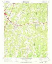 1968 La Crosse1972 Print · USGSMecklenburg County was a bustling rail corridor in the late sixties, centered on the strategic crossing at La Crosse. Genealogists can trace family landmarks like Booker-Boyd Sch and rural congregations at Miles Chapel or Mt Sinai Ch.3 unique versions available
 - 1968 Map of South Hill, 1977 Print
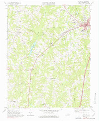 1968 South Hill1977 Print · USGSMecklenburg County in the late sixties reveals a landscape of growing towns and well-established rural crossroads. Genealogists can trace family landmarks like Oakwood Cem, rural parishes such as Lamberts Chapel, and historic school sites including Buckhorn Sch.2 unique versions available
 - 1984 Map of South Boston, 1985 Print
 1984 South Boston1985 Print · USGSSouthside Virginia and the northern border of North Carolina are defined by water and rail in the mid-1980s. Genealogists and historians can trace the development of riverside towns like Clarksville or follow the legacy of the Norfolk and Western and Southern railroads through Chase City and Halifax.
 - 2022 Map of La Crosse, 2022 Print
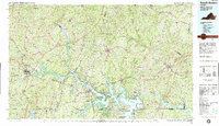
 2022 La Crosse2022 Print · USGSMecklenburg and Brunswick counties are shown here in the contemporary era as the old rail lines transition into public trails. Genealogists and local historians can locate many rural burying grounds, including Canaan Cem, La Crosse Cem, and Smith Cem.
 - 2022 Map of Forksville, 2022 Print
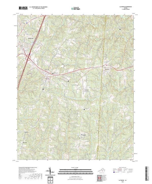
 2022 Forksville2022 Print · USGSLunenburg and Mecklenburg counties are captured here in the early 2020s, centered on the Meherrin River valley. Genealogists and local historians can locate numerous family sites like Hite Cem and rural hubs such as Stones Mill or Forksville.
 - 2022 Map of South Hill, 2022 Print
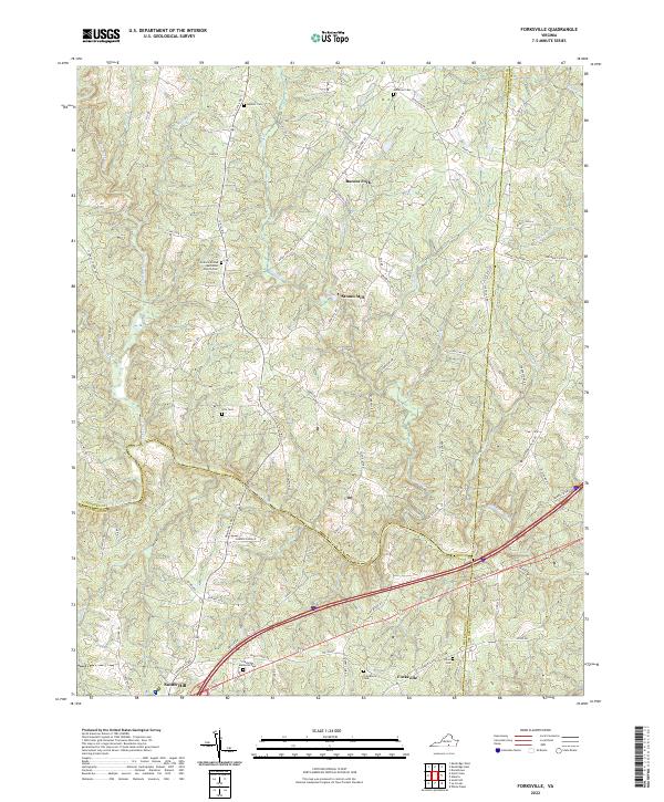
 2022 South Hill2022 Print · USGSMecklenburg County during the early twenty-first century reveals a landscape shaped by tobacco farming and historic rail lines. Genealogists can trace family footprints across numerous rural burial sites like Union Level Cem and Saint Lukes Cem or explore the path of the Tobacco Heritage Trl.
End of results
Showing maps 1-12 of 12
Top cities near South Hill
- Bracey historical maps
- Kenbridge historical maps
- La Crosse historical maps
- Alberta historical maps
- Brodnax historical maps
- Union Level historical maps
See more
Frequently asked questions
- What are the different types of historical maps available for South Hill?
- What is the oldest map of South Hill?
- Where can I purchase historical maps of South Hill for my home or office?
- Where can I download high-res historical maps of South Hill?
- Are there historical topographic maps available for South Hill?
- Is there historical aerial imagery available for South Hill?
- Where are historical maps of South Hill sourced from?