1970s Maps of Durrett Town, Virginia
Explore 3 historic maps of Durrett Town from the 1970s. These maps offer a rare glimpse into what life looked like during the 1970s — showing old roads, neighborhoods, homes, and landmarks that have changed or disappeared over time.
Whether you're researching your family's past, planning a metal detecting trip, or studying how Durrett Town's landscape evolved across the 1970s, these high-resolution maps are a powerful tool for exploring the history of this region.
- Focus on a specific era: All maps on this page are from the 1970s, giving you a focused view of this time period.
- See what’s changed: Compare century-old streets, trails, and buildings to today's modern landscape using overlays and satellite layers.
- Research with precision: Use these maps for genealogy, historical research, land use analysis, or educational projects.
- View, download, or print: Maps are fully viewable online in high resolution, and can be downloaded or printed for your own records.
Start exploring Durrett Town's history through authentic maps from the 1970s. This is your window into the past.
Durrett Town, VA maps
(3)- 1971 Map of Roanoke, 1977 Print
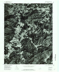
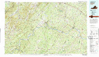
 1971 Roanoke1977 Print · USGSThe Virginia Piedmont and Blue Ridge mountains meet in this early 1970s landscape of river valleys and rail hubs. Researchers can trace historic transportation routes and landmarks like the Appomattox Court House Nat Hist Pk, the Peaks of Otter, and Amelia Court House.2 unique versions available
 - 1979 Map of Greenfield, 1982 Print
 1979 Greenfield1982 Print · USGSNelson County's agrarian landscape near Greenfield is captured in the late seventies through detailed aerial imagery. Genealogists and historians can trace property lines and family homesteads near Nelly s Ford, Avon, and the slopes of Pilot Mountain.
 - 1979 Map of Dillwyn, 1982 Print
 1979 Dillwyn1982 Print · USGSCentral Virginia in the late seventies is defined by the winding James River and the rural communities of the Piedmont. Trace old transportation corridors and family-named ridges from Dillwyn and Buckingham to the Blue Ridge foothills.
End of results
Showing maps 1-3 of 3
Top cities near Durrett Town
- Waynesboro historical maps
- Crozet historical maps
- Verona historical maps
- Crimora historical maps
- Lyndhurst historical maps
- Dooms historical maps
See more
Frequently asked questions
- What are the different types of historical maps available for Durrett Town?
- What is the oldest map of Durrett Town?
- Where can I purchase historical maps of Durrett Town for my home or office?
- Where can I download high-res historical maps of Durrett Town?
- Are there historical topographic maps available for Durrett Town?
- Is there historical aerial imagery available for Durrett Town?
- Where are historical maps of Durrett Town sourced from?