Old Maps of Norfolk, Virginia
Explore 21 old maps of Norfolk, spanning from 1907 to today. These high-resolution historic maps reveal how streets, neighborhoods, landmarks, and natural features evolved over time — perfect for genealogy, metal detecting, research, and local history exploration.
What you can do with these maps:
- See how Norfolk changed over time: Compare historical maps to modern-day views to trace roads, homesites, rail lines & more.
- View detailed metadata: Each map includes creators, publishers, year, scale, and archive source.
- Overlay maps with satellite & LiDAR: Visualize the past alongside modern tools to explore terrain & human change.
- Trusted historical sources: Maps sourced from the USGS, Library of Congress, and other archives.
- Access maps your way: View online, download high-res files, or order prints for personal or research use.
Start exploring old maps of Norfolk to uncover forgotten places, hidden landmarks, and the deep history beneath your feet.
Norfolk, VA maps
(21)- 1907 Map of Norfolk
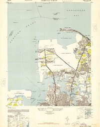
 1907 Norfolk1907 Print · USGSCovers Norfolk, including Virginia Beach, Chesapeake, and other nearby areas
 - 1918 Map of Cape Henry, 1961 Print
 1918 Cape Henry1961 Print · USGSCovers Norfolk, including Broad Creek, Alden Heights, and other nearby areas
 - 1919 Map of Cape Henry
 1919 Cape Henry1919 Print · USGSCovers Norfolk, including Broad Creek, Alden Heights, and other nearby areas7 unique versions available
 - 1921 Map of Newport News
 1921 Newport News1921 Print · USGSCovers Norfolk, including Newport News, Portsmouth, and other nearby areas4 unique versions available
 - 1944 Map of Norfolk South
 1944 Norfolk South1944 Print · USGSCovers Norfolk, including Portsmouth, Avalon, and other nearby areas
 - 1948 Map of Norfolk South
 1948 Norfolk South1948 Print · USGSCovers Norfolk, including Portsmouth, Avalon, and other nearby areas2 unique versions available
 - 1948 Map of Ocean View
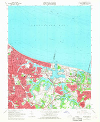
 1948 Ocean View1948 Print · USGSCovers Norfolk, including Alden Heights, Norview, and other nearby areas
 - 1948 Map of Norfolk North
 1948 Norfolk North1948 Print · USGSCovers Norfolk, including Merrimack Park, Green Hill Farms, and other nearby areas2 unique versions available
 - 1948 Map of Kempsville
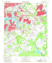
 1948 Kempsville1948 Print · USGSCovers Norfolk, including Broad Creek, Kempsville Colony, and other nearby areas
 - 1953 Map of Norfolk, 1954 Print
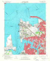
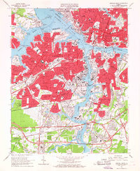
 1953 Norfolk1954 Print · USGSCovers Norfolk, including Chesapeake, Newport News, and other nearby areas4 unique versions available
 - 1954 Map of Ocean View, 1958 Print
 1954 Ocean View1958 Print · USGSCovers Norfolk, including Alden Heights, Norview, and other nearby areas
 - 1955 Map of Kempsville, 1958 Print
 1955 Kempsville1958 Print · USGSCovers Norfolk, including Broad Creek, Kempsville Colony, and other nearby areas
 - 1955 Map of Norfolk North, 1958 Print
 1955 Norfolk North1958 Print · USGSCovers Norfolk, including Merrimack Park, Green Hill Farms, and other nearby areas
 - 1955 Map of Norfolk South, 1958 Print
 1955 Norfolk South1958 Print · USGSCovers Norfolk, including Portsmouth, Avalon, and other nearby areas
 - 1964 Map of Little Creek, 1968 Print
 1964 Little Creek1968 Print · USGSCovers Norfolk, including Alden Heights, Norview, and other nearby areas5 unique versions available
 - 1965 Map of Norfolk North, 1968 Print
 1965 Norfolk North1968 Print · USGSCovers Norfolk, including Merrimack Park, Green Hill Farms, and other nearby areas6 unique versions available
 - 1965 Map of Kempsville, 1968 Print
 1965 Kempsville1968 Print · USGSCovers Norfolk, including Broad Creek, Kempsville Colony, and other nearby areas6 unique versions available
 - 1965 Map of Norfolk South, 1968 Print
 1965 Norfolk South1968 Print · USGSCovers Norfolk, including Portsmouth, Avalon, and other nearby areas6 unique versions available
 - 1985 Map of Norfolk, 1986 Print
 1985 Norfolk1986 Print · USGSCovers Norfolk, including Chesapeake, Newport News, and other nearby areas3 unique versions available
 - 1994 Map of Norfolk South, 2000 Print
 1994 Norfolk South2000 Print · USGSCovers Norfolk, including Portsmouth, Avalon, and other nearby areas
 - 1994 Map of Kempsville, 2000 Print
 1994 Kempsville2000 Print · USGSCovers Norfolk, including Broad Creek, Kempsville Colony, and other nearby areas
End of results
Showing maps 1-21 of 21
Top cities of Norfolk
Frequently asked questions
- What are the different types of historical maps available for Norfolk?
- What is the oldest map of Norfolk?
- Where can I purchase historical maps of Norfolk for my home or office?
- Where can I download high-res historical maps of Norfolk?
- Are there historical topographic maps available for Norfolk?
- Is there historical aerial imagery available for Norfolk?
- Where are historical maps of Norfolk sourced from?