Old Maps of The Meadows, Northampton County for Academic Research
Study the evolution of The Meadows with 14 high-resolution historic maps. Whether you're teaching, researching, or modeling changes in land use, these maps provide essential visual documentation of urban, environmental, and geographic change.
- Analyze long-term change: Track patterns in development, transportation, and natural features.
- Ideal for environmental or urban studies: Support academic projects with primary historical map data.
- Use in the classroom or lab: Educators and researchers rely on these maps to bring historical context to life.
These maps are a powerful tool for teaching, research, and visualizing how The Meadows has changed over the decades.
The Meadows, Northampton County maps
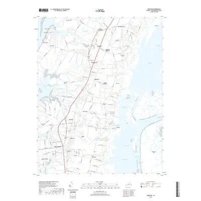
(14)- 1942 Map of Cheriton
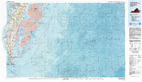
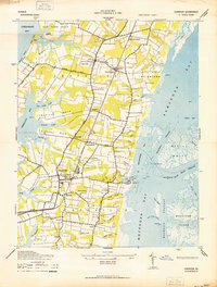 1942 Cheriton1942 Print · USGSThe Virginia Eastern Shore comes alive in this wartime-era survey of Northampton County, showing the region's transition from maritime hub to rail-connected agricultural center. Genealogists and historians can trace family roots through settlements like Cheriton, Pat Town, and Stumptown or explore the coastal inlets near Oyster.
 - 1946 Map of Eastville, 1971 Print
 1946 Eastville1971 Print · USGSCoastal Virginia and the Outer Banks are captured here during a period of expanding naval and aerospace presence. Researchers can trace the path of the Penn Central railroad through Chincoteague and Modest Town, or locate landmarks like the Wright Brothers National Memorial.
 - 1955 Map of Cheriton, 1956 Print
 1955 Cheriton1956 Print · USGSThe Virginia Eastern Shore is captured here in the mid-1950s, showing the agricultural 'necks' and maritime settlements between the bay and the Atlantic. Researchers can locate family landmarks like James Crossroads and Stumptown, or trace rail history at Cape Junction.
 - 1961 Map of Eastville
 1961 Eastville1961 Print · USGSThe Eastern Shore and Outer Banks are captured here in the mid-twentieth century, showing a maritime landscape of lighthouses, rail-linked towns, and naval outposts. Researchers can trace the Pennsylvania Railroad through Parksley or locate historical sites like Chincoteague Field Naval Auxiliary Air Station and Tangier Island.
 - 1966 Map of Eastville
 1966 Eastville1966 Print · USGSThe Delmarva Peninsula and Outer Banks appear in the mid-sixties, showing a landscape of maritime trade, military outposts, and fishing villages. Researchers can trace the lines of the Norfolk & Southern through Exmore and Parksley or locate historical sites like Fort John Custis and the Janes Island Lighthouse.
 - 1968 Map of Cheriton, 1971 Print
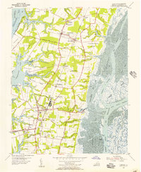
 1968 Cheriton1971 Print · USGSNorthampton County's eastern shore is documented here during the late sixties, showcasing the intersection of traditional neck-land farming and the maritime culture of the Chesapeake. Genealogists and historians can trace family locations near Eastville Station, Oyster, and the Bethlehem Temple Mission.3 unique versions available
 - 1977 Map of Cheriton, 1982 Print
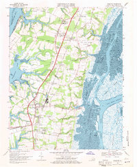
 1977 Cheriton1982 Print · USGSThe Eastern Shore of Virginia comes into focus in the late seventies, showing the traditional agricultural and maritime patterns of the peninsula. Researchers can trace land use around Eastville and locate coastal hamlets like Oyster and Old Plantation.
 - 1981 Map of Cheriton
 1981 Cheriton1981 Print · USGSThe Virginia Eastern Shore in the early eighties is mapped here at the junction of the bay and ocean. Researchers can trace the coastal heritage of the peninsula through landmarks like the Cape Charles Light and settlements such as Oyster, Townsend, and Eastville.
 - 1984 Map of Chincoteague
 1984 Chincoteague1984 Print · USGSThe Virginia Eastern Shore and Delmarva Peninsula are captured here in the mid-1980s, showcasing a landscape of barrier islands and tidewater towns. Researchers can trace the Penn Central rail line through Accomac or locate the Wallops Flight Facility (NASA) and Chincoteague Nat Wildlife Refuge.2 unique versions available
 - 2011 Map of Cheriton, 2011 Print
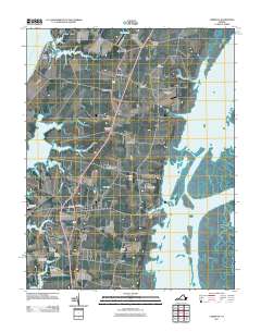 2011 Cheriton2011 Print · USGSCovers The Meadows, including Cape Charles, Cheriton, and other nearby areas
 - 2013 Map of Cheriton, 2013 Print
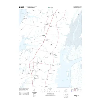 2013 Cheriton2013 Print · USGSCovers The Meadows, including Cape Charles, Cheriton, and other nearby areas
 - 2016 Map of Cheriton, 2016 Print
 2016 Cheriton2016 Print · USGSCovers The Meadows, including Cape Charles, Cheriton, and other nearby areas
 - 2019 Map of Cheriton, 2019 Print
 2019 Cheriton2019 Print · USGSCovers The Meadows, including Cape Charles, Cheriton, and other nearby areas
 - 2022 Map of Cheriton, 2022 Print
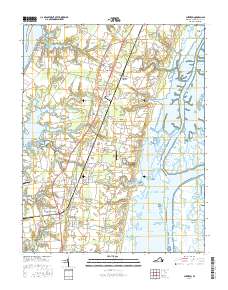
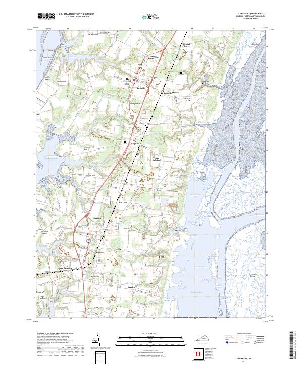 2022 Cheriton2022 Print · USGSThe Virginia Eastern Shore is captured in this modern survey as a patchwork of historic crossroads and intricate coastal marshlands. Genealogists can locate family landmarks like Whitehead Cem and Allen Cem or trace the early settlement footprints of Eastville and Cheriton.
End of results
Showing maps 1-14 of 14
Frequently asked questions
- What are the different types of historical maps available for The Meadows?
- What is the oldest map of The Meadows?
- Where can I purchase historical maps of The Meadows for my home or office?
- Where can I download high-res historical maps of The Meadows?
- Are there historical topographic maps available for The Meadows?
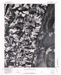
- Is there historical aerial imagery available for The Meadows?
- Where are historical maps of The Meadows sourced from?