1900s (20th Century) Maps of Northumberland County, Virginia
Explore 53 historic maps of Northumberland County from the 1900s (20th Century). These maps offer a rare glimpse into what life looked like during the 1900s — showing old roads, neighborhoods, homes, and landmarks that have changed or disappeared over time.
Whether you're researching your family's past, planning a metal detecting trip, or studying how Northumberland County's landscape evolved across the 1900s, these high-resolution maps are a powerful tool for exploring the history of this region.
- Focus on a specific era: All maps on this page are from the 1900s, giving you a focused view of this time period.
- See what’s changed: Compare century-old streets, trails, and buildings to today's modern landscape using overlays and satellite layers.
- Research with precision: Use these maps for genealogy, historical research, land use analysis, or educational projects.
- View, download, or print: Maps are fully viewable online in high resolution, and can be downloaded or printed for your own records.
Start exploring Northumberland County's history through authentic maps from the 1900s. This is your window into the past.
Northumberland County, VA maps
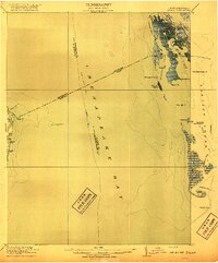
(53)- 1901 Map of Piney Point
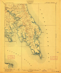
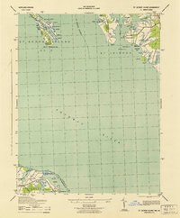
 1901 Piney Point1901 Print · USGSThe Potomac River tidewater at the opening of the twentieth century was a landscape of remote landings and river-bound commerce. Researchers can trace historic ferry crossings at Mount Holly, find the L.H. at Piney Point, or locate old mill sites like Clifton Mills.5 unique versions available
 - 1906 Map of St. Marys
 1906 St. Marys1906 Print · USGSChesapeake Bay and the Potomac River converge in this 1906 survey of the Maryland and Virginia tidewater. Historians can trace the region's maritime heritage through dozens of named landings and islands, from Solomons Id. to the remote reaches of Smith Island.4 unique versions available
 - 1912 Map of Point Lookout
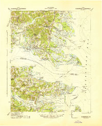
 1912 Point Lookout1912 Print · USGSSouthern St. Mary's County appears here just after the turn of the century, showing a waterfront economy dependent on the river and bay. Genealogists and historians can trace family landings at Broomes Wharf and Miller Wharf or locate old settlements like St Inigoes and Great Mills.2 unique versions available
 - 1916 Map of Kilmarnock
 1916 Kilmarnock1916 Print · USGSBefore the era of modern bridges, this coastal Virginia region relied on a busy steamboat route network connecting the Northern Neck and Middle Peninsula. Genealogists can locate family landmarks like Wharton Grove Camp, White Chapel Church, and numerous landings including Morattico Wharf.2 unique versions available
 - 1917 Map of Heathsville
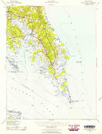
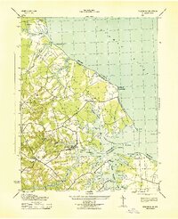
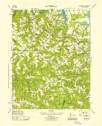
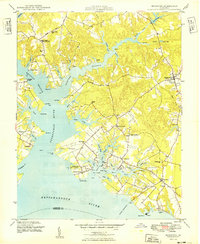
 1917 Heathsville1917 Print · USGSNorthumberland County's peninsulas and maritime crossroads are intricately detailed here during the late 1910s. Local researchers can trace family roots through historic landmarks like Macedonia Church, Coan Hall School, and the busy waters of the Steamboat Route at Reedville.4 unique versions available
 - 1917 Map of Morattico
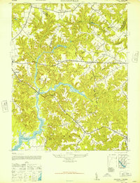
 1917 Morattico1917 Print · USGSThe Northern Neck of Virginia is shown here in the years before the Great War, when the Rappahannock River was a busy Steamboat Route. Genealogists can locate family landmarks like Gordys Millpond, Lively, and the Marvin Grove Camp in this detailed look at early rural life.
 - 1917 Map of Kilmarnock
 1917 Kilmarnock1917 Print · USGSThe Northern Neck and Middle Peninsula of Virginia are shown during the height of the steamboat era. Genealogists can locate family-named landmarks and essential community hubs like the Old Brick Church, Harmony Village, and Kilmarnock Wharf.4 unique versions available
 - 1917 Map of Ewell
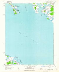
 1917 Ewell1917 Print · USGSIsolated island life in the Chesapeake comes into focus during the early twentieth century. Researchers can trace the original footprints of Ewell, Rhodes Point, and Tangier, alongside maritime landmarks like the Smith Point LH and old Steamboat Routes.2 unique versions available
 - 1918 Map of Morattico
 1918 Morattico1918 Print · USGSThe Northern Neck region relied heavily on the Rappahannock waterfront during the early twentieth century, when steamboats were still the primary connection to the outside world. Researchers can trace ancestral home sites and community centers from Lodge and Nuttsville to historic landmarks like Gibeon Church and Downings Mill.3 unique versions available
 - 1926 Map of Morattico, 1943 Print
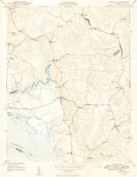
 1926 Morattico1943 Print · USGSThe Rappahannock River and Northern Neck are captured in the mid-1920s, showing a landscape defined by tidewater commerce and rural tradition. Genealogists can trace family roots through numerous churches and schools like Totuskey Church, Folly School, and Sharps.
 - 1937 Map of Point Lookout, 1958 Print
 1937 Point Lookout1958 Print · USGSThe tip of St. Mary's County appears here in the late thirties, where the Potomac meets the Chesapeake. Genealogists can trace family footprints through historic landings like Broomes Wharf and settlements such as St Inigoes and Drayden.2 unique versions available
 - 1942 Map of Kilmarnock
 1942 Kilmarnock1942 Print · USGSThe Virginia Tidewater in the early 1940s was a world of steamboat routes and bustling river landings. Trace the maritime history of the Northern Neck through Whitestone Wharf, the Shipleys Ferry crossing, and the grounds of Christ Church.
 - 1942 Map of St. George Island, 1961 Print
 1942 St. George Island1961 Print · USGSThe lower Potomac tidewater comes alive in this mid-century survey of the Maryland and Virginia borderlands. Researchers can trace early coastal settlements like St George Island Beach and Lewisetta alongside maritime landmarks at Kitts Point.
 - 1943 Map of St. George Island
 1943 St. George Island1943 Print · USGSThe Potomac River confluence and the maritime borders of Maryland and Virginia appear here during the mid-forties. Genealogists and historians can trace shoreline landings and navigational aids from St George Island and Wynne to the Virginia settlement of Lewisetta.
 - 1943 Map of Yeocomico
 1943 Yeocomico1943 Print · USGSThe Northern Neck of Virginia meets the Potomac in the 1940s, revealing a landscape of tidewater farms and river landings. Genealogists can locate family names and rural hubs like Kinsale, Zion Church, and the Fauntleroy Farm.2 unique versions available
 - 1943 Map of Richmond, 1972 Print
 1943 Richmond1972 Print · USGSCoastal Virginia and the state capital are shown in detail during the mid-century era of infrastructure expansion. Genealogists and historians can trace the grounds of Richmond Nat Battlefield Park, locate the Yorktown Nat Cem, or follow the many rural routes through Amelia Court House and Tappahannock.
 - 1944 Map of Sunnybank
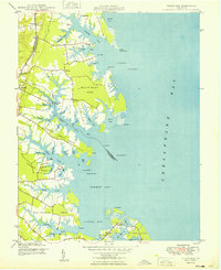
 1944 Sunnybank1944 Print · USGSCoastal Northumberland County comes alive in this mid-century record of the Northern Neck during the Second World War. Genealogists and historians can trace family roots at Fairfields Ch Cem or locate vanished landmarks like Grays School and the Smith Point Light.
 - 1944 Map of Reedville
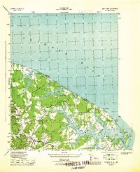
 1944 Reedville1944 Print · USGSNorthumberland County's maritime heritage is on full display during the 1940s, showing the intricate docks and settlements of the Northern Neck. Genealogists can trace family landmarks like the Julius Rosenwald Sch, Delanos Store, and Bethany Ch.2 unique versions available
 - 1944 Map of Lottsburg
 1944 Lottsburg1944 Print · USGSNorthumberland County in the mid-1940s was a network of tidal creeks and small crossroads settlements. Genealogists can trace family landmarks and rural infrastructure through Gordys Mill, Zion Church, and the E Branch Chapel School.2 unique versions available
 - 1944 Map of Heathsville
 1944 Heathsville1944 Print · USGSNorthumberland County during the mid-1940s reveals a landscape of tidal necks and rural crossroads settlements. Genealogists and local historians can trace family-named landmarks like Williams Corner, find old country parishes such as St Stephens Ch, and locate historic industrial sites like Crabbe Mill.
 - 1947 Map of Haynesville
 1947 Haynesville1947 Print · USGSThe Northern Neck of Virginia in the late 1940s remained a landscape of tidal creeks and quiet crossroads. Genealogists and local historians can trace family roots through numerous country landmarks like Lyells Chapel, Moores Mill, and the Mulberry Ch and Sch.
 - 1948 Map of Washington
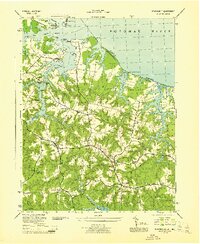
 1948 Washington1948 Print · USGSThe Potomac and Chesapeake regions in the late 1940s reveal a landscape of expanding military reach and deep-rooted Tidewater settlements. Trace old rail corridors like the Richmond Fredericksburg & Potomac RR or locate landmarks like the Wakefield Washington Monument and St. Marys College.2 unique versions available
 - 1948 Map of Litwalton
 1948 Litwalton1948 Print · USGSCoastal Lancaster and Richmond counties appear in the late 1940s as a region of tidal creeks and quiet crossroads. Researchers can trace rural life through landmarks like Lively Sch, the waters at Chinns Pond, and Griffins Landing on the river.2 unique versions available
 - 1949 Map of Irvington
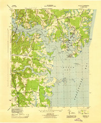
 1949 Irvington1949 Print · USGSCoastal Lancaster County was a thriving network of maritime landings and crossroads villages in the years following World War II. Researchers can trace family sites from Kilmarnock down to Whitestone, locating landmarks like Christ Church, Dunton Mill, and the Wharton Grove Camp.2 unique versions available
 - 1949 Map of Fleets Bay
 1949 Fleets Bay1949 Print · USGSCoastal Lancaster County at the edge of the Chesapeake Bay reveals a world of tidal creeks and maritime settlements in the late 1940s. Genealogists and historians can trace the landings and community centers of Kilmarnock Wharf, Fleets Island, and Foxwells.2 unique versions available
Showing maps 1-25 of 53
Top cities of Northumberland County
Frequently asked questions
- What are the different types of historical maps available for Northumberland County?
- What is the oldest map of Northumberland County?
- Where can I purchase historical maps of Northumberland County for my home or office?
- Where can I download high-res historical maps of Northumberland County?
- Are there historical topographic maps available for Northumberland County?
- Is there historical aerial imagery available for Northumberland County?
- Where are historical maps of Northumberland County sourced from?