Old Maps of Blackstone, Virginia
Explore 27 old maps of Blackstone, spanning from 1891 to today. These high-resolution historic maps reveal how streets, neighborhoods, landmarks, and natural features evolved over time — perfect for genealogy, metal detecting, research, and local history exploration.
What you can do with these maps:
- See how Blackstone changed over time: Compare historical maps to modern-day views to trace roads, homesites, rail lines & more.
- View detailed metadata: Each map includes creators, publishers, year, scale, and archive source.
- Overlay maps with satellite & LiDAR: Visualize the past alongside modern tools to explore terrain & human change.
- Trusted historical sources: Maps sourced from the USGS, Library of Congress, and other archives.
- Access maps your way: View online, download high-res files, or order prints for personal or research use.
Start exploring old maps of Blackstone to uncover forgotten places, hidden landmarks, and the deep history beneath your feet.
Blackstone, VA maps
(27)- 1891 Map of Farmville
 1891 Farmville1891 Print · USGSSouth-central Virginia's rail and river networks come alive in the 1890s, centered on the bustling hub of Farmville. Genealogists can trace family roots through old courthouse seats like Cumberland C.H. and vanished stops like Jennings Ordinary or Rice Depot.
 - 1893 Map of Farmville
 1893 Farmville1893 Print · USGSThe Virginia Piedmont at the end of the nineteenth century centers on the rail junction at Farmville and the winding Appomattox River. Genealogists can trace family lands near Hampden Sidney, Guinea Mills, and the old tavern site at Joppings Ordinary.8 unique versions available
 - 1897 Map of Amelia
 1897 Amelia1897 Print · USGSThe rural interior of central Virginia comes into focus in the late nineteenth century, as the Appomattox River corridor transitions from a river-based economy to a rail-centered one. Researchers can trace ancestral property lines near Giles Mill, locate the rail hub at Mosley Junction, or find old river crossings like Goode Bridge.5 unique versions available
 - 1943 Map of Richmond, 1972 Print
 1943 Richmond1972 Print · USGSCoastal Virginia and the state capital are shown in detail during the mid-century era of infrastructure expansion. Genealogists and historians can trace the grounds of Richmond Nat Battlefield Park, locate the Yorktown Nat Cem, or follow the many rural routes through Amelia Court House and Tappahannock.
 - 1947 Map of Roanoke, 1948 Print
 1947 Roanoke1948 Print · USGSCentral Virginia in the late 1940s reveals a region defined by its great mountain ridges and the powerful river-and-rail economy connecting Roanoke to Lynchburg. Researchers can trace the path of the Virginian RR and locate historic county seats like Charlotte Court House.2 unique versions available
 - 1949 Map of Richmond, 1951 Print
 1949 Richmond1951 Print · USGSCoastal Virginia in the years following World War II remained a landscape of historic river towns and expanding military bases. Genealogists and historians can trace the rail lines of the Southern Ry and locate established landmarks from Camp Lee to the remote reaches of Dragon Swamp.
 - 1958 Map of Crewe, 1959 Print
 1958 Crewe1959 Print · USGSNottoway County thrived as a railroad crossroads in the late fifties, centered on the busy rail hubs of Crewe and Burkeville. Researchers can trace old family sites and rural landmarks like the Piedmont Sanatorium, Jennings Ordinary, and Wards Chapel.2 unique versions available
 - 1959 Map of Roanoke
 1959 Roanoke1959 Print · USGSCentral Virginia and the Blue Ridge appear in great detail during the late fifties, showcasing the transition from mountain industry to Piedmont farmland. Trace the path of the Norfolk and Western railroad or find old river towns like Appomattox and Amelia Court House.
 - 1959 Map of Richmond
 1959 Richmond1959 Print · USGSMid-century Virginia is captured here at its most vital rail and river junctions, from the capital city to the Chesapeake Bay. Genealogists and historians can trace the development of colonial settlements like Williamsburg and military landmarks including Fort Monroe and Camp Lee.
 - 1963 Map of Roanoke
 1963 Roanoke1963 Print · USGSCentral Virginia and the Blue Ridge front appear here in the early sixties, caught between their deep railroad roots and new postwar developments. Genealogists and historians can trace the rail lines of the Norfolk and Western through towns like Bedford and Altavista, or locate family landmarks near Smith Mountain Lake.
 - 1964 Map of Richmond
 1964 Richmond1964 Print · USGSCoastal and central Virginia are mapped during the mid-twentieth century, showing the critical intersection of rail, river, and military life. Genealogists can trace family roots through rural county seats like Amelia or find vanished coastal neighborhoods near Phoebus and Hilton Village.
 - 1966 Map of Blackstone East, 1967 Print
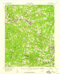
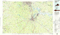
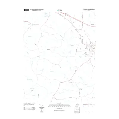
 1966 Blackstone East1967 Print · USGSNottoway County during the mid-sixties is captured here, showing the expansion of military training facilities alongside traditional rural life. Genealogists and historians can trace the foundations of Blackstone Army Air Base and locate local landmarks like Spring Hill Ch and the Nottoway Reservoir.5 unique versions available
 - 1968 Map of Blackstone West, 1972 Print
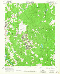
 1968 Blackstone West1972 Print · USGSBlackstone and the Southside Virginia countryside appear here in the late sixties, a period of transition for the rail-and-river landscape. Genealogists and historians can trace old community landmarks like Vaster High Sch, Lakeview Cemetery, and the Norfolk and Western rail line.3 unique versions available
 - 1971 Map of Roanoke, 1977 Print
 1971 Roanoke1977 Print · USGSThe Virginia Piedmont and Blue Ridge mountains meet in this early 1970s landscape of river valleys and rail hubs. Researchers can trace historic transportation routes and landmarks like the Appomattox Court House Nat Hist Pk, the Peaks of Otter, and Amelia Court House.2 unique versions available
 - 1973 Map of Richmond, 1974 Print
 1973 Richmond1974 Print · USGSThe Virginia Tidewater and Piedmont come alive in the early seventies, showcasing a region defined by its great rivers and massive military installations. Researchers can trace the mid-century growth of Richmond or locate family sites near Amelia Court House and Highland Springs.2 unique versions available
 - 1979 Map of Appomattox, 1982 Print
 1979 Appomattox1982 Print · USGSSouthside Virginia in the late seventies remains a landscape of historic rail towns and vast state forests. Genealogists and historians can trace the routes of the Norfolk and Western through Farmville or locate ancestral sites near Hampden Sydney and Charlotte Court House.
 - 1984 Map of Petersburg, 1985 Print
 1984 Petersburg1985 Print · USGSCentral Virginia in the mid-eighties shows a complex landscape of growing suburban centers and significant military installations. Researchers can trace historic boundaries and civic sites from Amelia Court House to the Glendale Nat Cem and Virginia State College.2 unique versions available
 - 2010 Map of Blackstone West, 2010 Print
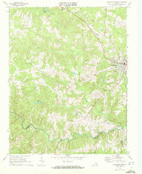
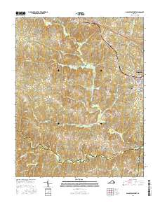
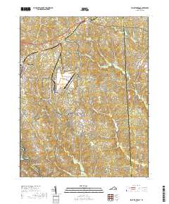
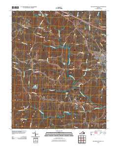 2010 Blackstone West2010 Print · USGSCovers Blackstone, including Cross Bridge, Sneads Spring, and other nearby areas
 - 2010 Map of Blackstone East, 2010 Print
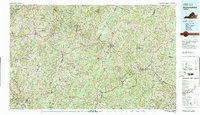
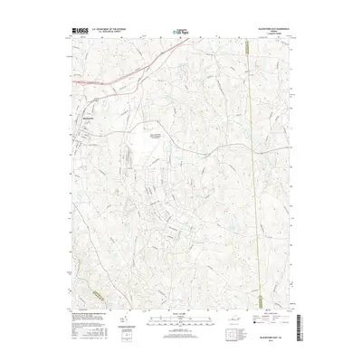
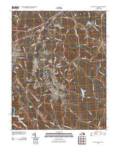 2010 Blackstone East2010 Print · USGSCovers Blackstone, including Dinwiddie County, Brunswick County, and other nearby areas
 - 2013 Map of Blackstone East, 2013 Print
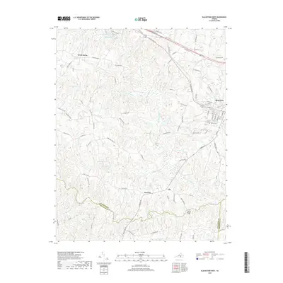
 2013 Blackstone East2013 Print · USGSCovers Blackstone, including Dinwiddie County, Brunswick County, and other nearby areas
 - 2013 Map of Blackstone West, 2013 Print
 2013 Blackstone West2013 Print · USGSCovers Blackstone, including Cross Bridge, Sneads Spring, and other nearby areas
 - 2016 Map of Blackstone West, 2016 Print
 2016 Blackstone West2016 Print · USGSCovers Blackstone, including Cross Bridge, Sneads Spring, and other nearby areas
 - 2016 Map of Blackstone East, 2016 Print
 2016 Blackstone East2016 Print · USGSCovers Blackstone, including Dinwiddie County, Brunswick County, and other nearby areas
 - 2019 Map of Blackstone West, 2019 Print
 2019 Blackstone West2019 Print · USGSCovers Blackstone, including Cross Bridge, Sneads Spring, and other nearby areas
 - 2019 Map of Blackstone East, 2019 Print
 2019 Blackstone East2019 Print · USGSCovers Blackstone, including Dinwiddie County, Brunswick County, and other nearby areas
Showing maps 1-25 of 27
Top cities near Blackstone
- Crewe historical maps
- Victoria historical maps
- Kenbridge historical maps
- Burkeville historical maps
- Alberta historical maps
- Nottoway historical maps
Frequently asked questions
- What are the different types of historical maps available for Blackstone?
- What is the oldest map of Blackstone?
- Where can I purchase historical maps of Blackstone for my home or office?
- Where can I download high-res historical maps of Blackstone?
- Are there historical topographic maps available for Blackstone?
- Is there historical aerial imagery available for Blackstone?
- Where are historical maps of Blackstone sourced from?