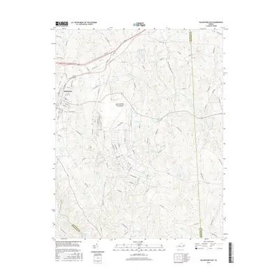
2016 Map of Blackstone East
USGS Topo · Published 2016About this map
Blackstone occupies the western edge of this territory, where the urban street grid meets the expansive grounds of the Allen C Perkinson Airport/Blackstone Army Airfield. This military and aviation hub dominates the central landscape, surrounded by a complex network of rural routes like Wellville Rd and Butterwood Rd. The topography is defined by the numerous water bodies and drainage systems that feed the region, including Butterwood Lake, Birchin Lake, and the larger Nottoway Reservoir to the south. The Norfolk Southern railroad cuts through the northwestern corner, continuing its legacy of transit through Nottoway County. Local landmarks such as Rocky Bump Rd and the family-named Pridgen Ln suggest a landscape where long-standing homesteads and modern infrastructure coexist alongside the creek beds of Birchin Creek and Tommeheton Cr.
Find a feature on this map
97 named features on this map. Tap any name to fly to it.
Don’t see what you’re looking for? This feature index may not catch every label — zoom into the map to look around manually.
Map Details
Editions of this 2016 Blackstone East Map
This is the sole edition of this map. No revisions or reprints were ever made.
Other maps of this area

1891 · Farmville
USGS Topo · 1:125,000

1893 · Farmville
USGS Topo · 1:125,000

1897 · Amelia
USGS Topo · 1:125,000

1918 · Lawrenceville
USGS Topo · 1:62,500

1920 · Lawrenceville
USGS Topo · 1:48,000

1921 · Lawrenceville
USGS Topo · 1:62,500

1942 · Lawrenceville
USGS Topo · 1:62,500

1943 · Richmond
USGS Topo · 1:250,000

1947 · Roanoke
USGS Topo · 1:250,000

1949 · Richmond
USGS Topo · 1:250,000