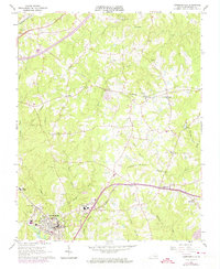
1918 Map of Lawrenceville
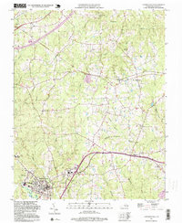
USGS Topo · Published 1963About this map
Lawrenceville serves as the focal point of this Southside Virginia landscape at the end of the Great War, where the Southern railroad meets a network of country roads like the Boydton and Petersburg Road. The region is defined by its deep agricultural and social infrastructure, evidenced by the numerous community hubs such as Sunnyside High School, Abernathy School, and the County Poor Farm. Industrial activity is localized along the watercourses, with Price Mill on Tatlo Br and Wheeler Mill on Waqua Creek marking the importance of small-scale milling to the local economy.
Find a feature on this map
93 named features on this map. Tap any name to fly to it.
Don’t see what you’re looking for? This feature index may not catch every label — zoom into the map to look around manually.
Map Details
Editions of this 1918 Lawrenceville Map
This is the sole edition of this map. No revisions or reprints were ever made.
Historical Maps of Lawrenceville Through Time
7 maps found