
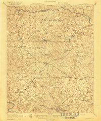
1921 Map of Lawrenceville
USGS Topo · Published 1921About this map
Lawrenceville serves as the focal point of this Southside Virginia landscape, situated at the southern end of a complex transportation network. Three major rail lines, the Seaboard Air Line, Southern Railway, and Virginian Railway, converge across the Brunswick County countryside, linking small agrarian settlements like Alberta and Cochran. The rural character of the early twentieth century is evident in the dense distribution of family-named landmarks and local institutions, including the County Poor Farm and numerous mills such as Harpers Mill and Wheeler Mill. Social life is anchored by schools and houses of worship like Abernathy School, Wilson Chapel School, and Little Mount Church. The terrain is defined by the winding Nottoway River to the north and the Meherrin River to the south, with numerous smaller watercourses like Sturgeon Creek and Waqua Creek cutting through the uplands.
Find a feature on this map
93 named features on this map. Tap any name to fly to it.
Don’t see what you’re looking for? This feature index may not catch every label — zoom into the map to look around manually.
Map Details
Editions of this 1921 Lawrenceville Map
2 editions found
Other maps of this area

1891 · Farmville
USGS Topo · 1:125,000

1893 · Farmville
USGS Topo · 1:125,000

1897 · Amelia
USGS Topo · 1:125,000

1918 · Lawrenceville
USGS Topo · 1:62,500

1919 · Mc Kenney
USGS Topo · 1:48,000

1919 · White Plains
USGS Topo · 1:48,000

1919 · Emporia
USGS Topo · 1:62,500

1920 · Lawrenceville
USGS Topo · 1:48,000

1920 · White Plains
USGS Topo · 1:62,500

1921 · Mc Kenney
USGS Topo · 1:62,500