Old Maps of Stanley, Virginia
Explore 25 old maps of Stanley, spanning from 1892 to today. These high-resolution historic maps reveal how streets, neighborhoods, landmarks, and natural features evolved over time — perfect for genealogy, metal detecting, research, and local history exploration.
What you can do with these maps:
- See how Stanley changed over time: Compare historical maps to modern-day views to trace roads, homesites, rail lines & more.
- View detailed metadata: Each map includes creators, publishers, year, scale, and archive source.
- Overlay maps with satellite & LiDAR: Visualize the past alongside modern tools to explore terrain & human change.
- Trusted historical sources: Maps sourced from the USGS, Library of Congress, and other archives.
- Access maps your way: View online, download high-res files, or order prints for personal or research use.
Start exploring old maps of Stanley to uncover forgotten places, hidden landmarks, and the deep history beneath your feet.
Stanley, VA maps
(25)- 1892 Map of Woodstock, 1898 Print
 1892 Woodstock1898 Print · USGSThe Shenandoah Valley in the 1890s is captured here as a landscape of river-driven towns and mountain iron furnaces. Researchers can trace family roots in Woodstock or Edinburg and locate historic industrial sites like Liberty Furnace and Columbia Furnace.5 unique versions available
 - 1893 Map of Luray, 1898 Print
 1893 Luray1898 Print · USGSThe Shenandoah Valley in the 1890s was a land of steep mountain ridges and vital new railways. Genealogists and historians can trace old homesteads and depots along the Shenandoah Valley Railroad or find remote hamlets like Seven Fountains and Browntown.
 - 1905 Map of Luray, 1910 Print
 1905 Luray1910 Print · USGSThe Blue Ridge and Shenandoah Valley are frozen in time just after the turn of the century, showing the critical rail networks and mountain gaps of the period. Genealogists can trace family names and settlements like Luray, Front Royal, and Strasburg along the Shenandoah Valley Railroad.4 unique versions available
 - 1929 Map of Stony Man
 1929 Stony Man1929 Print · USGSBlue Ridge mountain life and the early development of Shenandoah National Park are captured here just as the park boundary was being established. Genealogists and hikers can trace old mountain routes to the President Hoover Community Sch, locate St Luke Episcopal Mission, or find early trail markers at Sexton Shelter.2 unique versions available
 - 1933 Map of Stony Man
 1933 Stony Man1933 Print · USGSThe Blue Ridge highlands and Page Valley are captured here during the early years of the national park era. Genealogists and historians can trace family locations through mountain hollows and riverside crossings like Stricklers Ferry, St George Mission, and Baileys Store.3 unique versions available
 - 1942 Map of Mt Jackson, 1959 Print
 1942 Mt Jackson1959 Print · USGSThe Shenandoah Valley during the early forties reveals a landscape defined by the towering Massanutten Mountain and the winding river forks. Researchers can trace historic industrial sites like Catherine Furnace, old schools such as Soliloquy Sch, and the grounds of Shenandoah Academy.2 unique versions available
 - 1946 Map of Mt Jackson
 1946 Mt Jackson1946 Print · USGSThe Shenandoah Valley during the mid-1940s reveals a landscape defined by the parallel forks of its famous river and the rising wall of Massanutten Mountain. Genealogists can trace family lines through sites like Riedlers Sch, Catherine Furnace, and Long Cem.2 unique versions available
 - 1947 Map of Mt Jackson
 1947 Mt Jackson1947 Print · USGSThe Shenandoah Valley during the 1940s is captured here, showing the dramatic ridges between the river forks. Genealogists and historians can trace community roots through sites like Woods Chapel, Plains Mill, and Shenandoah Academy near New Market.2 unique versions available
 - 1949 Map of Charlottesville
 1949 Charlottesville1949 Print · USGSThe Shenandoah Valley and Blue Ridge appear in the late 1940s as a thriving corridor of rail and river commerce. Researchers can trace the mid-century footprints of Harrisonburg, Staunton, and Culpeper alongside the historic routes of the Southern Railway.2 unique versions available
 - 1956 Map of Charlottesville, 1966 Print
 1956 Charlottesville1966 Print · USGSThe Shenandoah Valley and Blue Ridge are captured in detail during the mid-1960s as the modern interstate system began to emerge. Genealogists and historians can trace rail-connected hubs like Waynesboro or follow the river paths of the Rapidan River and Rivanna River.4 unique versions available
 - 1965 Map of Big Meadows, 1966 Print
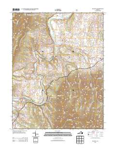
 1965 Big Meadows1966 Print · USGSThe high ridges of Page County meet the valley floor during the mid-1960s, showing the early infrastructure of the National Park. Genealogists and hikers can trace the original routes of the Appalachian Trail and find family landmarks like Trinity Ch, Bethlehem Ch, and Tanners Ridge.4 unique versions available
 - 1967 Map of Stanley, 1969 Print
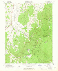
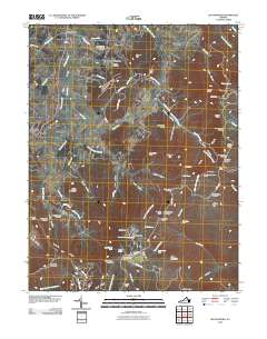
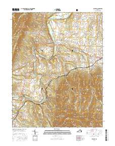
 1967 Stanley1969 Print · USGSPage County is documented in the late sixties as the river-and-rail economy of the Page Valley thrived. Genealogists and local historians can trace family locations near Alma, St Lukes Ch, and the old Grove Hill Landing on the river.2 unique versions available
 - 1986 Map of Front Royal
 1986 Front Royal1986 Print · USGSThe northern Shenandoah Valley and the Blue Ridge crest are captured here in the mid-eighties as modern highways began to bypass historic valley towns. Researchers can trace ancestral connections near Peola Mills, navigate the gaps like Manassas Gap, or study the river bends around Luray.3 unique versions available
 - 1994 Map of Big Meadows, 1997 Print
 1994 Big Meadows1997 Print · USGSThe high peaks and hollows of the Blue Ridge define this mid-1990s view of the Shenandoah wilderness and the adjacent Page County lowlands. Researchers can trace historic mountain sites like Skyland, Big Meadows, and the Appalachian Trail alongside valley landmarks such as Longs Store and Hawksbill Ch.
 - 1997 Map of Stanley, 2000 Print
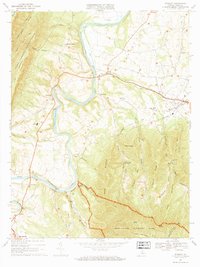
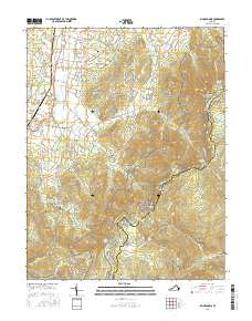
 1997 Stanley2000 Print · USGSThe South Fork Shenandoah River valley in the late nineties shows a landscape defined by riverside settlements and mountain ridges. Genealogists can trace family landmarks like Longs Cem or locate rural congregations at St Pauls Ch and Leake Chapel.
 - 2010 Map of Big Meadows, 2010 Print
 2010 Big Meadows2010 Print · USGSCovers Stanley, including Skyland, Blaineville, and other nearby areas
 - 2011 Map of Stanley, 2011 Print
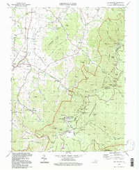
 2011 Stanley2011 Print · USGSCovers Stanley, including Shenandoah, Ingham, and other nearby areas
 - 2013 Map of Big Meadows, 2013 Print
 2013 Big Meadows2013 Print · USGSCovers Stanley, including Skyland, Blaineville, and other nearby areas
 - 2013 Map of Stanley, 2013 Print
 2013 Stanley2013 Print · USGSCovers Stanley, including Shenandoah, Ingham, and other nearby areas
 - 2016 Map of Stanley, 2016 Print
 2016 Stanley2016 Print · USGSCovers Stanley, including Shenandoah, Ingham, and other nearby areas
 - 2016 Map of Big Meadows, 2016 Print
 2016 Big Meadows2016 Print · USGSCovers Stanley, including Skyland, Blaineville, and other nearby areas
 - 2019 Map of Big Meadows, 2019 Print
 2019 Big Meadows2019 Print · USGSCovers Stanley, including Skyland, Blaineville, and other nearby areas
 - 2019 Map of Stanley, 2019 Print
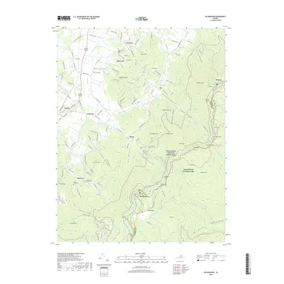
 2019 Stanley2019 Print · USGSCovers Stanley, including Shenandoah, Ingham, and other nearby areas
 - 2022 Map of Stanley, 2022 Print
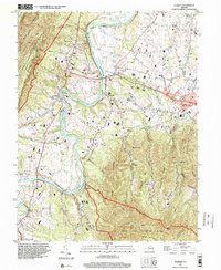
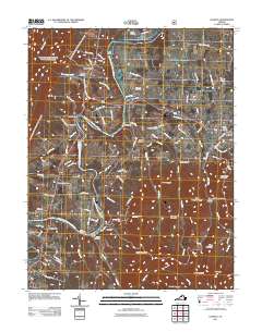
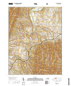
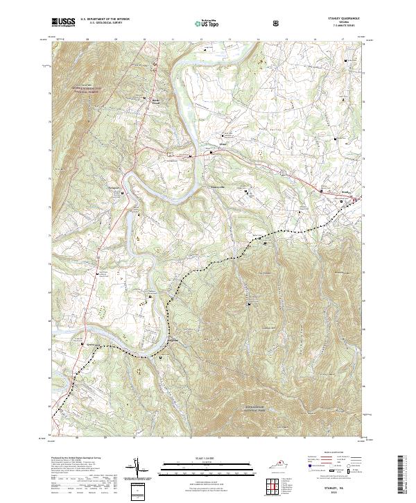 2022 Stanley2022 Print · USGSThe Page Valley comes into sharp focus in the 2020s, showing the rural communities along the South Fork Shenandoah River. Researchers can trace local lineage through dozens of named sites like Spitler Cem, Alma, and the Saint Luke Lutheran Church Cem.
 - 2022 Map of Big Meadows, 2022 Print
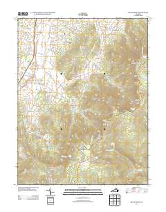
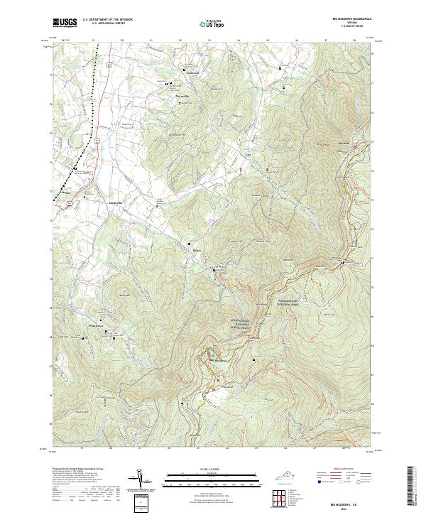 2022 Big Meadows2022 Print · USGSPage County is seen here during a modern era of conservation and mountain recreation, where the high ridges meet the valley floor. Genealogists and hikers can trace family sites like the Somers Family Cem or explore trails near Fishers Gap and Skyland.
End of results
Showing maps 1-25 of 25
Top cities near Stanley
- Luray historical maps
- Elkton historical maps
- Shenandoah historical maps
- New Market historical maps
- Mount Jackson historical maps
- McGaheysville historical maps
See more
Frequently asked questions
- What are the different types of historical maps available for Stanley?
- What is the oldest map of Stanley?
- Where can I purchase historical maps of Stanley for my home or office?
- Where can I download high-res historical maps of Stanley?
- Are there historical topographic maps available for Stanley?
- Is there historical aerial imagery available for Stanley?
- Where are historical maps of Stanley sourced from?