Old Maps of Petersburg, Virginia for Hiking & Exploration
Hike through history with 28 historic maps of Petersburg. Explore old trails, ghost towns, and forgotten backroads — perfect for outdoor adventurers and local explorers.
- Rediscover forgotten places: Map out old mining camps, roads, and footpaths that no longer exist on modern maps.
- Layer with modern tools: Combine with LiDAR or satellite views to plan hikes through historical terrain.
- Made for exploration: Popular among hikers, overlanders, and local history lovers.
Use these maps to find adventure and explore the hidden past of Petersburg.
Petersburg, VA maps
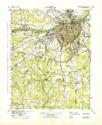
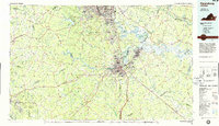
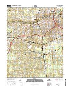
(28)- 1894 Map of Petersburg
 1894 Petersburg1894 Print · USGSPetersburg and its riverfront neighbors are captured here in the 1890s, when the Appomattox valley was a bustling hub of rail and mill industry. Genealogists can trace family-named sites across the countryside, from Youngblood's Store to Rowland's Mill and Poplar Spring Ch.6 unique versions available
 - 1943 Map of Richmond, 1972 Print
 1943 Richmond1972 Print · USGSCoastal Virginia and the state capital are shown in detail during the mid-century era of infrastructure expansion. Genealogists and historians can trace the grounds of Richmond Nat Battlefield Park, locate the Yorktown Nat Cem, or follow the many rural routes through Amelia Court House and Tappahannock.
 - 1944 Map of Petersburg
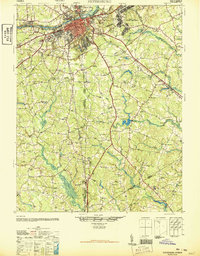
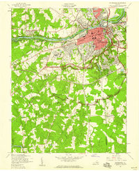
 1944 Petersburg1944 Print · USGSPetersburg and the surrounding Dinwiddie County countryside are shown here during the 1940s, revealing a landscape deeply intertwined with its Civil War history and rail industry. Researchers can locate family landmarks like Sharon Church, trace the lines of the Atlantic Coast Line, or study the grounds of Poplar Grove National Cemetery.2 unique versions available
 - 1946 Map of Petersburg
 1946 Petersburg1946 Print · USGSPetersburg and the surrounding tobacco and rail country of the mid-1940s are documented here just as the post-war era began. Genealogists and historians can trace family locations near Blandford Cemetery, search for rural schoolhouses like Bives School, or locate the historic river crossing at Pocahontas Island.3 unique versions available
 - 1949 Map of Petersburg
 1949 Petersburg1949 Print · USGSPetersburg and its industrial riverfront are captured here in the late Forties, showing a city deeply tied to its rail lines and Civil War heritage. Genealogists can locate family landmarks like Sharon Church and Smith Grove Church or trace the grounds of Blandford Cemetery.
 - 1949 Map of Richmond, 1951 Print
 1949 Richmond1951 Print · USGSCoastal Virginia in the years following World War II remained a landscape of historic river towns and expanding military bases. Genealogists and historians can trace the rail lines of the Southern Ry and locate established landmarks from Camp Lee to the remote reaches of Dragon Swamp.
 - 1952 Map of Prince George
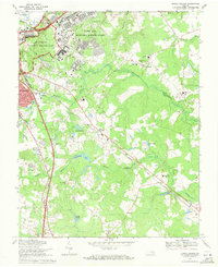
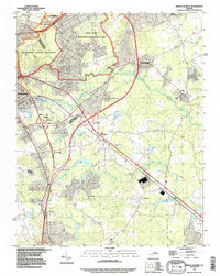
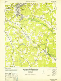 1952 Prince George1952 Print · USGSPrince George County is captured here in the early postwar years, revealing a landscape defined by military expansion and traditional rural settlements. Genealogists and historians can trace family locations near St Pauls Church, the village of New Bohemia, or the grounds of Rives School.2 unique versions available
 - 1952 Map of Petersburg, 1959 Print
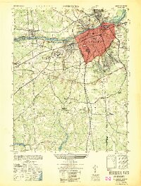
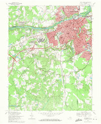
 1952 Petersburg1959 Print · USGSPetersburg and its surrounding riverfront communities are shown here during a period of significant postwar transition in the 1950s. You can trace the early path of the Richmond-Petersburg Turnpike as it bypasses historic sites like Fort Lee and Blandford Cemetery.
 - 1959 Map of Richmond
 1959 Richmond1959 Print · USGSMid-century Virginia is captured here at its most vital rail and river junctions, from the capital city to the Chesapeake Bay. Genealogists and historians can trace the development of colonial settlements like Williamsburg and military landmarks including Fort Monroe and Camp Lee.
 - 1964 Map of Richmond
 1964 Richmond1964 Print · USGSCoastal and central Virginia are mapped during the mid-twentieth century, showing the critical intersection of rail, river, and military life. Genealogists can trace family roots through rural county seats like Amelia or find vanished coastal neighborhoods near Phoebus and Hilton Village.
 - 1969 Map of Prince George, 1971 Print
 1969 Prince George1971 Print · USGSPrince George County at the close of the 1960s shows the intersection of Civil War history and modern growth. Trace the military legacy of Petersburg National Military Park and find local landmarks like New Bohemia, St Pauls Ch, and the Petersburg Jail Farm.2 unique versions available
 - 1969 Map of Petersburg, 1971 Print
 1969 Petersburg1971 Print · USGSPetersburg and Colonial Heights are shown in the late sixties as the urban core expands alongside a landscape defined by Civil War history. Researchers can trace numerous fortifications like Fort Wadsworth and locate family sites at Blandford Cemetery or Smith Grove Ch.3 unique versions available
 - 1973 Map of Richmond, 1974 Print
 1973 Richmond1974 Print · USGSThe Virginia Tidewater and Piedmont come alive in the early seventies, showcasing a region defined by its great rivers and massive military installations. Researchers can trace the mid-century growth of Richmond or locate family sites near Amelia Court House and Highland Springs.2 unique versions available
 - 1974 Map of Petersburg, 1977 Print
 1974 Petersburg1977 Print · USGSIn the mid-seventies, the urban core of Petersburg and Colonial Heights stands in sharp contrast to the surrounding rural countryside. Researchers can trace the development of riverside neighborhoods and industrial sites along the Appomattox River.
 - 1974 Map of Prince George, 1977 Print
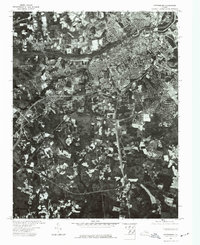
 1974 Prince George1977 Print · USGSThe Prince George area is captured from above in the mid-1970s, revealing the distinct divide between city and countryside. Researchers can trace the development patterns of Petersburg and the rural land use of Prince George through this unique aerial perspective.
 - 1984 Map of Petersburg, 1985 Print
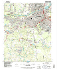
 1984 Petersburg1985 Print · USGSCentral Virginia in the mid-eighties shows a complex landscape of growing suburban centers and significant military installations. Researchers can trace historic boundaries and civic sites from Amelia Court House to the Glendale Nat Cem and Virginia State College.2 unique versions available
 - 1994 Map of Prince George, 1996 Print
 1994 Prince George1996 Print · USGSThe Petersburg area in the mid-nineties shows the convergence of military history and modern development. Researchers can trace the bounds of the Petersburg National Battlefield, find the small settlement of New Bohemia, and locate Southlawn Memorial Park (Cem).
 - 1994 Map of Petersburg, 1996 Print
 1994 Petersburg1996 Print · USGSPetersburg and its neighbors show a landscape of deep military history and river-based industry in the mid-nineties. Trace civil war fortifications from Petersburg Nat Battlefield to Fort Wadsworth alongside the sprawling Blandford Cemetery.
 - 2010 Map of Prince George, 2010 Print
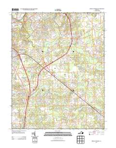
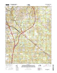
 2010 Prince George2010 Print · USGSCovers Petersburg, including Fort Gregg-Adams, Prince George, and other nearby areas
 - 2010 Map of Petersburg, 2010 Print
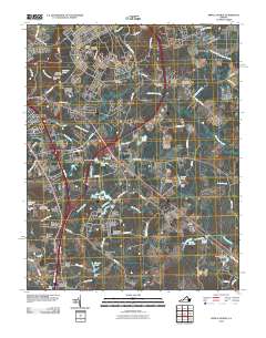
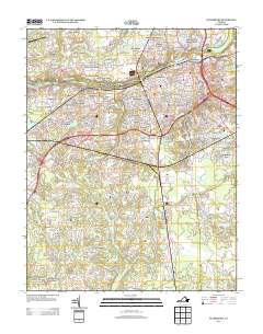
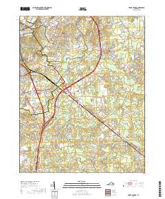
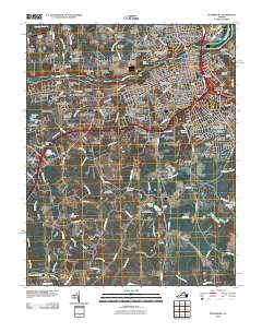 2010 Petersburg2010 Print · USGSCovers Petersburg, including Ettrick, Matoaca, and other nearby areas
 - 2013 Map of Petersburg, 2013 Print
 2013 Petersburg2013 Print · USGSCovers Petersburg, including Ettrick, Matoaca, and other nearby areas
 - 2013 Map of Prince George, 2013 Print
 2013 Prince George2013 Print · USGSCovers Petersburg, including Fort Gregg-Adams, Prince George, and other nearby areas
 - 2016 Map of Prince George, 2016 Print
 2016 Prince George2016 Print · USGSCovers Petersburg, including Fort Gregg-Adams, Prince George, and other nearby areas
 - 2016 Map of Petersburg, 2016 Print
 2016 Petersburg2016 Print · USGSCovers Petersburg, including Ettrick, Matoaca, and other nearby areas
 - 2019 Map of Prince George, 2019 Print
 2019 Prince George2019 Print · USGSCovers Petersburg, including Fort Gregg-Adams, Prince George, and other nearby areas
Showing maps 1-25 of 28
Top cities of Petersburg
Frequently asked questions
- What are the different types of historical maps available for Petersburg?
- What is the oldest map of Petersburg?
- Where can I purchase historical maps of Petersburg for my home or office?
- Where can I download high-res historical maps of Petersburg?
- Are there historical topographic maps available for Petersburg?
- Is there historical aerial imagery available for Petersburg?
- Where are historical maps of Petersburg sourced from?